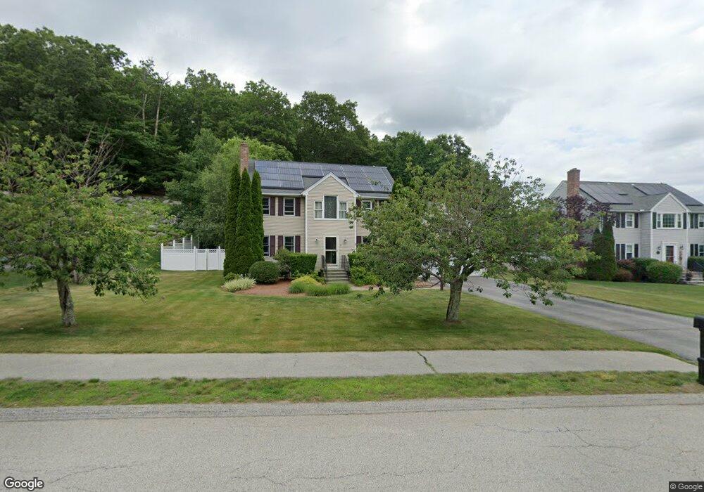
9 Rollie Shepard Dr Millbury, MA 01527
Estimated Value: $679,475 - $765,000
3
Beds
3
Baths
3,295
Sq Ft
$220/Sq Ft
Est. Value
About This Home
This home is located at 9 Rollie Shepard Dr, Millbury, MA 01527 and is currently estimated at $726,369, approximately $220 per square foot. 9 Rollie Shepard Dr is a home located in Worcester County with nearby schools including Elmwood Street Elementary School, Raymond E. Shaw Elementary School, and Millbury Junior/Senior High School.
Ownership History
Date
Name
Owned For
Owner Type
Purchase Details
Closed on
May 23, 2008
Sold by
Yip Chi Kai and Yip Ling
Bought by
Teixeira Joseph R and Teixeira Susan M
Current Estimated Value
Home Financials for this Owner
Home Financials are based on the most recent Mortgage that was taken out on this home.
Original Mortgage
$240,000
Interest Rate
5.94%
Mortgage Type
Purchase Money Mortgage
Purchase Details
Closed on
Nov 12, 1999
Sold by
Zanadu Inc
Bought by
Yip Chi Kai and Yip Ling
Create a Home Valuation Report for This Property
The Home Valuation Report is an in-depth analysis detailing your home's value as well as a comparison with similar homes in the area
Home Values in the Area
Average Home Value in this Area
Purchase History
| Date | Buyer | Sale Price | Title Company |
|---|---|---|---|
| Teixeira Joseph R | $373,478 | -- | |
| Teixeira Joseph R | $373,478 | -- | |
| Yip Chi Kai | $203,230 | -- | |
| Yip Chi Kai | $203,230 | -- |
Source: Public Records
Mortgage History
| Date | Status | Borrower | Loan Amount |
|---|---|---|---|
| Open | Yip Chi Kai | $250,000 | |
| Closed | Teixeira Joseph R | $240,000 | |
| Previous Owner | Yip Chi Kai | $130,000 | |
| Previous Owner | Yip Chi Kai | $139,500 |
Source: Public Records
Tax History Compared to Growth
Tax History
| Year | Tax Paid | Tax Assessment Tax Assessment Total Assessment is a certain percentage of the fair market value that is determined by local assessors to be the total taxable value of land and additions on the property. | Land | Improvement |
|---|---|---|---|---|
| 2025 | $7,754 | $579,100 | $125,700 | $453,400 |
| 2024 | $7,111 | $537,500 | $116,400 | $421,100 |
| 2023 | $6,458 | $446,900 | $81,400 | $365,500 |
| 2022 | $5,762 | $384,100 | $81,400 | $302,700 |
| 2021 | $5,184 | $368,100 | $81,400 | $286,700 |
| 2020 | $3,307 | $362,800 | $81,400 | $281,400 |
| 2019 | $5,605 | $353,600 | $81,100 | $272,500 |
| 2018 | $5,556 | $340,000 | $81,100 | $258,900 |
| 2017 | $5,445 | $315,600 | $81,100 | $234,500 |
| 2016 | $5,262 | $319,700 | $81,100 | $238,600 |
| 2015 | $5,101 | $309,900 | $82,700 | $227,200 |
| 2014 | $4,774 | $279,200 | $86,400 | $192,800 |
Source: Public Records
Map
Nearby Homes
- 3 May St
- 86 Wheelock Ave
- 2 Diane St
- 90 Macarthur Dr
- 12 Irene Ct
- 11 Westview Ave
- 1 Pineland Ave
- 1 Broadmeadow Ave
- 12 Alstead Path
- 46 John Dr Unit 46
- 5 Edward Dr
- 11 Maplewood Rd
- 21 Lordvale Blvd Unit 406
- 330 Millbury Ave
- 28 Lincoln Ln
- 27 A-B Grafton St
- 5 Lincoln Ln Unit 5
- 76 Samuel Dr
- 3 Stidsen Way
- 497 Massasoit Rd
- 11 Rollie Shepard Dr
- 7 Rollie Shepard Dr
- 1 Bill Graham Ln
- 6 Rollie Shepard Dr
- 8 Rollie Shepard Dr
- 3 Bill Graham Ln
- 10 Rollie Shepard Dr
- 27 Macarthur Dr
- 31 Macarthur Dr
- 3 Rollie Shepard Dr
- 25 Macarthur Dr
- 2 Bill Graham Ln
- 35 Macarthur Dr
- 12 Rollie Shepard Dr
- 5 Bill Graham Ln
- 13 Rollie Shepard Dr
- 1 Rollie Shepard Dr
- 41 Macarthur Dr
- 14 Rollie Shepard Dr
- 43 Macarthur Dr