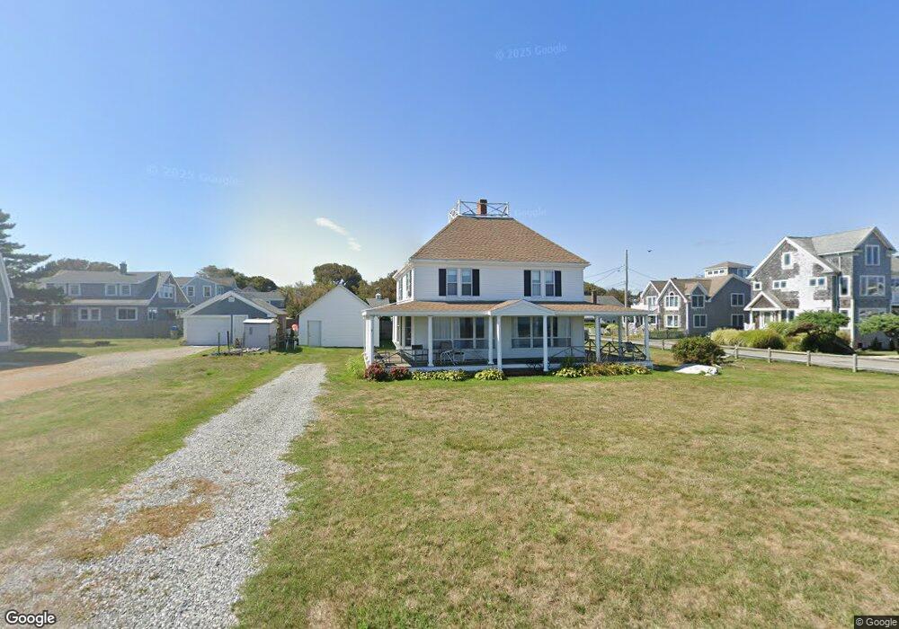
9 Seaside Rd Scituate, MA 02066
Estimated Value: $1,060,767 - $1,361,000
5
Beds
2
Baths
1,938
Sq Ft
$600/Sq Ft
Est. Value
About This Home
This home is located at 9 Seaside Rd, Scituate, MA 02066 and is currently estimated at $1,162,692, approximately $599 per square foot. 9 Seaside Rd is a home located in Plymouth County with nearby schools including Wampatuck Elementary School, Lester J. Gates Middle School, and Scituate High School.
Create a Home Valuation Report for This Property
The Home Valuation Report is an in-depth analysis detailing your home's value as well as a comparison with similar homes in the area
Home Values in the Area
Average Home Value in this Area
Tax History
| Year | Tax Paid | Tax Assessment Tax Assessment Total Assessment is a certain percentage of the fair market value that is determined by local assessors to be the total taxable value of land and additions on the property. | Land | Improvement |
|---|---|---|---|---|
| 2025 | $10,678 | $1,068,900 | $810,100 | $258,800 |
| 2024 | $10,260 | $990,300 | $736,500 | $253,800 |
| 2023 | $8,768 | $810,900 | $669,500 | $141,400 |
| 2022 | $8,768 | $694,800 | $567,700 | $127,100 |
| 2021 | $7,101 | $655,900 | $540,700 | $115,200 |
| 2020 | $6,989 | $636,400 | $519,900 | $116,500 |
| 2019 | $6,785 | $626,100 | $509,700 | $116,400 |
| 2018 | $6,338 | $628,000 | $502,600 | $125,400 |
| 2017 | $8,698 | $617,300 | $491,900 | $125,400 |
| 2016 | $8,514 | $602,100 | $481,200 | $120,900 |
| 2015 | $7,747 | $591,400 | $470,500 | $120,900 |
Source: Public Records
Map
Nearby Homes
- 92 Marion Rd
- 33 Oceanside Dr
- 23 Oceanside Dr
- 86 Hatherly Rd
- 54 Woodland Rd
- 430 Hatherly Rd
- 430 Hatherly Rd Unit Exhibit “A”
- 430 Hatherly Rd Unit Exhibit “B”
- 49 Jackson Rd
- 32 Barker Rd Unit 3
- 38 Lauren Ln
- 59 Captain Peirce Rd
- 11 Brookline Rd
- 20 Lee Ave
- 74 Branch St Unit 15
- 20 Lawson Rd
- 1 Washington Ln
- 49 Whittier Dr
- 46 Tilden Rd
- 25 Morton Place
Your Personal Tour Guide
Ask me questions while you tour the home.