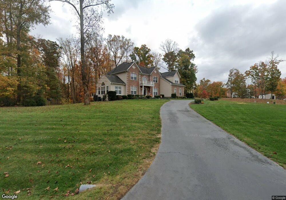
9 Sentry Ct Stafford, VA 22554
Fritters Corner NeighborhoodEstimated Value: $854,366 - $1,129,000
4
Beds
5
Baths
4,600
Sq Ft
$212/Sq Ft
Est. Value
About This Home
This home is located at 9 Sentry Ct, Stafford, VA 22554 and is currently estimated at $977,092, approximately $212 per square foot. 9 Sentry Ct is a home located in Stafford County with nearby schools including Stafford Elementary School, Stafford Middle School, and Brooke Point High School.
Ownership History
Date
Name
Owned For
Owner Type
Purchase Details
Closed on
Jan 29, 2009
Sold by
Syg Asscts Inc
Bought by
Lau Leslie
Current Estimated Value
Home Financials for this Owner
Home Financials are based on the most recent Mortgage that was taken out on this home.
Original Mortgage
$436,000
Outstanding Balance
$278,248
Interest Rate
5.28%
Mortgage Type
New Conventional
Estimated Equity
$698,844
Create a Home Valuation Report for This Property
The Home Valuation Report is an in-depth analysis detailing your home's value as well as a comparison with similar homes in the area
Home Values in the Area
Average Home Value in this Area
Purchase History
| Date | Buyer | Sale Price | Title Company |
|---|---|---|---|
| Lau Leslie | $545,000 | -- |
Source: Public Records
Mortgage History
| Date | Status | Borrower | Loan Amount |
|---|---|---|---|
| Open | Lau Leslie | $436,000 |
Source: Public Records
Tax History Compared to Growth
Tax History
| Year | Tax Paid | Tax Assessment Tax Assessment Total Assessment is a certain percentage of the fair market value that is determined by local assessors to be the total taxable value of land and additions on the property. | Land | Improvement |
|---|---|---|---|---|
| 2025 | $6,956 | $767,200 | $210,000 | $557,200 |
| 2024 | $6,956 | $767,200 | $210,000 | $557,200 |
| 2023 | $6,254 | $661,800 | $195,000 | $466,800 |
| 2022 | $5,625 | $661,800 | $195,000 | $466,800 |
| 2021 | $4,975 | $512,900 | $120,000 | $392,900 |
| 2020 | $4,975 | $512,900 | $120,000 | $392,900 |
| 2019 | $5,520 | $546,500 | $120,000 | $426,500 |
| 2018 | $5,410 | $546,500 | $120,000 | $426,500 |
| 2017 | $4,903 | $495,300 | $120,000 | $375,300 |
| 2016 | $4,903 | $495,300 | $120,000 | $375,300 |
| 2015 | -- | $487,400 | $120,000 | $367,400 |
| 2014 | -- | $487,400 | $120,000 | $367,400 |
Source: Public Records
Map
Nearby Homes
- 93 Brooke Crest Ln
- 129 Sentinel Ridge Ln
- 62 Brooke Crest Ln
- 65 Brooke Crest Ln
- 45 Twin Hill Ln
- 53 Brooke Crest Ln
- 00 Running Brook Ct Lot 139
- 58 Twin Hill Ln
- 70 Sentinel Ridge Ln
- 25 Poplar View Dr
- 2225 Camp Geary Ln
- 26 Sentinel Ridge Ln
- 22 Sentinel Ridge Ln
- 0 LOT 139 Running Brook Ct
- 2507 Running Brook Ct
- 0 0 Lot 140 Running Brook Ct
- 28 Millbrook Rd
- 61 Aquia Creek Rd
- 78 Canterbury Dr
- 121 Marlborough Point Rd
- 15 Sentry Ct
- 12 Sentry Ct
- 0 Sentry Ct
- 18 Sentry Ct
- 21 Sentry Ct
- 25 Sentry Ct
- 111 Brooke Crest Ln
- 28 Sentry Ct
- 103 Brooke Crest Ln
- 34 Sentry Ct
- 149 Sentinel Ridge Ln
- 99 Brooke Crest Ln
- 42 Sentry Ct
- 53 Sentry Ct
- 155 Sentinel Ridge Ln
- 48 Sentry Ct
- 0 Brooke Crest Ln Unit 1006350776
- 0 Brooke Crest Ln Unit ST6741694
- 141 Sentinel Ridge Ln
- 65 Sentry Ct