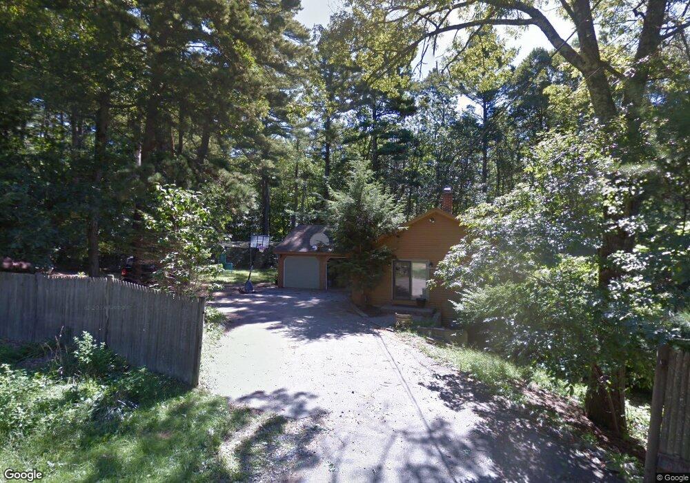
9 Shady Ln Sanford, ME 04073
South Sanford NeighborhoodEstimated Value: $545,000 - $569,000
3
Beds
2
Baths
1,713
Sq Ft
$324/Sq Ft
Est. Value
About This Home
This home is located at 9 Shady Ln, Sanford, ME 04073 and is currently estimated at $555,290, approximately $324 per square foot. 9 Shady Ln is a home located in York County.
Create a Home Valuation Report for This Property
The Home Valuation Report is an in-depth analysis detailing your home's value as well as a comparison with similar homes in the area
Home Values in the Area
Average Home Value in this Area
Tax History Compared to Growth
Tax History
| Year | Tax Paid | Tax Assessment Tax Assessment Total Assessment is a certain percentage of the fair market value that is determined by local assessors to be the total taxable value of land and additions on the property. | Land | Improvement |
|---|---|---|---|---|
| 2025 | $7,334 | $428,900 | $177,300 | $251,600 |
| 2024 | $6,922 | $428,900 | $177,300 | $251,600 |
| 2023 | $6,456 | $426,400 | $177,300 | $249,100 |
| 2022 | $6,311 | $426,400 | $177,300 | $249,100 |
| 2021 | $6,636 | $365,000 | $177,300 | $187,700 |
| 2020 | $6,320 | $313,500 | $154,900 | $158,600 |
| 2019 | $6,204 | $299,700 | $154,900 | $144,800 |
| 2018 | $5,797 | $282,800 | $138,600 | $144,200 |
| 2017 | $5,639 | $271,900 | $138,600 | $133,300 |
| 2016 | $5,865 | $257,900 | $138,800 | $119,100 |
| 2015 | $5,757 | $271,200 | $153,700 | $117,500 |
| 2014 | $5,130 | $232,700 | $115,200 | $117,500 |
| 2013 | -- | $247,300 | $129,800 | $117,500 |
Source: Public Records
Map
Nearby Homes
- 41 Sunny Ln
- 122 Country Club 3 Rd
- 99 Channel Ln
- Lot 8E Country Club Rd
- 42 Bernice Ave
- 22 Lentago Ln
- Lot 4 Tbd Lentago Ln Unit Lot 4
- 45 Grace Ln
- Lot 55-A Ford Quint Rd
- 247 Sam Allen Rd
- 469 High St
- 12 Birch Ln
- TBD Ridge Terrace Unit Lot 7
- TBD Ridge Terrace Unit Lot 6
- Lot 1 Ridge Terrace
- 761 Quarry Rd
- 43 Michaels Rd
- 56 Sam Allen Rd
- 17 Airport Rd
- 0 Airport Rd Unit 1634997