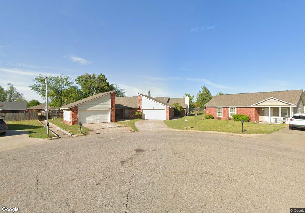
9 Shamrock Cir Shawnee, OK 74804
Estimated Value: $151,000 - $200,345
4
Beds
4
Baths
2,000
Sq Ft
$85/Sq Ft
Est. Value
About This Home
This home is located at 9 Shamrock Cir, Shawnee, OK 74804 and is currently estimated at $169,836, approximately $84 per square foot. 9 Shamrock Cir is a home located in Pottawatomie County with nearby schools including Will Rogers Elementary School, Shawnee Middle School, and Shawnee High School.
Ownership History
Date
Name
Owned For
Owner Type
Purchase Details
Closed on
Jul 9, 2025
Sold by
Kaye Steele Harrod Family Revocable Trus and Kaye Steele Harrod Family Trust
Bought by
Mrz Lizzies Home Rentals Llc
Current Estimated Value
Purchase Details
Closed on
Oct 28, 2010
Sold by
West Bart and West Kimberly
Bought by
Harrod Kaye Steele and The Kaye Steele Harrod Family Trust
Purchase Details
Closed on
Nov 8, 2006
Sold by
Sullins Tony and Sullins Phyllis
Bought by
West Bart and West Kimberly
Home Financials for this Owner
Home Financials are based on the most recent Mortgage that was taken out on this home.
Original Mortgage
$80,000
Interest Rate
6.28%
Mortgage Type
Unknown
Purchase Details
Closed on
Dec 9, 1998
Sold by
Noren Don and Noren Merillyn
Bought by
Sullins Tony and Sullins Phyllis
Create a Home Valuation Report for This Property
The Home Valuation Report is an in-depth analysis detailing your home's value as well as a comparison with similar homes in the area
Home Values in the Area
Average Home Value in this Area
Purchase History
| Date | Buyer | Sale Price | Title Company |
|---|---|---|---|
| Mrz Lizzies Home Rentals Llc | -- | None Listed On Document | |
| Mrz Lizzies Home Rentals Llc | -- | None Listed On Document | |
| Harrod Kaye Steele | $80,000 | None Available | |
| West Bart | $100,000 | None Available | |
| Sullins Tony | $100,000 | -- |
Source: Public Records
Mortgage History
| Date | Status | Borrower | Loan Amount |
|---|---|---|---|
| Previous Owner | West Bart | $80,000 |
Source: Public Records
Tax History Compared to Growth
Tax History
| Year | Tax Paid | Tax Assessment Tax Assessment Total Assessment is a certain percentage of the fair market value that is determined by local assessors to be the total taxable value of land and additions on the property. | Land | Improvement |
|---|---|---|---|---|
| 2024 | $1,419 | $14,261 | $1,150 | $13,111 |
| 2023 | $1,419 | $13,582 | $1,150 | $12,432 |
| 2022 | $1,334 | $13,002 | $1,150 | $11,852 |
| 2021 | $1,310 | $13,002 | $1,150 | $11,852 |
| 2020 | $1,300 | $12,865 | $1,150 | $11,715 |
| 2019 | $1,279 | $12,253 | $1,150 | $11,103 |
| 2018 | $1,194 | $11,669 | $1,150 | $10,519 |
| 2017 | $1,122 | $11,114 | $1,150 | $9,964 |
| 2016 | $1,080 | $10,584 | $1,150 | $9,434 |
| 2015 | $1,008 | $10,080 | $1,150 | $8,930 |
| 2014 | $960 | $9,600 | $1,150 | $8,450 |
Source: Public Records
Map
Nearby Homes
- 4011 Blaine Rd
- 4206 N Aydelotte Ave
- 310 W 37th St
- 4408 N Chapman Ave
- 4103 Pine Ridge Rd
- 4601 Pigeon Run
- 507 Blue Bird Ln
- 509 Blue Bird Ln
- 4529 Red Bird Rd
- 3306 N Oklahoma Ave
- 2525 N Broadway Ave
- 216 W Georgia St
- 210 W Georgia St
- 4220 N Harrison Ave
- 108 E Pulaski St
- 2318 N Broadway Ave
- 10 W Midland St
- 3930 Maple Grove Ave
- 4400 Peach Tree
- 1000 W 45th St
- 5 Shamrock Cir
- 117 Meadows Ln
- 115 Meadows Ln
- 6 Emerald Ct
- 119 Meadows Ln
- 113 Meadows Ln
- 2-4 Emerald Ct Unit 4 EMERALD
- 2 Emerald Ct
- 121 Meadows Ln
- 111 Meadows Ln
- 2 Shamrock Cir
- 1 Shamrock Cir
- 123 Meadows Ln
- 109 Meadows Ln
- 120 Meadows Ln
- 116 Meadows Ln
- 30 W Ken Del Dr
- 114 Meadows Ln
- 1 Emerald Ct
- 112 Meadows Ln