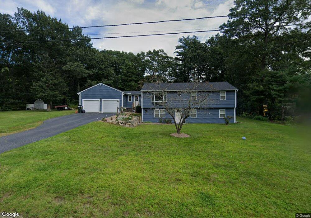
9 Shawn Ln Webster, MA 01570
Estimated Value: $451,000 - $482,000
3
Beds
2
Baths
1,628
Sq Ft
$286/Sq Ft
Est. Value
About This Home
This home is located at 9 Shawn Ln, Webster, MA 01570 and is currently estimated at $465,107, approximately $285 per square foot. 9 Shawn Ln is a home located in Worcester County with nearby schools including Park Avenue Elementary School, Webster Middle School, and Bartlett High School.
Ownership History
Date
Name
Owned For
Owner Type
Purchase Details
Closed on
Sep 18, 2025
Sold by
Fisher Richard and Fisher Maureen A
Bought by
Brown Ryan and Fisher Kristy
Current Estimated Value
Home Financials for this Owner
Home Financials are based on the most recent Mortgage that was taken out on this home.
Original Mortgage
$446,758
Outstanding Balance
$445,905
Interest Rate
6.63%
Mortgage Type
FHA
Estimated Equity
$19,202
Purchase Details
Closed on
Feb 23, 1998
Sold by
Langevin Mark A and Langevin Linda S
Bought by
Fisher Richard V and Fisher Maureen A
Home Financials for this Owner
Home Financials are based on the most recent Mortgage that was taken out on this home.
Original Mortgage
$124,592
Interest Rate
6.9%
Mortgage Type
Purchase Money Mortgage
Create a Home Valuation Report for This Property
The Home Valuation Report is an in-depth analysis detailing your home's value as well as a comparison with similar homes in the area
Home Values in the Area
Average Home Value in this Area
Purchase History
| Date | Buyer | Sale Price | Title Company |
|---|---|---|---|
| Brown Ryan | $455,000 | -- | |
| Fisher Richard V | $129,000 | -- |
Source: Public Records
Mortgage History
| Date | Status | Borrower | Loan Amount |
|---|---|---|---|
| Open | Brown Ryan | $446,758 | |
| Previous Owner | Fisher Richard V | $185,948 | |
| Previous Owner | Fisher Richard V | $124,592 | |
| Previous Owner | Fisher Richard V | $23,000 |
Source: Public Records
Tax History Compared to Growth
Tax History
| Year | Tax Paid | Tax Assessment Tax Assessment Total Assessment is a certain percentage of the fair market value that is determined by local assessors to be the total taxable value of land and additions on the property. | Land | Improvement |
|---|---|---|---|---|
| 2025 | $5,001 | $421,000 | $82,300 | $338,700 |
| 2024 | $4,983 | $409,100 | $79,100 | $330,000 |
| 2023 | $4,500 | $360,000 | $75,400 | $284,600 |
| 2022 | $4,339 | $310,800 | $73,200 | $237,600 |
| 2021 | $4,364 | $289,000 | $73,200 | $215,800 |
| 2020 | $4,203 | $279,100 | $73,200 | $205,900 |
| 2019 | $3,946 | $257,400 | $73,800 | $183,600 |
| 2018 | $3,807 | $247,400 | $73,800 | $173,600 |
| 2017 | $3,489 | $230,600 | $72,200 | $158,400 |
| 2016 | $3,357 | $221,700 | $68,900 | $152,800 |
| 2015 | $3,106 | $211,600 | $67,600 | $144,000 |
Source: Public Records
Map
Nearby Homes
- 98 Minebrook Rd
- 149 A Gore Rd
- 27 Lakeview Rd
- 23 Lakeview Rd
- 14 Browns Brook Rd
- 20 Lakeview Rd
- 8 Thompson Rd
- 27 Douglas Rd
- 18 Kingsbury Rd
- 194 Killdeer Rd
- 6 Hillside Ave
- 78 2nd Island Rd
- 13 Park Ave
- 48 Ray St
- 125 Birch Island Rd
- 107 Lake St Unit B
- 53 Bigelow Rd
- 95 Lake St
- 29 Whitcomb St
- 31 Whitcomb St