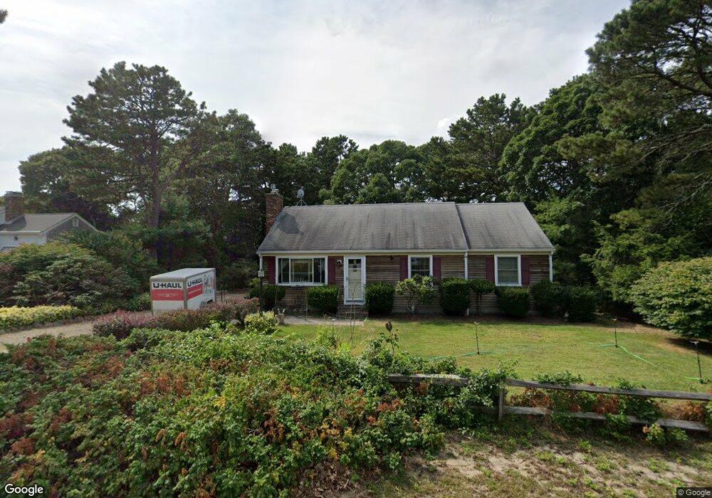
9 Sheffield Ave South Dennis, MA 02660
South Dennis NeighborhoodEstimated Value: $596,428 - $688,000
3
Beds
2
Baths
1,001
Sq Ft
$626/Sq Ft
Est. Value
About This Home
This home is located at 9 Sheffield Ave, South Dennis, MA 02660 and is currently estimated at $627,107, approximately $626 per square foot. 9 Sheffield Ave is a home located in Barnstable County with nearby schools including Dennis-Yarmouth Regional High School and St. Pius X. School.
Ownership History
Date
Name
Owned For
Owner Type
Purchase Details
Closed on
Mar 30, 1993
Sold by
Christie James F and Christie Catherine A
Bought by
Christie Aldo A and Giannotti Katharina
Current Estimated Value
Home Financials for this Owner
Home Financials are based on the most recent Mortgage that was taken out on this home.
Original Mortgage
$60,000
Interest Rate
7.73%
Mortgage Type
Purchase Money Mortgage
Create a Home Valuation Report for This Property
The Home Valuation Report is an in-depth analysis detailing your home's value as well as a comparison with similar homes in the area
Home Values in the Area
Average Home Value in this Area
Purchase History
| Date | Buyer | Sale Price | Title Company |
|---|---|---|---|
| Christie Aldo A | $115,000 | -- |
Source: Public Records
Mortgage History
| Date | Status | Borrower | Loan Amount |
|---|---|---|---|
| Closed | Christie Aldo A | $60,000 |
Source: Public Records
Tax History Compared to Growth
Tax History
| Year | Tax Paid | Tax Assessment Tax Assessment Total Assessment is a certain percentage of the fair market value that is determined by local assessors to be the total taxable value of land and additions on the property. | Land | Improvement |
|---|---|---|---|---|
| 2025 | $2,392 | $552,400 | $143,400 | $409,000 |
| 2024 | $2,268 | $516,700 | $137,900 | $378,800 |
| 2023 | $2,194 | $469,900 | $125,400 | $344,500 |
| 2022 | $2,131 | $380,500 | $125,500 | $255,000 |
| 2021 | $2,019 | $334,900 | $123,000 | $211,900 |
| 2020 | $1,924 | $315,400 | $123,000 | $192,400 |
| 2019 | $1,847 | $299,400 | $132,700 | $166,700 |
| 2018 | $1,691 | $266,700 | $114,800 | $151,900 |
| 2017 | $1,611 | $261,900 | $114,800 | $147,100 |
| 2016 | $1,471 | $225,300 | $120,600 | $104,700 |
| 2015 | $1,442 | $225,300 | $120,600 | $104,700 |
| 2014 | $1,436 | $226,200 | $103,300 | $122,900 |
Source: Public Records
Map
Nearby Homes
- 17 Margate Ln
- 52 Uncle Bobs Way
- 10 Joanne Dr
- 25 Skerry Rd
- 15 Captain Jud Rd
- 153 Bayridge Dr
- 7 Vinland Dr
- 1 Norseman Dr
- 17 Fairmount Rd
- 17 Fairmount Rd
- 4 Ebb Rd
- 6 Hawthorn St
- 62 Old Fish House Rd
- 118 Driftwood Ln
- 129 Driftwood Ln
- 2 Hemlock Ln
- 13 Covey Dr
- 32 Captain Walsh Dr
- 111 Merchant Ave
- 20 Sycamore Ln
- 15 Sheffield Ave
- 5 Sheffield Ave
- 10 Cornwall Rd
- 52 Kingswear Cir
- 10 Sheffield Ave
- 16 Cornwall Rd
- 14 Sheffield Ave
- 6 Sheffield Ave
- 19 Sheffield Ave
- 20 Sheffield Ave
- 22 Cornwall Rd
- 47 Kingswear Cir
- 3 Margate Ln
- 43 Kingswear Cir
- 53 Kingswear Cir
- 9 Devonshire Ln
- 15 Devonshire Ln
- 60 Kingswear Cir
- 5 Devonshire Ln
- 25 Sheffield Ave