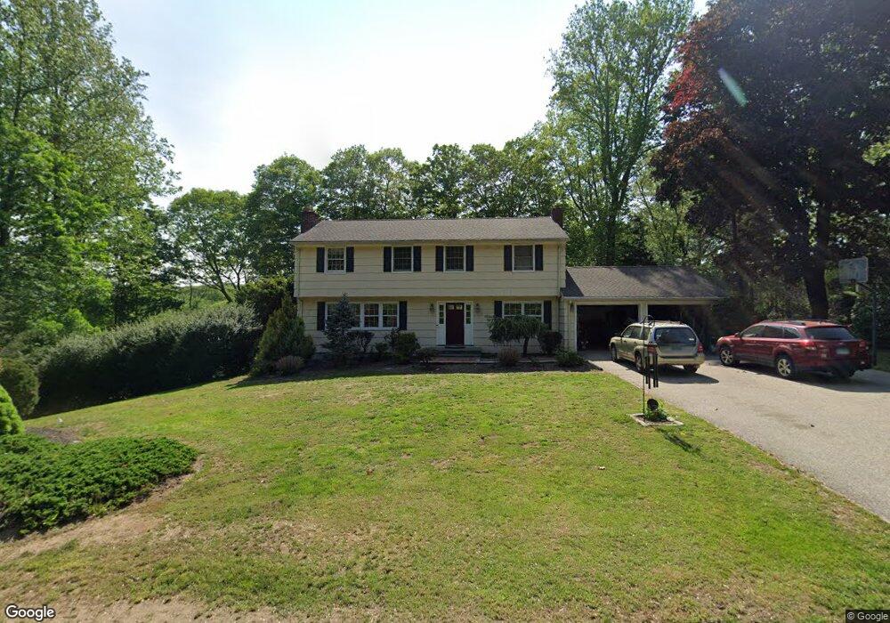
9 Shelter Rock Rd Trumbull, CT 06611
Daniel Farm District NeighborhoodEstimated Value: $751,000 - $801,000
4
Beds
3
Baths
2,226
Sq Ft
$349/Sq Ft
Est. Value
About This Home
This home is located at 9 Shelter Rock Rd, Trumbull, CT 06611 and is currently estimated at $776,732, approximately $348 per square foot. 9 Shelter Rock Rd is a home located in Fairfield County with nearby schools including Booth Hill School, Hillcrest Middle School, and Trumbull High School.
Ownership History
Date
Name
Owned For
Owner Type
Purchase Details
Closed on
Oct 19, 2009
Sold by
Miller Gregg S and Miller Dorothy G
Bought by
Ahle Henry and Ahle Monika
Current Estimated Value
Home Financials for this Owner
Home Financials are based on the most recent Mortgage that was taken out on this home.
Original Mortgage
$392,000
Outstanding Balance
$246,859
Interest Rate
5%
Estimated Equity
$529,873
Purchase Details
Closed on
Dec 2, 1993
Sold by
Gorman James and Gorman Jeanne
Bought by
Miller Gregg and Miller Dorothy
Home Financials for this Owner
Home Financials are based on the most recent Mortgage that was taken out on this home.
Original Mortgage
$200,000
Interest Rate
3.5%
Mortgage Type
Unknown
Create a Home Valuation Report for This Property
The Home Valuation Report is an in-depth analysis detailing your home's value as well as a comparison with similar homes in the area
Home Values in the Area
Average Home Value in this Area
Purchase History
| Date | Buyer | Sale Price | Title Company |
|---|---|---|---|
| Ahle Henry | $490,000 | -- | |
| Miller Gregg | $287,000 | -- |
Source: Public Records
Mortgage History
| Date | Status | Borrower | Loan Amount |
|---|---|---|---|
| Open | Miller Gregg | $392,000 | |
| Closed | Miller Gregg | $392,000 | |
| Previous Owner | Miller Gregg | $227,000 | |
| Previous Owner | Miller Gregg | $200,000 |
Source: Public Records
Tax History Compared to Growth
Tax History
| Year | Tax Paid | Tax Assessment Tax Assessment Total Assessment is a certain percentage of the fair market value that is determined by local assessors to be the total taxable value of land and additions on the property. | Land | Improvement |
|---|---|---|---|---|
| 2025 | $13,047 | $353,010 | $160,720 | $192,290 |
| 2024 | $12,672 | $353,010 | $160,720 | $192,290 |
| 2023 | $12,479 | $353,010 | $160,720 | $192,290 |
| 2022 | $12,287 | $353,010 | $160,720 | $192,290 |
| 2021 | $11,394 | $311,010 | $146,300 | $164,710 |
| 2020 | $11,183 | $311,010 | $146,300 | $164,710 |
| 2018 | $10,938 | $311,010 | $146,300 | $164,710 |
| 2017 | $10,730 | $311,010 | $146,300 | $164,710 |
| 2016 | $10,529 | $311,010 | $146,300 | $164,710 |
| 2015 | $10,609 | $314,800 | $146,300 | $168,500 |
| 2014 | $10,382 | $314,800 | $146,300 | $168,500 |
Source: Public Records
Map
Nearby Homes
- 50 Hemlock Trail
- 244 Strobel Rd
- 57 Gray Rock Rd
- 0 Pinewood Trail
- 2449 Huntington Turnpike
- 2428 Huntington Turnpike
- 0 Lot #4 & Lot #5 W Mischa Rd Unit 24138429
- 23 Finchwood Dr
- 3 Pam Bar Dr
- 75 Roosevelt Dr
- 118 Greenbrier Rd
- 184 Putting Green Rd
- 101 Golden Hill St
- 33 Enclave Dr Unit 33
- 11 Laurel St
- 7 Manor Dr
- 19 Hazel Ct
- 58 Daniels Farm Rd
- 93 Putting Green Rd N
- 121 Paugusett Cir
- 17 Shelter Rock Rd
- 60 Hemlock Trail
- 225 Strobel Rd
- 63 Hemlock Trail
- 12 Shelter Rock Rd
- 224 Strobel Rd
- 56 Hemlock Trail
- 25 Shelter Rock Rd
- 59 Hemlock Trail
- 206 Strobel Rd
- 16 Shelter Rock Rd
- 228 Strobel Rd
- 55 Hemlock Trail
- 232 Strobel Rd
- 195 Strobel Rd
- 51 Hemlock Trail
- 9 Bear Den Rd
- 236 Strobel Rd
- 28 Shelter Rock Rd
- 198 Strobel Rd