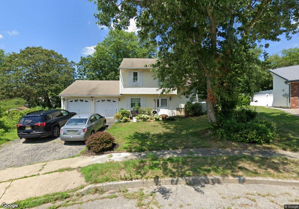
9 Silversmith Ct Barnegat, NJ 08005
Barnegat Township NeighborhoodEstimated Value: $388,000 - $414,000
4
Beds
2
Baths
1,406
Sq Ft
$287/Sq Ft
Est. Value
About This Home
This home is located at 9 Silversmith Ct, Barnegat, NJ 08005 and is currently estimated at $403,761, approximately $287 per square foot. 9 Silversmith Ct is a home located in Ocean County with nearby schools including Barnegat High School, Lighthouse Christian Academy, and St. Mary Academy.
Ownership History
Date
Name
Owned For
Owner Type
Purchase Details
Closed on
Feb 1, 2002
Sold by
Elmo Carol
Bought by
Spratley Lynn
Current Estimated Value
Home Financials for this Owner
Home Financials are based on the most recent Mortgage that was taken out on this home.
Original Mortgage
$129,200
Outstanding Balance
$53,687
Interest Rate
7.13%
Estimated Equity
$350,074
Purchase Details
Closed on
May 29, 1996
Sold by
Lines Peter
Bought by
Elmo Carol
Create a Home Valuation Report for This Property
The Home Valuation Report is an in-depth analysis detailing your home's value as well as a comparison with similar homes in the area
Home Values in the Area
Average Home Value in this Area
Purchase History
| Date | Buyer | Sale Price | Title Company |
|---|---|---|---|
| Spratley Lynn | $138,000 | -- | |
| Elmo Carol | $87,000 | -- |
Source: Public Records
Mortgage History
| Date | Status | Borrower | Loan Amount |
|---|---|---|---|
| Open | Spratley Lynn | $129,200 |
Source: Public Records
Tax History Compared to Growth
Tax History
| Year | Tax Paid | Tax Assessment Tax Assessment Total Assessment is a certain percentage of the fair market value that is determined by local assessors to be the total taxable value of land and additions on the property. | Land | Improvement |
|---|---|---|---|---|
| 2025 | $5,725 | $192,300 | $88,400 | $103,900 |
| 2024 | $5,598 | $192,300 | $88,400 | $103,900 |
| 2023 | $5,417 | $192,300 | $88,400 | $103,900 |
| 2022 | $5,417 | $192,300 | $88,400 | $103,900 |
| 2021 | $5,392 | $192,300 | $88,400 | $103,900 |
| 2020 | $5,367 | $192,300 | $88,400 | $103,900 |
| 2019 | $5,288 | $192,300 | $88,400 | $103,900 |
| 2018 | $5,248 | $192,300 | $88,400 | $103,900 |
| 2017 | $5,161 | $192,300 | $88,400 | $103,900 |
| 2016 | $5,056 | $192,300 | $88,400 | $103,900 |
| 2015 | $4,896 | $192,300 | $88,400 | $103,900 |
| 2014 | $4,771 | $192,300 | $88,400 | $103,900 |
Source: Public Records
Map
Nearby Homes
- 14 Georgetown Blvd
- 56 Georgetown Blvd
- 60 Lamp Post Dr
- 41 Deck St
- 99 Old Main Shore Rd
- 82 Mary Bell Rd
- 135 S Main St
- 132 Kristine Ave
- 99 Village Dr
- 67 Gunning River Rd
- 87 Village Dr
- 93 Windward Dr
- 3 Lexington Blvd
- 83 Gunning River Rd
- 23 Sextant Dr
- 25 Aphrodite Dr
- 5 Willow Ct
- 5 Sloop Ct
- 21 Shelli Terrace
- 0 Trinity Ct Unit Willet Model