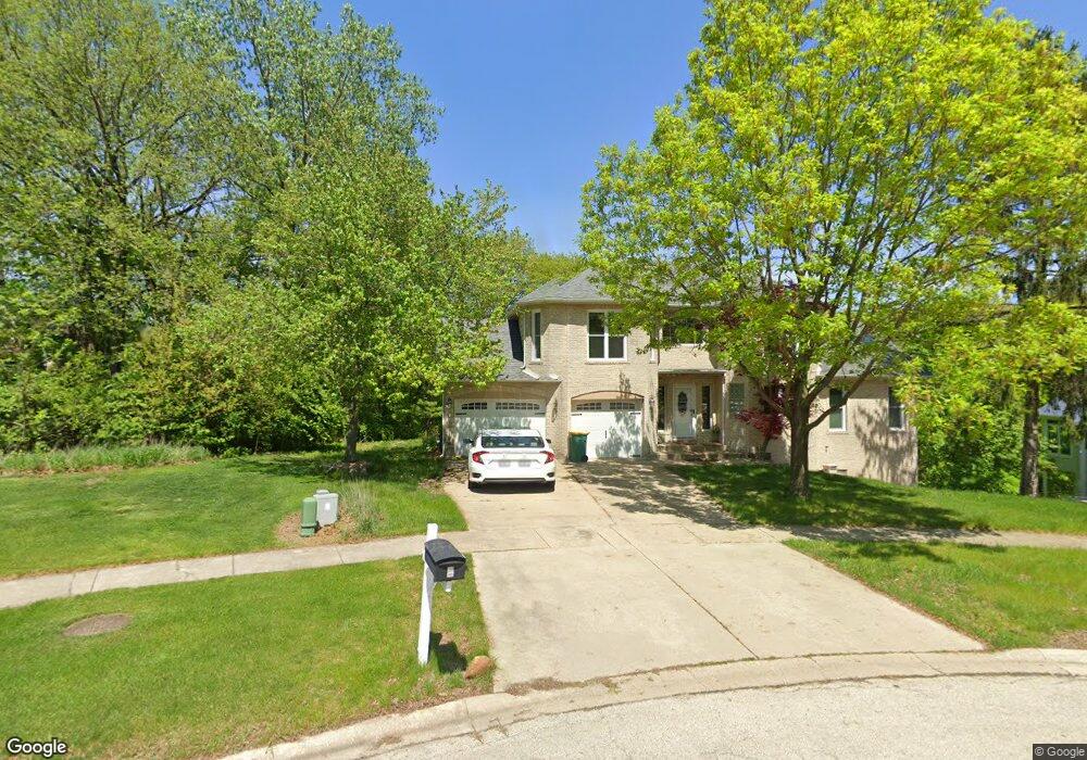
9 Spruce Ct Lemont, IL 60439
West Lemont NeighborhoodEstimated Value: $592,000 - $777,000
4
Beds
4
Baths
2,707
Sq Ft
$239/Sq Ft
Est. Value
About This Home
This home is located at 9 Spruce Ct, Lemont, IL 60439 and is currently estimated at $647,520, approximately $239 per square foot. 9 Spruce Ct is a home located in Cook County with nearby schools including Oakwood School, River Valley School, and Old Quarry Middle School.
Ownership History
Date
Name
Owned For
Owner Type
Purchase Details
Closed on
Jul 13, 2017
Sold by
Fox Brian T and Fox Leigh A
Bought by
Imber Matthew J and Armbruster Valerie L
Current Estimated Value
Home Financials for this Owner
Home Financials are based on the most recent Mortgage that was taken out on this home.
Original Mortgage
$308,750
Outstanding Balance
$254,789
Interest Rate
3.91%
Mortgage Type
New Conventional
Estimated Equity
$392,731
Purchase Details
Closed on
Oct 1, 2001
Sold by
Jandak Fred V and Jandak Susan K
Bought by
Fox Brian T and Fox Leigh A
Home Financials for this Owner
Home Financials are based on the most recent Mortgage that was taken out on this home.
Original Mortgage
$300,000
Interest Rate
6.92%
Mortgage Type
Seller Take Back
Create a Home Valuation Report for This Property
The Home Valuation Report is an in-depth analysis detailing your home's value as well as a comparison with similar homes in the area
Home Values in the Area
Average Home Value in this Area
Purchase History
| Date | Buyer | Sale Price | Title Company |
|---|---|---|---|
| Imber Matthew J | $325,000 | Agents National Insurance Co | |
| Fox Brian T | $385,000 | -- |
Source: Public Records
Mortgage History
| Date | Status | Borrower | Loan Amount |
|---|---|---|---|
| Open | Imber Matthew J | $308,750 | |
| Previous Owner | Fox Brian T | $300,000 |
Source: Public Records
Tax History
| Year | Tax Paid | Tax Assessment Tax Assessment Total Assessment is a certain percentage of the fair market value that is determined by local assessors to be the total taxable value of land and additions on the property. | Land | Improvement |
|---|---|---|---|---|
| 2025 | $10,599 | $51,000 | $15,103 | $35,897 |
| 2024 | $10,599 | $51,000 | $15,103 | $35,897 |
| 2023 | $8,182 | $51,000 | $15,103 | $35,897 |
| 2022 | $8,182 | $33,700 | $13,360 | $20,340 |
| 2021 | $7,931 | $33,699 | $13,360 | $20,339 |
| 2020 | $8,014 | $33,699 | $13,360 | $20,339 |
| 2019 | $9,351 | $40,428 | $13,360 | $27,068 |
| 2018 | $9,197 | $40,428 | $13,360 | $27,068 |
| 2017 | $8,303 | $40,428 | $13,360 | $27,068 |
| 2016 | $7,312 | $33,470 | $11,036 | $22,434 |
| 2015 | $7,392 | $33,470 | $11,036 | $22,434 |
| 2014 | $7,476 | $33,470 | $11,036 | $22,434 |
| 2013 | $7,367 | $35,040 | $11,036 | $24,004 |
Source: Public Records
Map
Nearby Homes
- 724 Ridge Rd
- 51 Evergreen Dr
- 1009 Walter St
- 1023 Walter St
- 1025 Walter St
- 1012 Warner Ave
- 705 State St
- 16 E Illinois St
- 700 Czacki St
- 400 Mccarthy Rd Unit 419
- 400 Mccarthy Rd Unit 421
- 614 Czacki St
- 332 River St Unit 4504
- 342 River St Unit 3402
- 12504 Thornberry Dr
- 11174 Tuscany Ln
- 523 Talcott Ave
- 15500 E 127th St
- 16441 Kayla Dr
- 16541 Kayla Dr
Your Personal Tour Guide
Ask me questions while you tour the home.