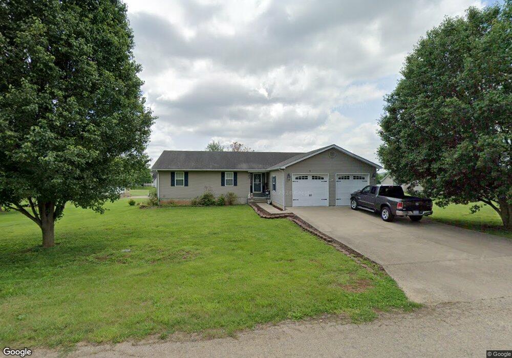
9 St Francois St Fredericktown, MO 63645
Estimated Value: $197,540 - $303,000
3
Beds
--
Bath
1,620
Sq Ft
$160/Sq Ft
Est. Value
About This Home
This home is located at 9 St Francois St, Fredericktown, MO 63645 and is currently estimated at $259,135, approximately $159 per square foot. 9 St Francois St is a home with nearby schools including Fredericktown Elementary School, Fredericktown Intermediate School, and Kelly A. Burlison Middle School.
Ownership History
Date
Name
Owned For
Owner Type
Purchase Details
Closed on
May 25, 2007
Sold by
Priester Gary and Priester Melyssa
Bought by
Moyers Harry E and Moyers Sandra A
Current Estimated Value
Home Financials for this Owner
Home Financials are based on the most recent Mortgage that was taken out on this home.
Original Mortgage
$77,500
Outstanding Balance
$47,141
Interest Rate
6.17%
Mortgage Type
Future Advance Clause Open End Mortgage
Estimated Equity
$211,994
Create a Home Valuation Report for This Property
The Home Valuation Report is an in-depth analysis detailing your home's value as well as a comparison with similar homes in the area
Home Values in the Area
Average Home Value in this Area
Purchase History
| Date | Buyer | Sale Price | Title Company |
|---|---|---|---|
| Moyers Harry E | -- | None Available |
Source: Public Records
Mortgage History
| Date | Status | Borrower | Loan Amount |
|---|---|---|---|
| Open | Moyers Harry E | $77,500 |
Source: Public Records
Tax History Compared to Growth
Tax History
| Year | Tax Paid | Tax Assessment Tax Assessment Total Assessment is a certain percentage of the fair market value that is determined by local assessors to be the total taxable value of land and additions on the property. | Land | Improvement |
|---|---|---|---|---|
| 2024 | $1,866 | $29,500 | $0 | $0 |
| 2023 | $1,856 | $29,500 | $0 | $0 |
| 2022 | $1,728 | $27,210 | $0 | $0 |
| 2021 | $1,722 | $27,210 | $0 | $0 |
| 2020 | $1,783 | $26,630 | $0 | $0 |
| 2019 | $1,766 | $26,630 | $0 | $0 |
| 2018 | $1,776 | $26,630 | $0 | $0 |
| 2017 | $1,733 | $26,630 | $0 | $0 |
| 2016 | $1,699 | $26,630 | $0 | $0 |
| 2015 | -- | $26,630 | $0 | $0 |
| 2014 | -- | $26,620 | $0 | $0 |
| 2013 | -- | $26,620 | $0 | $0 |
| 2012 | -- | $26,620 | $0 | $0 |
Source: Public Records
Map
Nearby Homes
- 300 Lee St
- 713 Oak St
- 608 Marshall St
- 804 Walnut St
- 705 Marshall St Unit 705
- 803 W College Ave
- 404 Marshall St
- 210 Delmar St
- 310 Cahoon St
- 306 Cahoon St
- 700 S Main St
- 600 S Main St
- 209 W College Ave
- 309 S Main St
- 211 S Main St
- 306 S Mine La Motte St
- 0 S Mine La Motte Ave
- 216 S Mine La Motte St
- 10 Dogwood Ct
- 1261 W Main St
- 10 Riverwoods Dr
- 10 St Francois St
- 5 St Francois St
- 11 St Francois St
- 12 St Francois St
- 12 Riverwoods Dr
- 6 Riverwoods Dr
- 2 River's Edge Subdivision
- 14 St Francois St
- 6 St Francois St
- 618 Whitworth St
- 17 Riverwoods Dr
- 11 Sunset Dr
- 0 Riverwoods Dr
- 7 Sunset Dr
- 20 Riverwoods Dr
- 9 Sunset Dr
- 3 Riverwoods Dr
- 11 Riverwoods Dr
- 614 Whitworth St