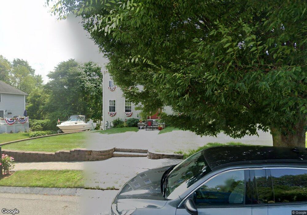
9 Strawberry Ln Haverhill, MA 01835
Salem Street NeighborhoodEstimated Value: $694,068 - $763,000
4
Beds
3
Baths
2,128
Sq Ft
$342/Sq Ft
Est. Value
About This Home
This home is located at 9 Strawberry Ln, Haverhill, MA 01835 and is currently estimated at $728,517, approximately $342 per square foot. 9 Strawberry Ln is a home located in Essex County with nearby schools including Bradford Elementary School.
Ownership History
Date
Name
Owned For
Owner Type
Purchase Details
Closed on
Apr 23, 2020
Sold by
Jarvis Robert M
Bought by
Jarvis Antonette R and Jarvis Robert M
Current Estimated Value
Purchase Details
Closed on
Jul 3, 2002
Sold by
Kd Constr Llc
Bought by
Jarvis Robert M
Home Financials for this Owner
Home Financials are based on the most recent Mortgage that was taken out on this home.
Original Mortgage
$295,000
Interest Rate
6.82%
Mortgage Type
Purchase Money Mortgage
Create a Home Valuation Report for This Property
The Home Valuation Report is an in-depth analysis detailing your home's value as well as a comparison with similar homes in the area
Home Values in the Area
Average Home Value in this Area
Purchase History
| Date | Buyer | Sale Price | Title Company |
|---|---|---|---|
| Jarvis Antonette R | -- | None Available | |
| Jarvis Robert M | $328,600 | -- |
Source: Public Records
Mortgage History
| Date | Status | Borrower | Loan Amount |
|---|---|---|---|
| Previous Owner | Jarvis Robert M | $365,701 | |
| Previous Owner | Jarvis Robert M | $219,999 | |
| Previous Owner | Jarvis Robert M | $295,000 | |
| Previous Owner | Jarvis Robert M | $135,000 |
Source: Public Records
Tax History Compared to Growth
Tax History
| Year | Tax Paid | Tax Assessment Tax Assessment Total Assessment is a certain percentage of the fair market value that is determined by local assessors to be the total taxable value of land and additions on the property. | Land | Improvement |
|---|---|---|---|---|
| 2025 | $6,555 | $612,000 | $197,000 | $415,000 |
| 2024 | $6,265 | $588,800 | $190,100 | $398,700 |
| 2023 | $6,177 | $554,000 | $190,100 | $363,900 |
| 2022 | $5,919 | $465,300 | $172,800 | $292,500 |
| 2021 | $5,884 | $437,800 | $169,400 | $268,400 |
| 2020 | $5,856 | $430,600 | $169,400 | $261,200 |
| 2019 | $5,693 | $408,100 | $146,900 | $261,200 |
| 2018 | $5,579 | $391,200 | $146,900 | $244,300 |
| 2017 | $5,410 | $360,900 | $131,400 | $229,500 |
| 2016 | $5,255 | $342,100 | $117,500 | $224,600 |
| 2015 | $5,145 | $335,200 | $110,600 | $224,600 |
Source: Public Records
Map
Nearby Homes
- 3 Munroe St
- 141 Washington St
- 138 Hyatt Ave
- 100 Lincolnshire Dr
- 151 Hyatt Ave
- 500 Water St Unit A8
- 88 Muriel Terrace
- 41 Agawam Ave
- 77 Stetson St
- 70 Race St
- 25 Race St
- 358 Main St
- 54 S Williams St
- 1 Atwood Ln
- 28 Jordan St
- 83 S Central St Unit 83
- 21 Conover Way
- 15 Fermanagh St
- 28 Fernald Ave
- 5 S Webster St