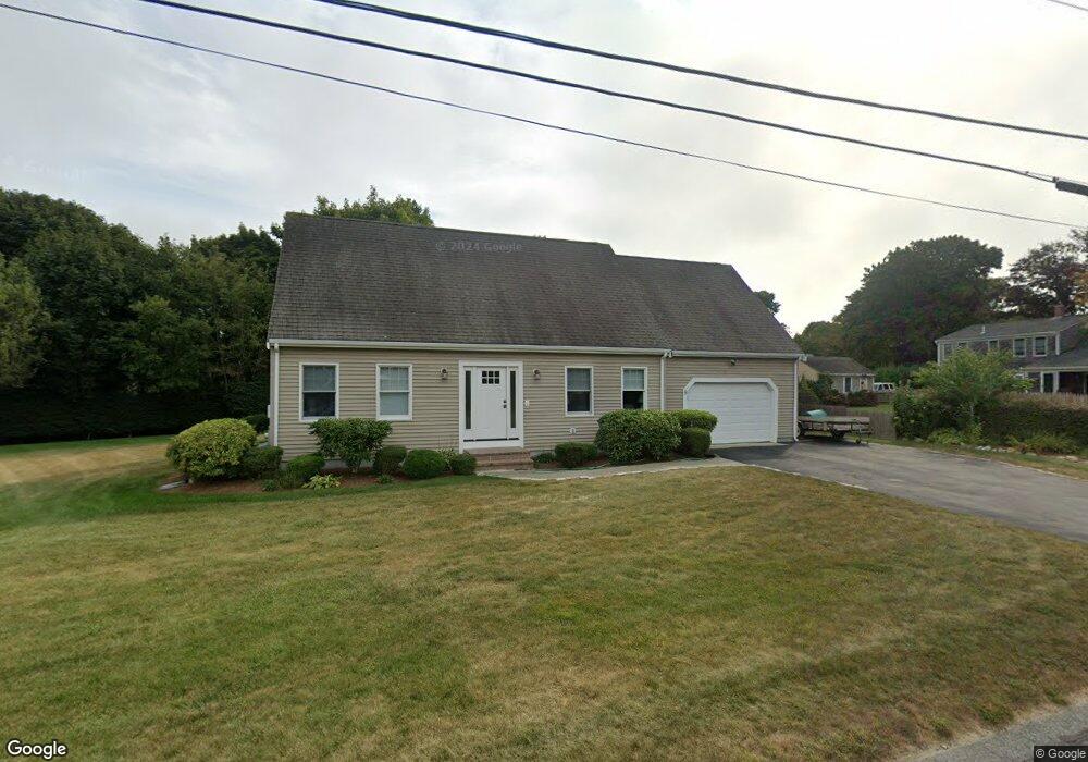
9 Terry Lou Ave East Falmouth, MA 02536
Estimated Value: $774,365 - $995,000
3
Beds
3
Baths
1,901
Sq Ft
$474/Sq Ft
Est. Value
About This Home
This home is located at 9 Terry Lou Ave, East Falmouth, MA 02536 and is currently estimated at $901,591, approximately $474 per square foot. 9 Terry Lou Ave is a home located in Barnstable County with nearby schools including East Falmouth Elementary School, Morse Pond School, and Lawrence School.
Ownership History
Date
Name
Owned For
Owner Type
Purchase Details
Closed on
Mar 3, 2021
Sold by
Martinho Carlos A
Bought by
Martinho Irt and Martinho
Current Estimated Value
Purchase Details
Closed on
Jan 15, 1998
Sold by
Kachadoorian S Michael
Bought by
Martinho Carlos A
Purchase Details
Closed on
Sep 23, 1997
Sold by
Medeiros Joseph T and Thrasher Patricia A
Bought by
Kachadoorian S Michael
Create a Home Valuation Report for This Property
The Home Valuation Report is an in-depth analysis detailing your home's value as well as a comparison with similar homes in the area
Home Values in the Area
Average Home Value in this Area
Purchase History
| Date | Buyer | Sale Price | Title Company |
|---|---|---|---|
| Martinho Irt | -- | None Available | |
| Martinho Carlos A | $57,500 | -- | |
| Kachadoorian S Michael | $45,000 | -- |
Source: Public Records
Mortgage History
| Date | Status | Borrower | Loan Amount |
|---|---|---|---|
| Previous Owner | Kachadoorian S Michael | $65,000 |
Source: Public Records
Tax History Compared to Growth
Tax History
| Year | Tax Paid | Tax Assessment Tax Assessment Total Assessment is a certain percentage of the fair market value that is determined by local assessors to be the total taxable value of land and additions on the property. | Land | Improvement |
|---|---|---|---|---|
| 2025 | $3,664 | $624,200 | $144,600 | $479,600 |
| 2024 | $3,597 | $572,800 | $137,000 | $435,800 |
| 2023 | $3,545 | $512,300 | $137,000 | $375,300 |
| 2022 | $3,228 | $401,000 | $103,300 | $297,700 |
| 2021 | $2,909 | $342,200 | $98,800 | $243,400 |
| 2020 | $2,862 | $333,200 | $89,800 | $243,400 |
| 2019 | $2,800 | $327,100 | $89,800 | $237,300 |
| 2018 | $2,751 | $318,200 | $89,800 | $228,400 |
| 2017 | $2,631 | $308,400 | $89,800 | $218,600 |
| 2016 | $2,581 | $308,400 | $89,800 | $218,600 |
| 2015 | $2,526 | $308,400 | $89,800 | $218,600 |
| 2014 | $2,537 | $311,300 | $94,600 | $216,700 |
Source: Public Records
Map
Nearby Homes
- 241 Davisville Rd
- 30 Weatherglass Ln
- 9 Theroux Dr
- 37 Seashell Ln
- 23 N Bournes Pond Rd
- 23 N Bournes Pond Rd
- 58 Striper Ln
- 42 Hanson Cir
- 27 Harborview Dr
- 45 Green Pond Rd
- 87 Acapesket Rd Unit 3A
- 87 Acapesket Rd Unit 3B
- 28 Sheila Way
- 53 Eel River Rd
- 13 Suncrest Dr
- 0 Tobey Ln
- 16 Edgewood Dr
- LOTA Commodore Ln
- 242 Davisville Rd
- 15 Terry Lou Ave
- 10 Terry Lou Ave
- 230 Davisville Rd
- 246 Davisville Rd
- 16 Terry Lou Ave
- 21 Terry Lou Ave
- 1 Pheasant Ln
- 16 Pacheco Path Unit A&B
- 16 Pacheco Path Unit Lower LL
- 16 Pacheco Path Unit A
- 250 Davisville Rd
- 20 Terry Lou Ave
- 233 Davisville Rd
- 2 Pheasant Ln
- 3 Pheasant Ln
- 25 Terry Lou Ave
- 10 Elizabeth Jean Dr
- 222 Davisville Rd
- 222 Davisville Rd Unit 222