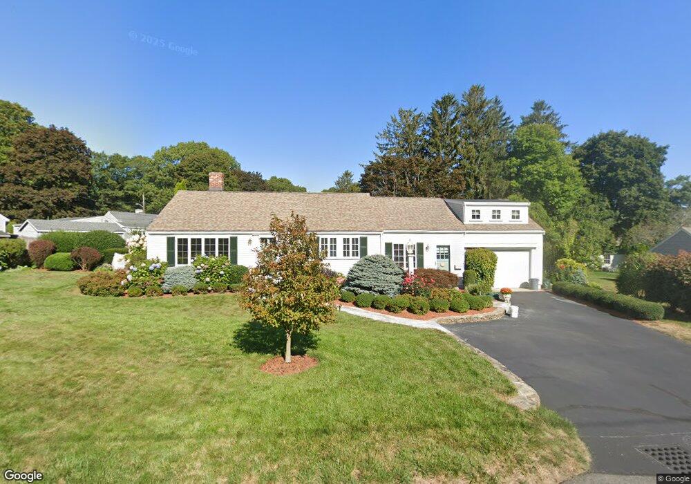
9 Thomas Ave Scituate, MA 02066
Estimated Value: $804,922 - $904,000
3
Beds
1
Bath
1,788
Sq Ft
$481/Sq Ft
Est. Value
About This Home
This home is located at 9 Thomas Ave, Scituate, MA 02066 and is currently estimated at $859,231, approximately $480 per square foot. 9 Thomas Ave is a home located in Plymouth County with nearby schools including Wampatuck Elementary School, Lester J. Gates Middle School, and Scituate High School.
Ownership History
Date
Name
Owned For
Owner Type
Purchase Details
Closed on
Aug 18, 1992
Sold by
Scanlon Kathleen M
Bought by
Roche Cynthia A
Current Estimated Value
Purchase Details
Closed on
Feb 20, 1991
Sold by
Scanlon Robert J and Scanlon Kathleen M
Bought by
Scanlon Kathleen M
Create a Home Valuation Report for This Property
The Home Valuation Report is an in-depth analysis detailing your home's value as well as a comparison with similar homes in the area
Home Values in the Area
Average Home Value in this Area
Purchase History
| Date | Buyer | Sale Price | Title Company |
|---|---|---|---|
| Roche Cynthia A | $152,500 | -- | |
| Scanlon Kathleen M | $75,500 | -- |
Source: Public Records
Mortgage History
| Date | Status | Borrower | Loan Amount |
|---|---|---|---|
| Open | Scanlon Kathleen M | $205,000 | |
| Closed | Scanlon Kathleen M | $30,000 | |
| Closed | Scanlon Kathleen M | $10,000 |
Source: Public Records
Tax History
| Year | Tax Paid | Tax Assessment Tax Assessment Total Assessment is a certain percentage of the fair market value that is determined by local assessors to be the total taxable value of land and additions on the property. | Land | Improvement |
|---|---|---|---|---|
| 2025 | $6,884 | $689,100 | $370,600 | $318,500 |
| 2024 | $6,726 | $649,200 | $336,900 | $312,300 |
| 2023 | $6,609 | $601,000 | $323,300 | $277,700 |
| 2022 | $6,609 | $523,700 | $291,100 | $232,600 |
| 2021 | $6,356 | $476,800 | $277,200 | $199,600 |
| 2020 | $6,165 | $456,700 | $266,500 | $190,200 |
| 2019 | $6,055 | $440,700 | $261,300 | $179,400 |
| 2018 | $6,029 | $432,200 | $262,000 | $170,200 |
| 2017 | $5,936 | $421,300 | $251,100 | $170,200 |
| 2016 | $5,649 | $399,500 | $229,300 | $170,200 |
| 2015 | $5,091 | $388,600 | $218,400 | $170,200 |
Source: Public Records
Map
Nearby Homes
- 20 Lee Ave
- 38 Lauren Ln
- 111 Elm St
- 20 Grace Way Unit 20
- 1 Grace Way Unit 1
- 6 Grace Way Unit 6
- 27 Grace Way
- 74 Branch St Unit 15
- 115 Elm St
- 46 Tilden Rd
- 76 A Brook St
- 76 A Brook St Unit 1
- 12 Richfield Rd
- 86 Hatherly Rd
- 54 Woodland Rd
- 50 First Parish Rd
- 25 Morton Place
- 32 Barker Rd Unit 3
- 33 Rosas Ln
- 92 Marion Rd