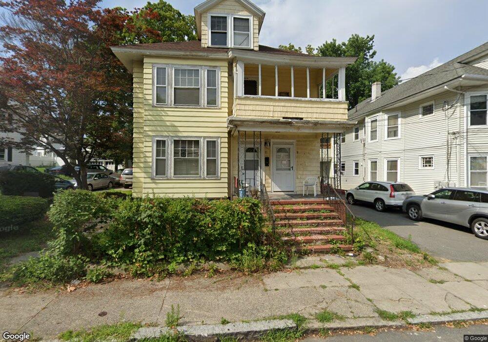
9 Thorndike St Unit 11 Lawrence, MA 01841
Arlington NeighborhoodEstimated Value: $592,000 - $779,000
6
Beds
2
Baths
2,844
Sq Ft
$238/Sq Ft
Est. Value
About This Home
This home is located at 9 Thorndike St Unit 11, Lawrence, MA 01841 and is currently estimated at $676,776, approximately $237 per square foot. 9 Thorndike St Unit 11 is a home located in Essex County with nearby schools including School For Exceptional Studies and Esperanza Academy School of Hope.
Ownership History
Date
Name
Owned For
Owner Type
Purchase Details
Closed on
Nov 30, 2022
Sold by
Thomas Eric S
Bought by
Eric S Thomas Lt
Current Estimated Value
Purchase Details
Closed on
Feb 1, 1999
Sold by
Kulig Richard T
Bought by
Thomas Eric S
Home Financials for this Owner
Home Financials are based on the most recent Mortgage that was taken out on this home.
Original Mortgage
$51,000
Interest Rate
6.67%
Mortgage Type
Purchase Money Mortgage
Create a Home Valuation Report for This Property
The Home Valuation Report is an in-depth analysis detailing your home's value as well as a comparison with similar homes in the area
Home Values in the Area
Average Home Value in this Area
Purchase History
| Date | Buyer | Sale Price | Title Company |
|---|---|---|---|
| Eric S Thomas Lt | -- | None Available | |
| Thomas Eric S | $92,000 | -- |
Source: Public Records
Mortgage History
| Date | Status | Borrower | Loan Amount |
|---|---|---|---|
| Previous Owner | Thomas Eric S | $51,000 |
Source: Public Records
Tax History
| Year | Tax Paid | Tax Assessment Tax Assessment Total Assessment is a certain percentage of the fair market value that is determined by local assessors to be the total taxable value of land and additions on the property. | Land | Improvement |
|---|---|---|---|---|
| 2025 | $5,351 | $608,100 | $138,700 | $469,400 |
| 2024 | $4,550 | $491,900 | $102,500 | $389,400 |
| 2023 | $4,803 | $472,700 | $100,000 | $372,700 |
| 2022 | $4,608 | $402,800 | $100,000 | $302,800 |
| 2021 | $4,512 | $367,700 | $100,000 | $267,700 |
| 2020 | $4,424 | $355,900 | $89,900 | $266,000 |
| 2019 | $3,996 | $292,100 | $80,900 | $211,200 |
| 2018 | $3,653 | $255,100 | $69,600 | $185,500 |
| 2017 | $3,499 | $228,100 | $68,700 | $159,400 |
| 2016 | $3,408 | $219,700 | $50,200 | $169,500 |
| 2015 | $3,149 | $208,300 | $50,200 | $158,100 |
Source: Public Records
Map
Nearby Homes
- 5 Kendrick St
- 229 Jackson St
- 129-131 Lexington St
- 192 Union St
- 439-441 High St
- 41-43 E Haverhill St
- 164 Union St Unit 164
- 25 Kendall St
- 7-9 Bennington St
- 25-27 Bicknell Ave
- 89 Newbury St Unit 89B
- 162 E Haverhill St
- 6 Kendall St
- 6 Cranshaw Place
- 14 Court St
- 39 Swan Ave
- 434-438 Hampshire St
- 9 Russ St
- 545 Hampshire St Unit 545
- 57 Olive St
- 57 Thorndike St
- 5-7 Thorndike St
- 14 Thorndike St Unit 16
- 13 Thorndike St
- 8 Thorndike St
- 15-17 Thorndike St
- 15-17 Thorndike St Unit 3
- 15-17 Thorndike St Unit 2
- 15 Thorndike St Unit 17
- 18 Thorndike St Unit 20
- 15 - 17 Thorndike St
- 22 Thorndike St Unit 24
- 2 Thorndike St Unit 1
- 24 Thorndike St
- 30 Hall St
- 12 Hall St Unit 16
- 224 Bruce St
- 228 Bruce St
- 232 Bruce St
- 32 Hall St Unit 34
Your Personal Tour Guide
Ask me questions while you tour the home.