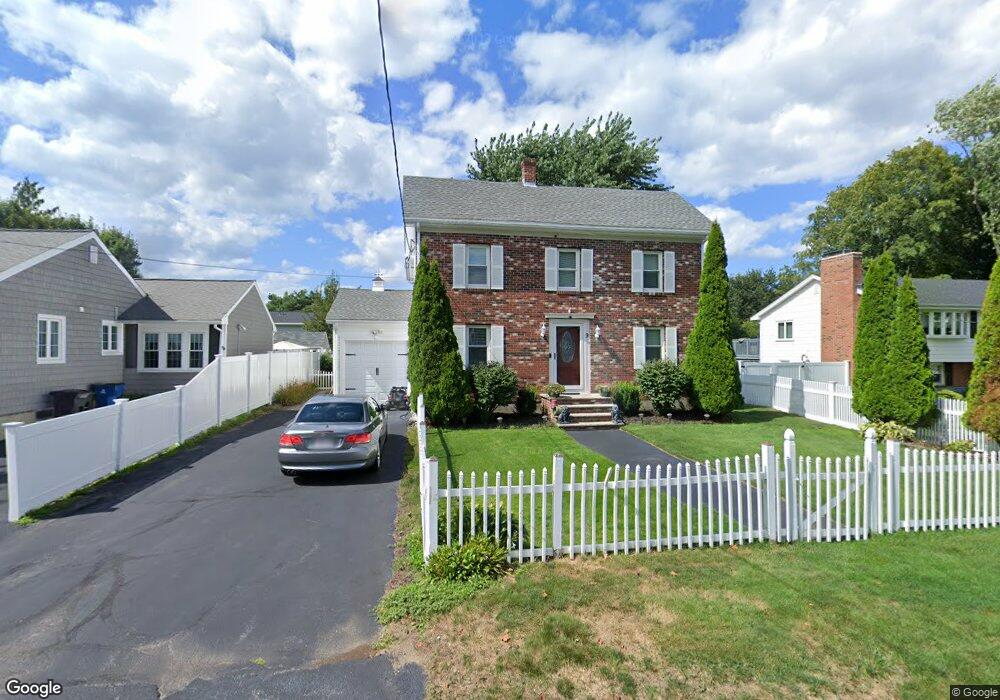
9 Thornton St Unit A Woburn, MA 01801
Cummingsville NeighborhoodEstimated Value: $699,000 - $930,000
3
Beds
1
Bath
1,060
Sq Ft
$773/Sq Ft
Est. Value
About This Home
This home is located at 9 Thornton St Unit A, Woburn, MA 01801 and is currently estimated at $818,876, approximately $772 per square foot. 9 Thornton St Unit A is a home located in Middlesex County with nearby schools including Hurld Elementary School, Daniel L. Joyce Middle School, and Woburn High School.
Create a Home Valuation Report for This Property
The Home Valuation Report is an in-depth analysis detailing your home's value as well as a comparison with similar homes in the area
Home Values in the Area
Average Home Value in this Area
Tax History Compared to Growth
Tax History
| Year | Tax Paid | Tax Assessment Tax Assessment Total Assessment is a certain percentage of the fair market value that is determined by local assessors to be the total taxable value of land and additions on the property. | Land | Improvement |
|---|---|---|---|---|
| 2025 | $5,623 | $658,400 | $324,900 | $333,500 |
| 2024 | $4,689 | $581,800 | $309,500 | $272,300 |
| 2023 | $4,733 | $544,000 | $281,300 | $262,700 |
| 2022 | $4,610 | $493,600 | $244,600 | $249,000 |
| 2021 | $4,343 | $465,500 | $233,000 | $232,500 |
| 2020 | $4,095 | $439,400 | $233,000 | $206,400 |
| 2019 | $3,763 | $396,100 | $221,800 | $174,300 |
| 2018 | $3,633 | $367,300 | $203,600 | $163,700 |
| 2017 | $3,431 | $345,200 | $193,900 | $151,300 |
| 2016 | $3,272 | $325,600 | $181,200 | $144,400 |
| 2015 | $3,163 | $311,000 | $169,400 | $141,600 |
| 2014 | $2,993 | $286,700 | $169,400 | $117,300 |
Source: Public Records
Map
Nearby Homes
- 12 Cassidy Dr
- 18 Winn Valley Dr
- 68 Hammond Place Unit 68
- 7 Locust St
- 36 Cambridge Rd Unit 40
- 29 Overlook Ave
- 19 Hammond Place Unit 19
- 4 Ardmore Ave
- 17 Wright St
- 123 Cambridge Rd Unit 4
- 0 Johnson Rd
- 82 Lowell St
- 26 Flagg St
- 192 Lexington St
- 185 Lexington St
- 18 Hamilton Rd
- 18 Beacon St Unit 18
- 37 1/2 Chestnut St
- 3 Hart St
- 31 Arlington Rd Unit 1-6