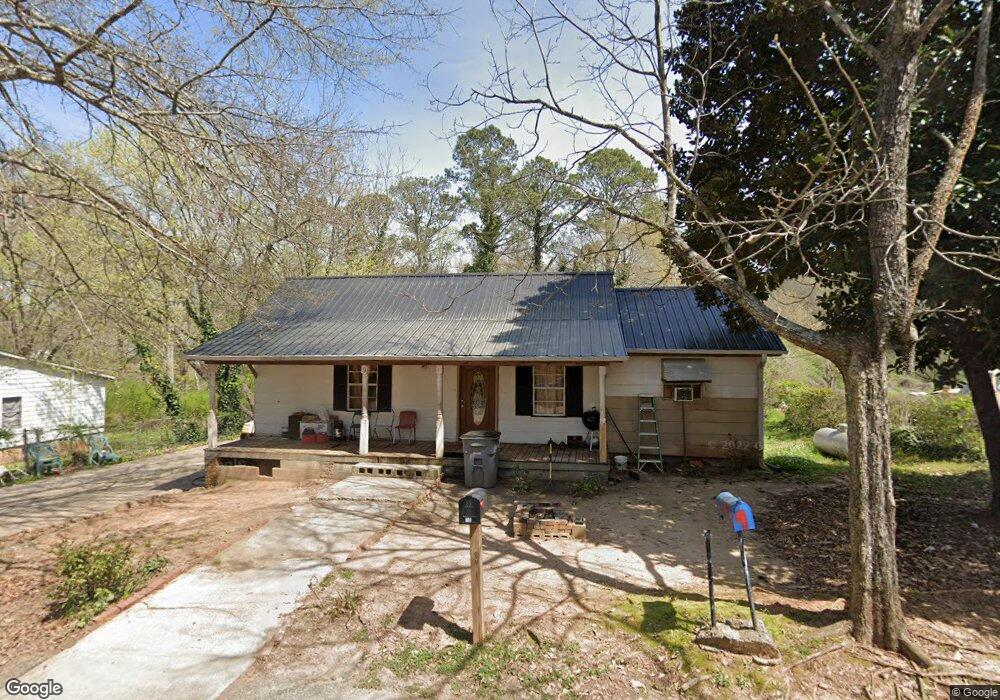
9 Timothy St Lagrange, GA 30240
Estimated Value: $70,609 - $140,000
2
Beds
2
Baths
966
Sq Ft
$109/Sq Ft
Est. Value
About This Home
This home is located at 9 Timothy St, Lagrange, GA 30240 and is currently estimated at $105,402, approximately $109 per square foot. 9 Timothy St is a home located in Troup County with nearby schools including Ethel W. Kight Elementary School, Hollis Hand Elementary School, and Franklin Forest Elementary School.
Ownership History
Date
Name
Owned For
Owner Type
Purchase Details
Closed on
Apr 3, 2000
Sold by
Joyce Tucker
Bought by
Davis Jimmy L and Davis Leonard B
Current Estimated Value
Purchase Details
Closed on
Jan 28, 1999
Sold by
Mitchell Etal
Bought by
Joyce Tucker
Purchase Details
Closed on
Jul 11, 1986
Sold by
Hand Dober and Hand Mary
Bought by
Mitchell Etal
Purchase Details
Closed on
Nov 1, 1951
Sold by
Callaway Community Fdn
Bought by
Hand Dober and Hand Mary
Create a Home Valuation Report for This Property
The Home Valuation Report is an in-depth analysis detailing your home's value as well as a comparison with similar homes in the area
Purchase History
| Date | Buyer | Sale Price | Title Company |
|---|---|---|---|
| Davis Jimmy L | -- | -- | |
| Joyce Tucker | -- | -- | |
| Mitchell Etal | -- | -- | |
| Hand Dober | -- | -- |
Source: Public Records
Tax History
| Year | Tax Paid | Tax Assessment Tax Assessment Total Assessment is a certain percentage of the fair market value that is determined by local assessors to be the total taxable value of land and additions on the property. | Land | Improvement |
|---|---|---|---|---|
| 2025 | $427 | $18,268 | $3,120 | $15,148 |
| 2024 | $396 | $16,508 | $3,120 | $13,388 |
| 2023 | $2 | $12,828 | $3,120 | $9,708 |
| 2022 | $286 | $12,228 | $3,120 | $9,108 |
| 2021 | $203 | $8,716 | $3,120 | $5,596 |
| 2020 | $203 | $8,716 | $3,120 | $5,596 |
| 2019 | $193 | $8,372 | $3,280 | $5,092 |
| 2018 | $193 | $8,372 | $3,280 | $5,092 |
| 2017 | $193 | $8,372 | $3,280 | $5,092 |
| 2016 | $187 | $8,168 | $3,280 | $4,888 |
| 2015 | $183 | $8,020 | $3,132 | $4,888 |
| 2014 | $175 | $7,762 | $3,132 | $4,631 |
| 2013 | -- | $8,046 | $3,132 | $4,914 |
Source: Public Records
Map
Nearby Homes
- 205 Grady St
- 101 Crown St Unit LOT 5
- 102 Crown St Unit LOT 1
- 1520 Brownwood Ave
- 1015 Stonewall St
- 1017 Stonewall St
- 109 Garfield St
- 202 Parker Ln
- 1308 Forrest Ave
- 1304 Forrest Ave
- 1405 Forrest Ave
- 1402 Forrest Ave
- 507 S Lee St
- 211 Moores Hill
- 0 Moores Hill
- 1808 Murphy Ave
- 900 B N Pkwy
- 799 Hunnicutt St
- 797 Hunnicutt St
- 1308 Park Ave
Your Personal Tour Guide
Ask me questions while you tour the home.