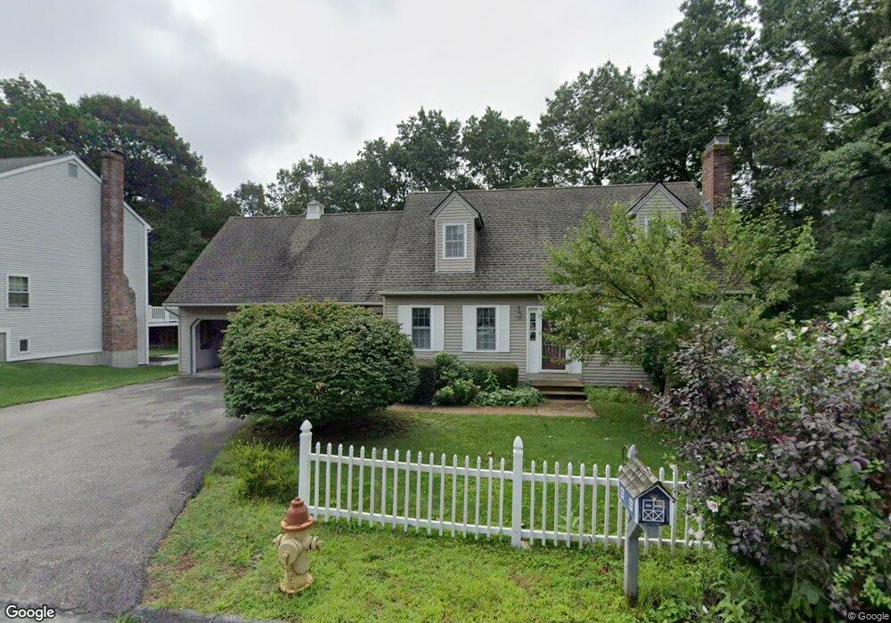
9 Trevor Ln Worcester, MA 01605
Forest Grove NeighborhoodEstimated Value: $549,795 - $616,000
3
Beds
2
Baths
1,742
Sq Ft
$339/Sq Ft
Est. Value
About This Home
This home is located at 9 Trevor Ln, Worcester, MA 01605 and is currently estimated at $590,699, approximately $339 per square foot. 9 Trevor Ln is a home located in Worcester County with nearby schools including Nelson Place Elementary School, Jacob Hiatt Magnet School, and Chandler Magnet.
Ownership History
Date
Name
Owned For
Owner Type
Purchase Details
Closed on
Aug 26, 2008
Sold by
Molt Karl H and Molt Louise
Bought by
Molt Karl H
Current Estimated Value
Purchase Details
Closed on
Jul 11, 2008
Sold by
Molt Karl H and Molt Louise
Bought by
Molt Karl H
Purchase Details
Closed on
May 19, 1995
Sold by
Marko Dev Corp
Bought by
Molt Karl H and Molt Louise
Create a Home Valuation Report for This Property
The Home Valuation Report is an in-depth analysis detailing your home's value as well as a comparison with similar homes in the area
Home Values in the Area
Average Home Value in this Area
Purchase History
| Date | Buyer | Sale Price | Title Company |
|---|---|---|---|
| Molt Karl H | -- | -- | |
| Molt Karl H | -- | -- | |
| Molt Karl H | $52,500 | -- | |
| Molt Karl H | $52,500 | -- |
Source: Public Records
Mortgage History
| Date | Status | Borrower | Loan Amount |
|---|---|---|---|
| Previous Owner | Molt Karl H | $50,000 |
Source: Public Records
Tax History Compared to Growth
Tax History
| Year | Tax Paid | Tax Assessment Tax Assessment Total Assessment is a certain percentage of the fair market value that is determined by local assessors to be the total taxable value of land and additions on the property. | Land | Improvement |
|---|---|---|---|---|
| 2025 | $6,496 | $492,500 | $118,700 | $373,800 |
| 2024 | $6,324 | $459,900 | $118,700 | $341,200 |
| 2023 | $6,097 | $425,200 | $103,200 | $322,000 |
| 2022 | $5,628 | $370,000 | $82,600 | $287,400 |
| 2021 | $5,503 | $338,000 | $66,100 | $271,900 |
| 2020 | $5,423 | $319,000 | $66,100 | $252,900 |
| 2019 | $5,357 | $297,600 | $59,500 | $238,100 |
| 2018 | $5,350 | $282,900 | $59,500 | $223,400 |
| 2017 | $5,082 | $264,400 | $59,500 | $204,900 |
| 2016 | $5,126 | $248,700 | $43,800 | $204,900 |
| 2015 | $4,991 | $248,700 | $43,800 | $204,900 |
| 2014 | $4,860 | $248,700 | $43,800 | $204,900 |
Source: Public Records
Map
Nearby Homes
- 12 Tattan Farm Rd
- 7 Otter Trail
- 61 Barry Rd
- 49 Barry Rd
- 46 Barry Rd
- 90 Lynnwood Ln
- 17 Leslie Rd
- 70 Jordan Rd
- 4004 Brompton Cir
- 303 Greenwich Ct Unit 303
- 3901 Knightsbridge Close Unit 3901
- 97 Parkton Ave
- 770 Salisbury St Unit 201
- 4 Barrows Rd
- 667 Grove St
- 82 Holden St
- 3 Lynnwood Ln
- 9 Emily St
- 617 Salisbury St
- 96 Indian Hill Rd
- 7 Trevor Ln
- 18 Laurelwood Dr
- 16 Laurelwood Dr
- 16 Laurelwood Dr Unit SF
- 16 Laurelwood Dr Unit 1
- 16 Laurelwood Dr Unit 16
- 10 Trevor Ln
- 20 Laurelwood Dr
- 5 Trevor Ln
- 11 Russell Calvin Dr
- 8 Trevor Ln
- 12 Laurelwood Dr
- 9 Russell Calvin Dr
- 22 Laurelwood Dr
- 3 Trevor Ln
- 6 Trevor Ln
- 7 Russell Calvin Dr
- 7 Russell Calvin Dr
- 13 Russell Calvin Dr
- 19 Laurelwood Dr