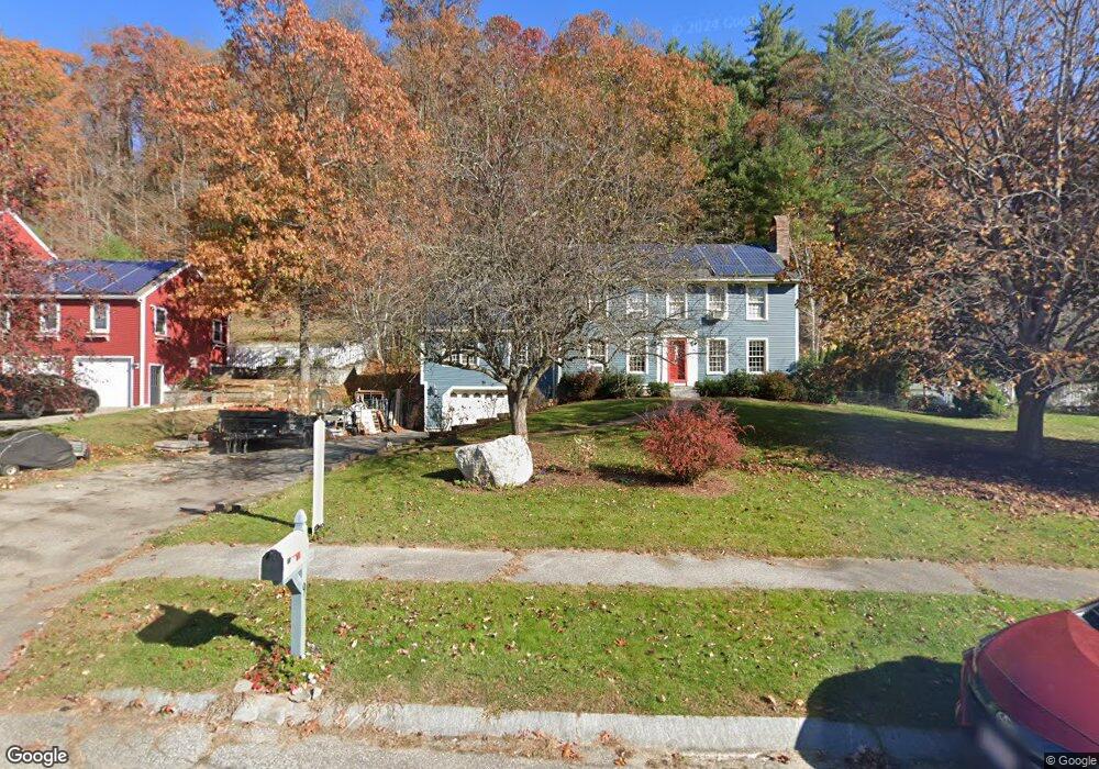
9 Tuxbury Ln Amesbury, MA 01913
Estimated Value: $846,557 - $969,000
3
Beds
4
Baths
2,494
Sq Ft
$368/Sq Ft
Est. Value
About This Home
This home is located at 9 Tuxbury Ln, Amesbury, MA 01913 and is currently estimated at $918,139, approximately $368 per square foot. 9 Tuxbury Ln is a home located in Essex County with nearby schools including Amesbury High School and Amesbury Seventh-Day Adventist School.
Ownership History
Date
Name
Owned For
Owner Type
Purchase Details
Closed on
Jun 28, 2023
Sold by
Calderwood Richard D and Calderwood Wendy P
Bought by
9 Tuxbury Lane Rt and Calderwood
Current Estimated Value
Purchase Details
Closed on
Sep 21, 2021
Sold by
9 Tuxbury Lane Rt and Calderwood
Bought by
Calderwood Richard D and Calderwood Wendy P
Home Financials for this Owner
Home Financials are based on the most recent Mortgage that was taken out on this home.
Original Mortgage
$186,000
Interest Rate
2.8%
Mortgage Type
Stand Alone Refi Refinance Of Original Loan
Purchase Details
Closed on
Oct 25, 2010
Sold by
Calderwood Richard D and Calderwood Wendy P
Bought by
9 Tuxbury Ln Rt and Calderwood
Home Financials for this Owner
Home Financials are based on the most recent Mortgage that was taken out on this home.
Original Mortgage
$225,400
Interest Rate
4.37%
Mortgage Type
Purchase Money Mortgage
Create a Home Valuation Report for This Property
The Home Valuation Report is an in-depth analysis detailing your home's value as well as a comparison with similar homes in the area
Home Values in the Area
Average Home Value in this Area
Purchase History
| Date | Buyer | Sale Price | Title Company |
|---|---|---|---|
| 9 Tuxbury Lane Rt | -- | None Available | |
| 9 Tuxbury Lane Rt | -- | None Available | |
| 9 Tuxbury Lane Rt | -- | None Available | |
| Calderwood Richard D | -- | None Available | |
| Calderwood Richard D | -- | None Available | |
| Calderwood Richard D | -- | None Available | |
| 9 Tuxbury Ln Rt | -- | -- | |
| Calderwood Richard D | -- | -- | |
| Calderwood Richard D | -- | -- |
Source: Public Records
Mortgage History
| Date | Status | Borrower | Loan Amount |
|---|---|---|---|
| Previous Owner | Calderwood Richard D | $186,000 | |
| Previous Owner | Calderwood Richard D | $225,400 |
Source: Public Records
Tax History Compared to Growth
Tax History
| Year | Tax Paid | Tax Assessment Tax Assessment Total Assessment is a certain percentage of the fair market value that is determined by local assessors to be the total taxable value of land and additions on the property. | Land | Improvement |
|---|---|---|---|---|
| 2025 | $11,682 | $763,500 | $279,400 | $484,100 |
| 2024 | $11,153 | $713,100 | $263,700 | $449,400 |
| 2023 | $10,224 | $625,700 | $229,500 | $396,200 |
| 2022 | $9,807 | $554,400 | $199,800 | $354,600 |
| 2021 | $9,610 | $526,600 | $161,400 | $365,200 |
| 2020 | $8,638 | $502,800 | $155,200 | $347,600 |
| 2019 | $8,770 | $477,400 | $155,200 | $322,200 |
| 2018 | $8,443 | $444,600 | $147,800 | $296,800 |
| 2017 | $8,666 | $434,400 | $147,800 | $286,600 |
| 2016 | $8,651 | $426,600 | $147,800 | $278,800 |
| 2015 | $8,491 | $413,400 | $147,800 | $265,600 |
| 2014 | $8,283 | $395,000 | $147,800 | $247,200 |
Source: Public Records
Map
Nearby Homes
- 1 Tuxbury Ln
- 152 Kimball Rd
- 2 Alnette Rd
- 3 Greystone Rd
- 4 Acadia Kimball Rd
- 1 Acadia Kimball Rd Unit 1
- 21 Currier St
- 20 Mason Ct
- 10 Mason Ct Unit 10
- 22 Jewell St
- 8 Old County Rd
- 4 Woodsom Dr
- 16 Glen Devin St
- 188 Lions Mouth Rd
- 5 Moncrief St Unit 5
- 160 Haverhill Rd
- 10 Sharon Cir
- 3 B St
- 18 Harriman Rd
- 7 Ashley Ln