Estimated Value: $1,372,000 - $3,780,000
2
Beds
2
Baths
964
Sq Ft
$2,684/Sq Ft
Est. Value
About This Home
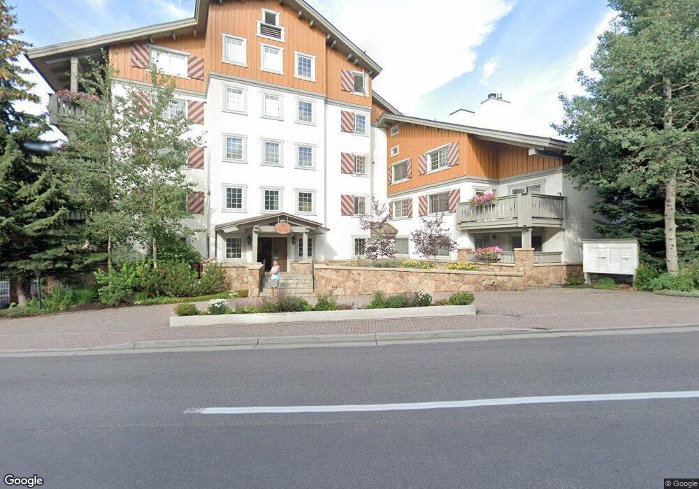
This home is located at 9 Vail Rd Unit 2B, Vail, CO 81657 and is currently estimated at $2,586,975, approximately $2,683 per square foot. 9 Vail Rd Unit 2B is a home located in Eagle County with nearby schools including Red Sandstone Elementary School, Battle Mountain High School, and Vail Mountain School.
Ownership History
Date
Name
Owned For
Owner Type
Purchase Details
Closed on
Jun 30, 2014
Sold by
9 Vail Road #21 Llc
Bought by
Lundstrom Mark E
Current Estimated Value
Home Financials for this Owner
Home Financials are based on the most recent Mortgage that was taken out on this home.
Original Mortgage
$1,165,313
Outstanding Balance
$877,872
Interest Rate
3.87%
Mortgage Type
Adjustable Rate Mortgage/ARM
Estimated Equity
$1,709,103
Purchase Details
Closed on
Sep 16, 2011
Sold by
Bradshaw Scott D
Bought by
9 Vail Road #21 Llc
Create a Home Valuation Report for This Property
The Home Valuation Report is an in-depth analysis detailing your home's value as well as a comparison with similar homes in the area
Home Values in the Area
Average Home Value in this Area
Purchase History
| Date | Buyer | Sale Price | Title Company |
|---|---|---|---|
| Lundstrom Mark E | $1,553,750 | Land Title Guarantee Company | |
| 9 Vail Road #21 Llc | -- | None Available |
Source: Public Records
Mortgage History
| Date | Status | Borrower | Loan Amount |
|---|---|---|---|
| Open | Lundstrom Mark E | $1,165,313 |
Source: Public Records
Tax History
| Year | Tax Paid | Tax Assessment Tax Assessment Total Assessment is a certain percentage of the fair market value that is determined by local assessors to be the total taxable value of land and additions on the property. | Land | Improvement |
|---|---|---|---|---|
| 2024 | $5,370 | $112,910 | -- | $112,910 |
| 2023 | $5,370 | $112,910 | $0 | $112,910 |
| 2022 | $5,101 | $99,270 | $0 | $99,270 |
| 2021 | $5,253 | $102,130 | $0 | $102,130 |
| 2020 | $5,038 | $99,260 | $0 | $99,260 |
| 2019 | $5,054 | $99,260 | $0 | $99,260 |
| 2018 | $5,264 | $101,320 | $0 | $101,320 |
| 2017 | $5,238 | $101,320 | $0 | $101,320 |
| 2016 | $5,962 | $116,600 | $0 | $116,600 |
Source: Public Records
Map
Nearby Homes
- 22 W Meadow Dr Unit 125
- 17 Vail Rd Unit 1
- 100 E Meadow Dr Unit 25
- 100 E Meadow Dr Unit 30
- 1 Vail Rd Unit 7105L
- 1 Vail Rd Unit 4103i
- 1 Vail Rd Unit 7105B
- 1 Vail Rd Unit 5101J
- 16 Vail Rd Unit 402/Weeks 4 & 12
- 16 Vail Rd
- 16 Vail Rd Unit 427
- 16 Vail Rd Unit 318A
- 12 Vail Rd Unit R8
- 126 Forest Rd Unit W
- 175 Forest Rd
- 100 Vail Rd
- 185 Forest Rd
- 103 Willow Place Unit 302
- 103 Willow Place Unit 301
- 103 Willow Place Unit 203
- 9 Vail Rd Unit 5A
- 9 Vail Rd Unit 4A
- 9 Vail Rd Unit 3D
- 9 Vail Rd Unit 3A
- 9 Vail Rd Unit 2F
- 9 Vail Rd Unit 2E
- 9 Vail Rd Unit 2D
- 9 Vail Rd Unit 1K
- 9 Vail Rd Unit 1H
- 9 Vail Rd Unit 1F
- 9 Vail Rd Unit 4D
- 9 Vail Rd Unit 4C
- 9 Vail Rd Unit 4B
- 9 Vail Rd Unit 3E
- 9 Vail Rd Unit 3C
- 9 Vail Rd Unit 3B
- 9 Vail Rd Unit 2H
- 9 Vail Rd Unit 1E
- 9 Vail Rd Unit 1D
- 9 Vail Rd Unit 1C
Your Personal Tour Guide
Ask me questions while you tour the home.