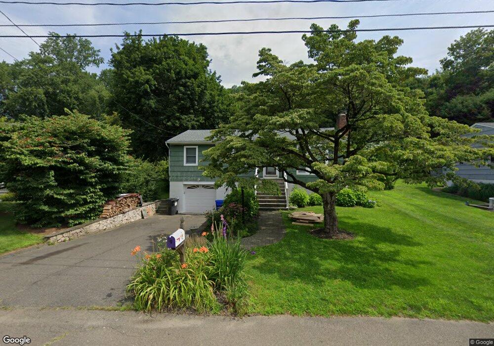
9 Victor Dr Ridgefield, CT 06877
Estimated Value: $608,704 - $715,000
3
Beds
1
Bath
1,285
Sq Ft
$523/Sq Ft
Est. Value
About This Home
This home is located at 9 Victor Dr, Ridgefield, CT 06877 and is currently estimated at $671,676, approximately $522 per square foot. 9 Victor Dr is a home located in Fairfield County with nearby schools including Ridgefield High School, St. Mary School, and Ridgefield Montessori School.
Ownership History
Date
Name
Owned For
Owner Type
Purchase Details
Closed on
Sep 27, 2000
Sold by
Armstrong John S and Faro-Armstrong Marie
Bought by
Larubbio Mary
Current Estimated Value
Home Financials for this Owner
Home Financials are based on the most recent Mortgage that was taken out on this home.
Original Mortgage
$200,000
Interest Rate
7.94%
Purchase Details
Closed on
Aug 2, 1994
Sold by
Sansolo Michael J and Sansolo Janice C
Bought by
Armstrong John S and Faro Armstrong Marie
Create a Home Valuation Report for This Property
The Home Valuation Report is an in-depth analysis detailing your home's value as well as a comparison with similar homes in the area
Home Values in the Area
Average Home Value in this Area
Purchase History
| Date | Buyer | Sale Price | Title Company |
|---|---|---|---|
| Larubbio Mary | $285,000 | -- | |
| Armstrong John S | $215,000 | -- |
Source: Public Records
Mortgage History
| Date | Status | Borrower | Loan Amount |
|---|---|---|---|
| Open | Armstrong John S | $39,700 | |
| Open | Armstrong John S | $174,000 | |
| Closed | Armstrong John S | $200,000 | |
| Closed | Armstrong John S | $200,000 |
Source: Public Records
Tax History Compared to Growth
Tax History
| Year | Tax Paid | Tax Assessment Tax Assessment Total Assessment is a certain percentage of the fair market value that is determined by local assessors to be the total taxable value of land and additions on the property. | Land | Improvement |
|---|---|---|---|---|
| 2025 | $7,397 | $270,060 | $178,500 | $91,560 |
| 2024 | $7,116 | $270,060 | $178,500 | $91,560 |
| 2023 | $6,970 | $270,060 | $178,500 | $91,560 |
| 2022 | $7,182 | $252,610 | $161,840 | $90,770 |
| 2021 | $7,126 | $252,610 | $161,840 | $90,770 |
| 2020 | $7,103 | $252,610 | $161,840 | $90,770 |
| 2019 | $7,103 | $252,610 | $161,840 | $90,770 |
| 2018 | $7,018 | $252,610 | $161,840 | $90,770 |
| 2017 | $5,940 | $218,310 | $129,860 | $88,450 |
| 2016 | $5,827 | $218,310 | $129,860 | $88,450 |
| 2015 | $5,678 | $218,310 | $129,860 | $88,450 |
| 2014 | $5,678 | $218,310 | $129,860 | $88,450 |
Source: Public Records
Map
Nearby Homes
- 75A New St
- 75 New St
- 0 Pound St Unit 113831
- 0 Pound St
- 33 N Salem Rd
- 8 Stebbins Close Unit 8
- 105 Olcott Way Unit 105
- 40 North St
- 75 Lawson Ln
- 13 Lawson Ln Unit 13
- 22 Ketcham Rd
- 9 Cook Close
- 52 Lawson Ln Unit 52
- 27 Catoonah St
- 151 North St
- 59 Prospect St Unit C
- 2 Westmoreland Rd
- 77 Sunset Ln Unit 223
- 71 Peaceable Ridge Rd
- 19 Prospect Ridge Unit 14