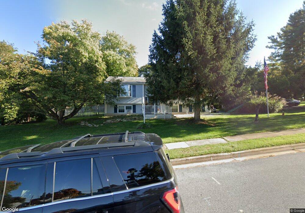
9 Walgrove Rd Reisterstown, MD 21136
Estimated Value: $355,000 - $405,000
--
Bed
3
Baths
1,138
Sq Ft
$341/Sq Ft
Est. Value
About This Home
This home is located at 9 Walgrove Rd, Reisterstown, MD 21136 and is currently estimated at $387,692, approximately $340 per square foot. 9 Walgrove Rd is a home located in Baltimore County with nearby schools including Reisterstown Elementary, Franklin Middle, and Franklin High.
Ownership History
Date
Name
Owned For
Owner Type
Purchase Details
Closed on
Aug 14, 2001
Sold by
Joann Franklin M
Bought by
Joann Franklin M and Joann Robert K
Current Estimated Value
Purchase Details
Closed on
May 11, 1995
Sold by
Sims Michael A
Bought by
Franklin J
Home Financials for this Owner
Home Financials are based on the most recent Mortgage that was taken out on this home.
Original Mortgage
$130,062
Interest Rate
8.31%
Purchase Details
Closed on
Oct 4, 1984
Sold by
Belt Douglas C
Bought by
Sims Michael A
Create a Home Valuation Report for This Property
The Home Valuation Report is an in-depth analysis detailing your home's value as well as a comparison with similar homes in the area
Home Values in the Area
Average Home Value in this Area
Purchase History
| Date | Buyer | Sale Price | Title Company |
|---|---|---|---|
| Joann Franklin M | -- | -- | |
| Franklin J | $130,900 | -- | |
| Sims Michael A | $72,000 | -- |
Source: Public Records
Mortgage History
| Date | Status | Borrower | Loan Amount |
|---|---|---|---|
| Previous Owner | Franklin J | $130,062 |
Source: Public Records
Tax History Compared to Growth
Tax History
| Year | Tax Paid | Tax Assessment Tax Assessment Total Assessment is a certain percentage of the fair market value that is determined by local assessors to be the total taxable value of land and additions on the property. | Land | Improvement |
|---|---|---|---|---|
| 2025 | $3,649 | $262,633 | -- | -- |
| 2024 | $3,649 | $242,700 | $69,500 | $173,200 |
| 2023 | $1,788 | $237,533 | $0 | $0 |
| 2022 | $3,694 | $232,367 | $0 | $0 |
| 2021 | $3,478 | $227,200 | $69,500 | $157,700 |
| 2020 | $3,478 | $221,100 | $0 | $0 |
| 2019 | $3,444 | $215,000 | $0 | $0 |
| 2018 | $3,445 | $208,900 | $69,500 | $139,400 |
| 2017 | $3,274 | $199,833 | $0 | $0 |
| 2016 | $2,673 | $190,767 | $0 | $0 |
| 2015 | $2,673 | $181,700 | $0 | $0 |
| 2014 | $2,673 | $181,700 | $0 | $0 |
Source: Public Records
Map
Nearby Homes
- 225 Highmeadow Rd
- 10 Pennyborough Ct
- 215 Greenview Ave
- 123 Glyndon Trace Dr
- 65A Bond Ave
- 223 New Ave
- 11921 Tarragon Rd Unit H
- 3 Meadow Mist Ct
- 13 Bellinger Ct
- 11906 Tarragon Rd Unit I
- 11906 Tarragon Rd Unit J
- 11902 Tarragon Rd Unit A
- 15 Gloucester Ct
- 10 Simpson Ct
- 105 Fitz Ct Unit 202
- 101 Fitz Ct Unit 202
- 105 Fitz Ct Unit 101
- 203 Cork Ln Unit T4
- 208 Parkholme Cir
- 118 Mardan Dr
- 11 Walgrove Rd
- 633 Main St
- 101 Walgrove Rd
- 10 Walgrove Rd
- 704 Walgrove Ct
- 100 Walgrove Rd
- 702 Walgrove Ct
- 103 Walgrove Rd
- 614 Piper Rd
- 706 Walgrove Ct
- 102 Walgrove Rd
- 612 Piper Rd
- 101 Brunk Rd
- 104 Walgrove Rd
- 641 Reisterstown Rd
- 641 Main St
- 635 Main St Unit SUITE MAIN
- 635 Main St Unit SUITE 1
- 635 Main St Unit SUITE 3
- 635 Main St Unit 1