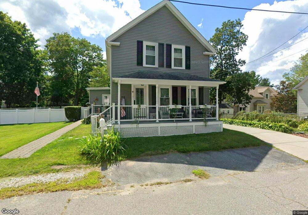
9 Walnut St Attleboro, MA 02703
Estimated Value: $460,000 - $495,000
3
Beds
2
Baths
1,417
Sq Ft
$337/Sq Ft
Est. Value
About This Home
This home is located at 9 Walnut St, Attleboro, MA 02703 and is currently estimated at $477,887, approximately $337 per square foot. 9 Walnut St is a home located in Bristol County with nearby schools including A. Irvin Studley Elementary School, Cyril K. Brennan Middle School, and Attleboro High School.
Ownership History
Date
Name
Owned For
Owner Type
Purchase Details
Closed on
Jul 21, 2008
Sold by
Moore James H and Moore Linda M
Bought by
Moore James H and Moore Mary A
Current Estimated Value
Home Financials for this Owner
Home Financials are based on the most recent Mortgage that was taken out on this home.
Original Mortgage
$130,000
Outstanding Balance
$84,291
Interest Rate
6.17%
Mortgage Type
Purchase Money Mortgage
Estimated Equity
$393,596
Create a Home Valuation Report for This Property
The Home Valuation Report is an in-depth analysis detailing your home's value as well as a comparison with similar homes in the area
Home Values in the Area
Average Home Value in this Area
Purchase History
| Date | Buyer | Sale Price | Title Company |
|---|---|---|---|
| Moore James H | -- | -- |
Source: Public Records
Mortgage History
| Date | Status | Borrower | Loan Amount |
|---|---|---|---|
| Open | Moore James H | $130,000 |
Source: Public Records
Tax History Compared to Growth
Tax History
| Year | Tax Paid | Tax Assessment Tax Assessment Total Assessment is a certain percentage of the fair market value that is determined by local assessors to be the total taxable value of land and additions on the property. | Land | Improvement |
|---|---|---|---|---|
| 2025 | $5,083 | $405,000 | $145,200 | $259,800 |
| 2024 | $5,087 | $399,600 | $145,200 | $254,400 |
| 2023 | $4,896 | $357,600 | $132,000 | $225,600 |
| 2022 | $4,750 | $328,700 | $125,800 | $202,900 |
| 2021 | $4,376 | $295,700 | $121,000 | $174,700 |
| 2020 | $4,285 | $294,300 | $117,400 | $176,900 |
| 2019 | $3,995 | $282,100 | $115,200 | $166,900 |
| 2018 | $3,794 | $256,000 | $111,800 | $144,200 |
| 2017 | $3,750 | $257,700 | $111,800 | $145,900 |
| 2016 | $3,509 | $236,800 | $109,600 | $127,200 |
| 2015 | $3,219 | $218,800 | $109,600 | $109,200 |
| 2014 | $3,130 | $210,800 | $104,400 | $106,400 |
Source: Public Records
Map
Nearby Homes
- 24 Oakland Ave Unit 1
- 22 Oakland Ave Unit 1
- 309 Thacher St
- 17 Jewel Ave
- 34 Hawthorne St
- 31 Verndale Ave
- 52 Hawthorne St
- 804 County St
- 49 Bushee St
- 0 Tulip Unit 73410552
- 0 Tulip Unit 73407296
- 75 Grant St
- 3 Grant St
- 21 Dennis St
- 101 South Ave Unit 803
- 660 Thacher St Unit 1402
- 26 Lamb St
- 115 Ellis St
- 49 Dennis St
- 429 S Main St Unit 1
- 690 County St
- 17 Walnut St
- 10 Walnut St
- 694 County St
- 21 Walnut St
- 682 County St
- 20 Walnut St
- 12 Birch St
- Lot 22 Cooper Farm
- Lot 24 Cooper Farm
- 000 Jospeh St
- Lot 40 Cooper Farm
- Lot 7 Cooper Farm
- Lot 39 Cooper Farm
- 674 County St
- 28 Birch St Unit 27
- 36 Chestnut St
- 29 Walnut St
- 15 Birch St Unit 9
- 15 Birch St Unit 11