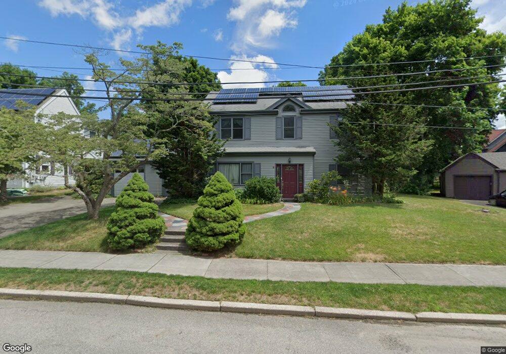
9 Walsh Rd Newton Center, MA 02459
Mount Ida NeighborhoodEstimated Value: $1,385,000 - $1,927,000
5
Beds
4
Baths
2,637
Sq Ft
$639/Sq Ft
Est. Value
About This Home
This home is located at 9 Walsh Rd, Newton Center, MA 02459 and is currently estimated at $1,684,787, approximately $638 per square foot. 9 Walsh Rd is a home located in Middlesex County with nearby schools including Memorial Spaulding Elementary School, Oak Hill Middle School, and Newton South High School.
Ownership History
Date
Name
Owned For
Owner Type
Purchase Details
Closed on
Aug 28, 2020
Sold by
Straub Carolyn M
Bought by
Carolyn M Straub Ret
Current Estimated Value
Purchase Details
Closed on
May 1, 1986
Bought by
Straub Carolyn M
Create a Home Valuation Report for This Property
The Home Valuation Report is an in-depth analysis detailing your home's value as well as a comparison with similar homes in the area
Home Values in the Area
Average Home Value in this Area
Purchase History
| Date | Buyer | Sale Price | Title Company |
|---|---|---|---|
| Carolyn M Straub Ret | -- | None Available | |
| Straub Carolyn M | $180,500 | -- |
Source: Public Records
Mortgage History
| Date | Status | Borrower | Loan Amount |
|---|---|---|---|
| Previous Owner | Straub Carolyn M | $220,000 | |
| Previous Owner | Straub Carolyn M | $129,500 | |
| Previous Owner | Straub Carolyn M | $131,200 | |
| Previous Owner | Straub Carolyn M | $45,000 |
Source: Public Records
Tax History Compared to Growth
Tax History
| Year | Tax Paid | Tax Assessment Tax Assessment Total Assessment is a certain percentage of the fair market value that is determined by local assessors to be the total taxable value of land and additions on the property. | Land | Improvement |
|---|---|---|---|---|
| 2025 | $10,603 | $1,081,900 | $669,000 | $412,900 |
| 2024 | $11,969 | $1,226,300 | $649,500 | $576,800 |
| 2023 | $11,206 | $1,100,800 | $494,700 | $606,100 |
| 2022 | $10,723 | $1,019,300 | $458,100 | $561,200 |
| 2021 | $10,347 | $961,600 | $432,200 | $529,400 |
| 2020 | $10,039 | $961,600 | $432,200 | $529,400 |
| 2019 | $9,756 | $933,600 | $419,600 | $514,000 |
| 2018 | $9,360 | $865,100 | $380,100 | $485,000 |
| 2017 | $9,075 | $816,100 | $358,600 | $457,500 |
| 2016 | $8,680 | $762,700 | $335,100 | $427,600 |
| 2015 | $8,356 | $719,700 | $313,200 | $406,500 |
Source: Public Records
Map
Nearby Homes
- 5 Kappius Path
- 22 Nightingale Path
- 141 Spiers Rd
- 544 Saw Mill Brook Pkwy
- 30 Esty Farm Rd
- 210 Nahanton St Unit 404
- 853 Dedham St
- 133 Oak Hill St
- 207 Nahanton St Unit 207
- 36 Ober Rd
- 21 Lovett Rd
- 44 Lovett Rd
- 579 Baker St Unit 579
- 701 Greendale Ave
- 577 Baker St Unit 577
- 931 Lagrange St
- 1307 Lagrange St Unit 1307
- 135 Hartman Rd
- 865 Lagrange St Unit 5
- 845 Lagrange St Unit 4
- 787 Saw Mill Brook Pkwy
- 17 Walsh Rd
- 26 Van Roosen Rd
- 18 Van Roosen Rd
- 781 Saw Mill Brook Pkwy
- 801 Saw Mill Brook Pkwy
- 23 Walsh Rd
- 32 Van Roosen Rd
- 32 Van Roosen Rd Unit 1
- 16 Walsh Rd
- 10 Van Roosen Rd
- 22 Walsh Rd
- 40 Van Roosen Rd
- 31 Walsh Rd
- 30 Walsh Rd
- 10 K Roadway
- 118 Osborne Path
- 21 Van Roosen Rd
- 15 Van Roosen Rd
- 46 Van Roosen Rd