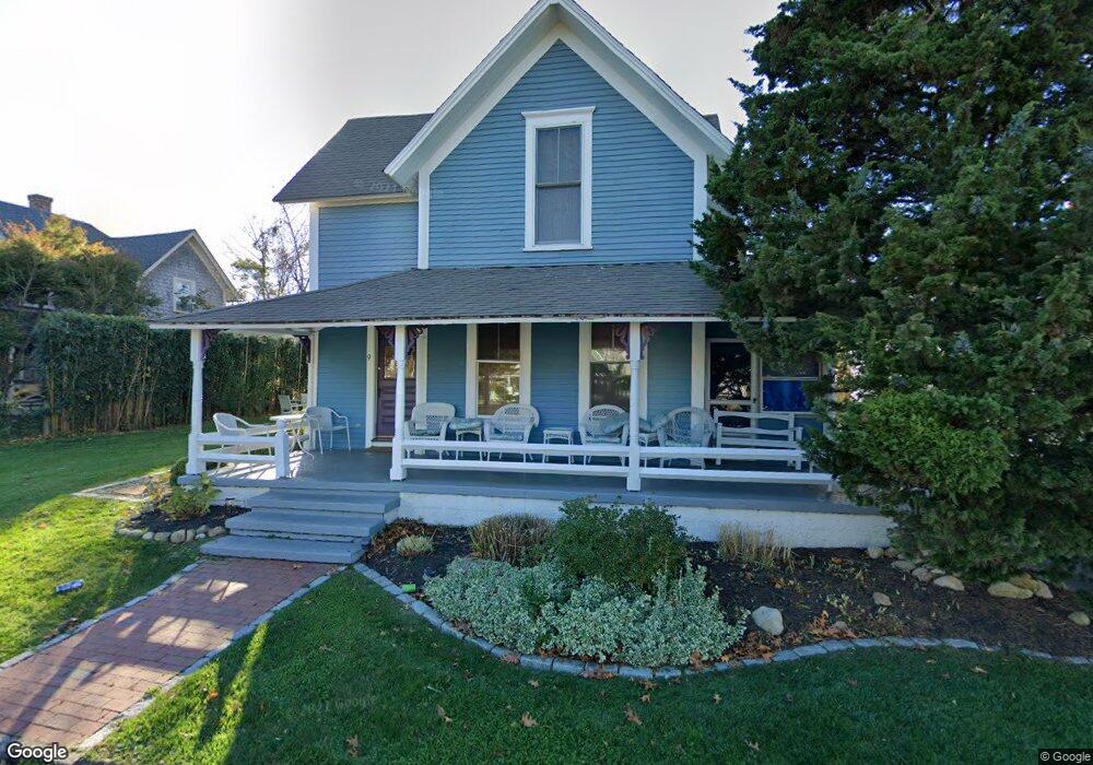
9 Wamsutta Ave Oak Bluffs, MA 02557
Oak Bluffs NeighborhoodEstimated Value: $1,569,038 - $1,803,000
5
Beds
3
Baths
1,966
Sq Ft
$857/Sq Ft
Est. Value
About This Home
This home is located at 9 Wamsutta Ave, Oak Bluffs, MA 02557 and is currently estimated at $1,684,760, approximately $856 per square foot. 9 Wamsutta Ave is a home with nearby schools including Oak Bluffs Elementary School and Martha's Vineyard Regional High School.
Ownership History
Date
Name
Owned For
Owner Type
Purchase Details
Closed on
Jun 21, 2004
Sold by
Carson Kathryn and Carson Kyle
Bought by
Mcmahon Joseph A
Current Estimated Value
Home Financials for this Owner
Home Financials are based on the most recent Mortgage that was taken out on this home.
Original Mortgage
$525,680
Outstanding Balance
$259,038
Interest Rate
6.12%
Mortgage Type
Purchase Money Mortgage
Estimated Equity
$1,425,722
Purchase Details
Closed on
Dec 23, 1999
Sold by
Caldwell Caleb and Ibsen Mary
Bought by
Carson Kyle and Carson Kathryna
Purchase Details
Closed on
Mar 31, 1998
Sold by
Daniel Richard O
Bought by
Caldwell Caleb and Ibsen Mary
Home Financials for this Owner
Home Financials are based on the most recent Mortgage that was taken out on this home.
Original Mortgage
$142,500
Interest Rate
6.96%
Mortgage Type
Purchase Money Mortgage
Create a Home Valuation Report for This Property
The Home Valuation Report is an in-depth analysis detailing your home's value as well as a comparison with similar homes in the area
Home Values in the Area
Average Home Value in this Area
Purchase History
| Date | Buyer | Sale Price | Title Company |
|---|---|---|---|
| Mcmahon Joseph A | $657,100 | -- | |
| Carson Kyle | $150,000 | -- | |
| Caldwell Caleb | $108,000 | -- |
Source: Public Records
Mortgage History
| Date | Status | Borrower | Loan Amount |
|---|---|---|---|
| Open | Caldwell Caleb | $525,680 | |
| Previous Owner | Caldwell Caleb | $142,500 |
Source: Public Records
Tax History Compared to Growth
Tax History
| Year | Tax Paid | Tax Assessment Tax Assessment Total Assessment is a certain percentage of the fair market value that is determined by local assessors to be the total taxable value of land and additions on the property. | Land | Improvement |
|---|---|---|---|---|
| 2025 | $6,721 | $1,330,900 | $593,700 | $737,200 |
| 2024 | $6,501 | $1,243,100 | $539,500 | $703,600 |
| 2023 | $5,967 | $1,130,100 | $524,200 | $605,900 |
| 2022 | $5,952 | $876,600 | $394,900 | $481,700 |
| 2021 | $5,704 | $773,900 | $333,700 | $440,200 |
| 2020 | $5,395 | $725,100 | $317,800 | $407,300 |
| 2019 | $5,200 | $676,200 | $277,100 | $399,100 |
| 2018 | $5,085 | $649,400 | $250,300 | $399,100 |
| 2017 | $4,853 | $595,400 | $237,300 | $358,100 |
| 2016 | $4,576 | $564,200 | $244,600 | $319,600 |
| 2015 | $4,196 | $527,100 | $244,600 | $282,500 |
| 2014 | $4,559 | $583,800 | $251,000 | $332,800 |
Source: Public Records
Map
Nearby Homes
- 79 Circuit Ave
- 34 Massasoit Ave
- 1 Cottage Park
- 16 Cottage Park
- 17 Siloam Ave
- 41 Trinity Park
- 2 Lincoln Ave
- 46 Kennebec Ave
- 10 Siloam Ave
- 50 Canonicus Ave
- 181 Circuit Ave
- 22 Greenleaf Ave
- 22 Greenleaf Ave
- 26 Winthrop Ave
- 0 Heather Ln Unit 11 43465
- 30 Franklin Ave
- 4 Canonicus Ave
- 9 Brunswick Ave
- 8 Hitchings Cir
- 23 Circuit Avenue Extension
- 7 Wamsutta Ave
- 11 Wamsutta Ave Ob540
- 5 Wamsuttsa Ave
- 5 Wamsutta Ave
- 5 Wamsutta Ave
- 15 Wamsutta Ave
- 8 Uncas Ave
- 1 Wamsutta Ave
- 94 Tuckernuck
- 75 & 77 Tuckernuck Ave
- 75 Tuckernuck Ave
- 73 Tuckernuck Ave
- 16 Circuit Ave
- 190 Circuit Ave
- 55 Tuckernuck Ave
- 49 Tuckernuck Ave
- 3 Uncas Ave
- 71 Tuckernuck Ave
- 84 Circuit Ave
- 40 Circuit Ave