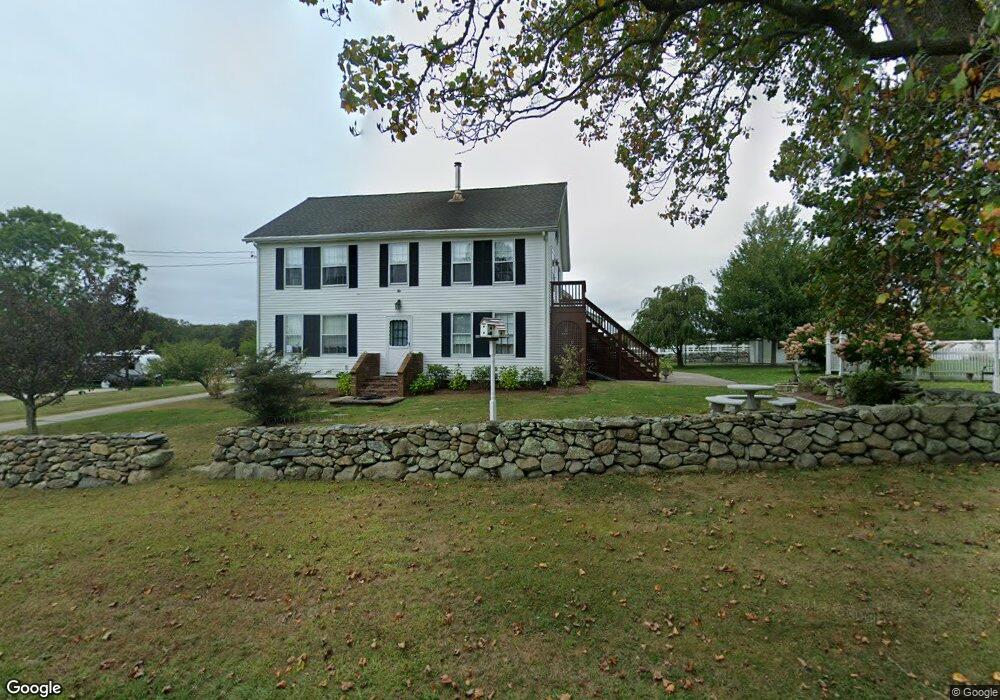
9 William Sisson Rd Little Compton, RI 02837
Estimated Value: $1,238,569 - $1,789,000
5
Beds
3
Baths
2,572
Sq Ft
$575/Sq Ft
Est. Value
About This Home
This home is located at 9 William Sisson Rd, Little Compton, RI 02837 and is currently estimated at $1,479,856, approximately $575 per square foot. 9 William Sisson Rd is a home located in Newport County with nearby schools including Wilbur & McMahon School.
Ownership History
Date
Name
Owned For
Owner Type
Purchase Details
Closed on
Aug 15, 2023
Sold by
Stpierre Paris M
Bought by
Stpierre Paris M and Ferry Gary
Current Estimated Value
Home Financials for this Owner
Home Financials are based on the most recent Mortgage that was taken out on this home.
Original Mortgage
$500,000
Outstanding Balance
$488,050
Interest Rate
6.78%
Mortgage Type
Stand Alone Refi Refinance Of Original Loan
Estimated Equity
$991,806
Purchase Details
Closed on
Oct 31, 2006
Sold by
Tockwotton Home
Bought by
Little Compton Agricul
Create a Home Valuation Report for This Property
The Home Valuation Report is an in-depth analysis detailing your home's value as well as a comparison with similar homes in the area
Home Values in the Area
Average Home Value in this Area
Purchase History
| Date | Buyer | Sale Price | Title Company |
|---|---|---|---|
| Stpierre Paris M | -- | None Available | |
| Stpierre Paris M | -- | None Available | |
| Little Compton Agricul | $40,000 | -- | |
| Little Compton Agricul | $40,000 | -- |
Source: Public Records
Mortgage History
| Date | Status | Borrower | Loan Amount |
|---|---|---|---|
| Open | Stpierre Paris M | $500,000 | |
| Closed | Stpierre Paris M | $500,000 | |
| Previous Owner | Little Compton Agricul | $130,000 | |
| Previous Owner | Little Compton Agricul | $20,000 |
Source: Public Records
Tax History
| Year | Tax Paid | Tax Assessment Tax Assessment Total Assessment is a certain percentage of the fair market value that is determined by local assessors to be the total taxable value of land and additions on the property. | Land | Improvement |
|---|---|---|---|---|
| 2025 | $4,357 | $909,500 | $212,400 | $697,100 |
| 2024 | $4,373 | $860,900 | $185,100 | $675,800 |
| 2023 | $4,270 | $860,900 | $185,100 | $675,800 |
| 2022 | $4,200 | $857,200 | $185,100 | $672,100 |
| 2021 | $3,605 | $596,800 | $161,900 | $434,900 |
| 2020 | $3,083 | $514,700 | $161,900 | $352,800 |
| 2019 | $3,047 | $513,800 | $161,000 | $352,800 |
| 2018 | $2,954 | $495,600 | $161,000 | $334,600 |
| 2016 | $2,810 | $495,600 | $161,000 | $334,600 |
| 2015 | $2,802 | $487,300 | $151,800 | $335,500 |
| 2014 | $2,748 | $487,300 | $151,800 | $335,500 |
Source: Public Records
Map
Nearby Homes
- 128 Maple Ave
- 138 Willow Ave
- 505 Long Hwy
- 89 S Shore Rd
- 255 John Dyer Rd
- 141 S Of Commons Rd
- 0 Willow Ave
- 30 Indian Rd
- 49 Ocean Dr
- 141 Peckham Rd
- 245 John Dyer Rd
- 140I Long Hwy
- 140 Long Hwy
- 1 Puddingstone Cir
- 38 Old Bull Ln
- 116 Amy Hart Path
- 17 Amy Hart Path
- 180 W Main Rd
- 441 W Main Rd
- 90 Two Rod Rd
- 9 William Sisson Rd Unit 2
- 1 William Sisson Rd
- 2 William Sisson Rd
- 0 William Sisson Rd
- 15 William Sisson Rd
- 451 Long Hwy
- 446 Long Hwy
- 455 Long Hwy
- 450 Long Hwy
- 440 Long Hwy
- 16 William Sisson Rd
- 463 Long Hwy
- 22 William Sisson Rd
- 460B Long Hwy
- 460 Long Hwy
- 464 Long Hwy
- 469 Long Hwy
- 432 Long Hwy
- 468 Long Hwy
- 472 Long Hwy
Your Personal Tour Guide
Ask me questions while you tour the home.