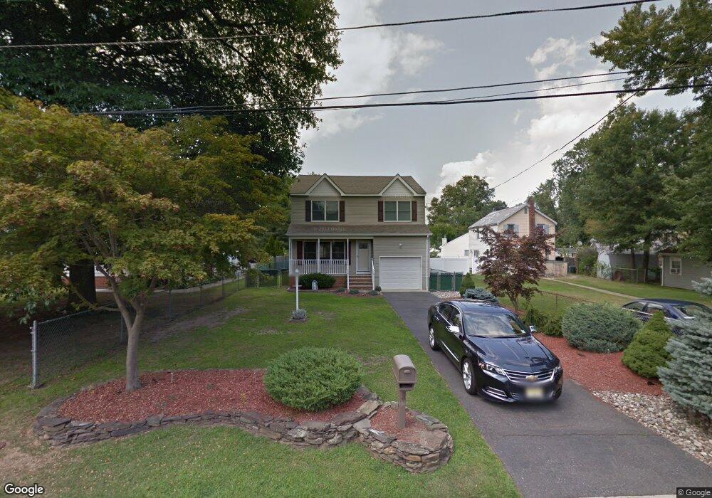
9 Williams Ave North Middletown, NJ 07748
Estimated Value: $563,000 - $570,000
3
Beds
2
Baths
1,836
Sq Ft
$308/Sq Ft
Est. Value
About This Home
This home is located at 9 Williams Ave, North Middletown, NJ 07748 and is currently estimated at $566,344, approximately $308 per square foot. 9 Williams Ave is a home located in Monmouth County with nearby schools including Ocean Avenue Elementary School, Thorne Middle School, and Keansburg High School.
Ownership History
Date
Name
Owned For
Owner Type
Purchase Details
Closed on
Jul 22, 2010
Sold by
Walsh Stacy
Bought by
Walsh Stacy
Current Estimated Value
Purchase Details
Closed on
Apr 8, 2008
Sold by
Morgan Jack and Morgan John F
Bought by
Friedman Scott B and Cooper Kristina E
Purchase Details
Closed on
Jul 25, 1994
Sold by
Derosa Pat
Bought by
Vaccaro Peter and Vaccaro Debra
Home Financials for this Owner
Home Financials are based on the most recent Mortgage that was taken out on this home.
Original Mortgage
$120,000
Interest Rate
8.52%
Mortgage Type
Purchase Money Mortgage
Create a Home Valuation Report for This Property
The Home Valuation Report is an in-depth analysis detailing your home's value as well as a comparison with similar homes in the area
Home Values in the Area
Average Home Value in this Area
Purchase History
| Date | Buyer | Sale Price | Title Company |
|---|---|---|---|
| Walsh Stacy | -- | None Available | |
| Friedman Scott B | $320,000 | Fidelity Natl Title Ins Co | |
| Vaccaro Peter | $143,000 | -- |
Source: Public Records
Mortgage History
| Date | Status | Borrower | Loan Amount |
|---|---|---|---|
| Previous Owner | Vaccaro Peter | $120,000 |
Source: Public Records
Tax History Compared to Growth
Tax History
| Year | Tax Paid | Tax Assessment Tax Assessment Total Assessment is a certain percentage of the fair market value that is determined by local assessors to be the total taxable value of land and additions on the property. | Land | Improvement |
|---|---|---|---|---|
| 2025 | $7,815 | $559,300 | $280,500 | $278,800 |
| 2024 | $7,818 | $475,100 | $198,100 | $277,000 |
| 2023 | $7,818 | $449,800 | $179,300 | $270,500 |
| 2022 | $7,060 | $422,100 | $158,300 | $263,800 |
| 2021 | $7,060 | $339,400 | $110,300 | $229,100 |
| 2020 | $7,203 | $336,900 | $110,300 | $226,600 |
| 2019 | $7,086 | $335,500 | $110,300 | $225,200 |
| 2018 | $7,099 | $327,600 | $110,300 | $217,300 |
| 2017 | $7,027 | $321,000 | $110,300 | $210,700 |
| 2016 | $6,625 | $310,900 | $110,300 | $200,600 |
| 2015 | $6,531 | $295,900 | $110,300 | $185,600 |
| 2014 | $6,567 | $290,200 | $110,300 | $179,900 |
Source: Public Records
Map
Nearby Homes
- 173 Forest Ave
- 270 Main St Unit 6
- 11 Snyder Ave
- 19 Randall Place
- 123 Forest Ave
- 358 Carr Ave
- 210 Main St
- 213 Main St Unit 17
- 213 Main St Unit 7
- 516 Henry Place
- 170 Park Ave
- 18 John St
- 18 John St Unit 133
- 18 Saint Johns Place
- 71 Bay Ave
- 3 Carlo Dr
- 74 Forest Ave
- 49 Lincoln Ct
- 282 Carr Ave
- 101 Manning Place
- 7 Williams Ave
- 210 Raritan Place
- 214 Raritan Place
- 3 Williams Ave
- 249 Forest Ave
- 247 Forest Ave
- 19 Williams Ave
- 22 Van Brunt Place
- 245 Forest Ave
- 12 Williams Ave
- 87 Walling Ave
- 2 Williams Ave
- 14 Williams Ave
- 18 Van Brunt Place
- 243 Forest Ave
- 18 Williams Ave
- 253 Forest Ave
- 211 Raritan Place
- 213 Raritan Place
- 25 Williams Ave