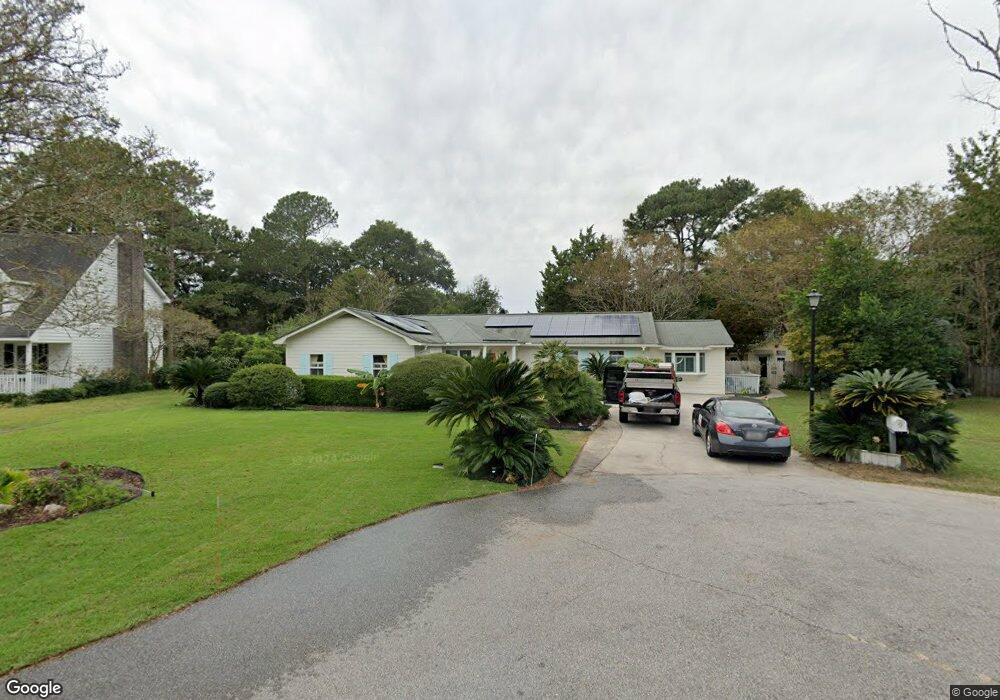
9 Willingham Ct Charleston, SC 29412
James Island NeighborhoodEstimated Value: $763,000 - $1,168,720
5
Beds
3
Baths
3,308
Sq Ft
$289/Sq Ft
Est. Value
About This Home
This home is located at 9 Willingham Ct, Charleston, SC 29412 and is currently estimated at $955,680, approximately $288 per square foot. 9 Willingham Ct is a home located in Charleston County with nearby schools including Harbor View Elementary School, Camp Road Middle, and James Island Charter High School.
Ownership History
Date
Name
Owned For
Owner Type
Purchase Details
Closed on
Apr 2, 2025
Sold by
Meissner Kenneth W and Meissner Christine D
Bought by
Meissner Family Trust and Meissner
Current Estimated Value
Purchase Details
Closed on
Mar 26, 2020
Sold by
Meissner Kenneth W and Meissner Christine D
Bought by
Meissner Kenneth W and Meissner Christine P
Home Financials for this Owner
Home Financials are based on the most recent Mortgage that was taken out on this home.
Original Mortgage
$412,500
Interest Rate
3.2%
Mortgage Type
New Conventional
Purchase Details
Closed on
May 29, 2015
Sold by
Meissner Kenneth W and Meissner Christine D
Bought by
Meissner Kenneth W and Meissner Christine D
Purchase Details
Closed on
Apr 28, 2014
Sold by
Dove George D and Burns Laurel A
Bought by
Meissner Kenneth W and Meissner Christine D
Home Financials for this Owner
Home Financials are based on the most recent Mortgage that was taken out on this home.
Original Mortgage
$244,000
Interest Rate
4.37%
Mortgage Type
New Conventional
Purchase Details
Closed on
Jul 28, 2009
Sold by
Cooke Shirley L
Bought by
Dove George D and Dove Laurel A Burns
Home Financials for this Owner
Home Financials are based on the most recent Mortgage that was taken out on this home.
Original Mortgage
$295,920
Interest Rate
5.37%
Mortgage Type
New Conventional
Create a Home Valuation Report for This Property
The Home Valuation Report is an in-depth analysis detailing your home's value as well as a comparison with similar homes in the area
Home Values in the Area
Average Home Value in this Area
Purchase History
| Date | Buyer | Sale Price | Title Company |
|---|---|---|---|
| Meissner Family Trust | -- | None Listed On Document | |
| Meissner Family Trust | -- | None Listed On Document | |
| Meissner Kenneth W | -- | None Available | |
| Meissner Kenneth W | -- | -- | |
| Meissner Kenneth W | $305,000 | -- | |
| Dove George D | $369,900 | -- |
Source: Public Records
Mortgage History
| Date | Status | Borrower | Loan Amount |
|---|---|---|---|
| Previous Owner | Meissner Kenneth W | $412,500 | |
| Previous Owner | Meissner Kenneth W | $244,000 | |
| Previous Owner | Dove George D | $295,920 |
Source: Public Records
Tax History Compared to Growth
Tax History
| Year | Tax Paid | Tax Assessment Tax Assessment Total Assessment is a certain percentage of the fair market value that is determined by local assessors to be the total taxable value of land and additions on the property. | Land | Improvement |
|---|---|---|---|---|
| 2024 | $2,710 | $18,330 | $0 | $0 |
| 2023 | $2,710 | $18,330 | $0 | $0 |
| 2022 | $2,520 | $18,330 | $0 | $0 |
| 2021 | $2,612 | $18,330 | $0 | $0 |
| 2020 | $2,687 | $18,330 | $0 | $0 |
| 2019 | $2,403 | $15,940 | $0 | $0 |
| 2017 | $1,629 | $12,200 | $0 | $0 |
| 2016 | $1,562 | $12,200 | $0 | $0 |
| 2015 | $4,475 | $18,300 | $0 | $0 |
| 2014 | -- | $0 | $0 | $0 |
| 2011 | -- | $0 | $0 | $0 |
Source: Public Records
Map
Nearby Homes
- 50 Held Cir Unit C
- 14 Maplecrest Dr
- 9 Maplecrest Dr
- 1 Maplecrest Dr
- 27 Brockman Dr Unit 27B
- 27 Brockman Dr Unit 27C
- 17 S Anderson Ave Unit A,B,C, D
- 14 Clam Shell Row
- 1616 Relyea Ave
- 36 Forde Row
- 35 Rivers Point Row Unit A
- 1632 N Relyea Ave
- 1 S Anderson Ave
- 1563 Relyea Ave
- 10 Bass Ln Unit D
- 1453 Camp Rd
- 1402 Camp Rd Unit 5E
- 1402 Camp Rd Unit 6E
- 1402 Camp Rd Unit 1H
- 1402 Camp Rd Unit 8B