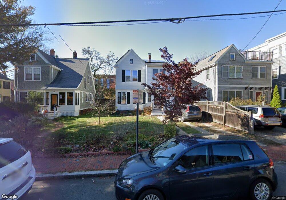
9 Yerxa Rd Cambridge, MA 02140
North Cambridge NeighborhoodEstimated Value: $1,084,000 - $1,547,000
3
Beds
3
Baths
1,601
Sq Ft
$888/Sq Ft
Est. Value
About This Home
This home is located at 9 Yerxa Rd, Cambridge, MA 02140 and is currently estimated at $1,421,307, approximately $887 per square foot. 9 Yerxa Rd is a home located in Middlesex County with nearby schools including Benjamin Banneker Charter Public School, Cambridge Friends School, and Cambridge Montessori School.
Ownership History
Date
Name
Owned For
Owner Type
Purchase Details
Closed on
Jan 26, 2017
Sold by
Nelson Derek S and Leslie Emma F
Bought by
9 Yerxa Road Rt
Current Estimated Value
Purchase Details
Closed on
Dec 9, 1991
Sold by
Krasnow Michael and Hanna Douglas
Bought by
Wever Kirsten R
Purchase Details
Closed on
Dec 14, 1990
Sold by
Krasnow Michael
Bought by
Nelson Derek S
Home Financials for this Owner
Home Financials are based on the most recent Mortgage that was taken out on this home.
Original Mortgage
$65,000
Interest Rate
10.07%
Mortgage Type
Purchase Money Mortgage
Create a Home Valuation Report for This Property
The Home Valuation Report is an in-depth analysis detailing your home's value as well as a comparison with similar homes in the area
Home Values in the Area
Average Home Value in this Area
Purchase History
| Date | Buyer | Sale Price | Title Company |
|---|---|---|---|
| 9 Yerxa Road Rt | -- | -- | |
| Wever Kirsten R | $166,400 | -- | |
| Nelson Derek S | $219,500 | -- |
Source: Public Records
Mortgage History
| Date | Status | Borrower | Loan Amount |
|---|---|---|---|
| Previous Owner | Nelson Derek S | $69,500 | |
| Previous Owner | Nelson Derek S | $65,000 | |
| Previous Owner | Nelson Derek S | $130,000 | |
| Closed | Nelson Derek S | $0 |
Source: Public Records
Tax History
| Year | Tax Paid | Tax Assessment Tax Assessment Total Assessment is a certain percentage of the fair market value that is determined by local assessors to be the total taxable value of land and additions on the property. | Land | Improvement |
|---|---|---|---|---|
| 2025 | $8,134 | $1,281,000 | $508,100 | $772,900 |
| 2024 | $7,276 | $1,229,100 | $529,300 | $699,800 |
| 2023 | $6,711 | $1,145,200 | $539,900 | $605,300 |
| 2022 | $6,329 | $1,069,100 | $533,300 | $535,800 |
| 2021 | $6,045 | $1,033,300 | $535,100 | $498,200 |
| 2020 | $5,701 | $991,500 | $519,300 | $472,200 |
| 2019 | $5,345 | $899,800 | $463,500 | $436,300 |
| 2018 | $3,011 | $806,700 | $390,400 | $416,300 |
| 2017 | $4,903 | $755,500 | $366,000 | $389,500 |
| 2016 | $4,738 | $677,800 | $317,200 | $360,600 |
| 2015 | $4,701 | $601,100 | $278,800 | $322,300 |
| 2014 | $4,710 | $562,000 | $244,000 | $318,000 |
Source: Public Records
Map
Nearby Homes
- 151 Sherman St
- 151 Sherman St Unit 151
- 3 Warwick Park Unit 2
- 11 Cogswell Ave Unit 15
- 11 Cogswell Ave Unit 13
- 178 Richdale Ave
- 54 Bellis Cir
- 2353 Massachusetts Ave Unit 44
- 7 Russell St Unit 1
- 124 Jackson St
- 49 Clifton St
- 69 Harvey St Unit 1
- 108 Clay St
- 40 Mount Pleasant St Unit 4
- 126 Harvey St Unit 2
- 127 Harvey St
- 24 Cambridge Terrace Unit 2
- 7 Beech St Unit 319
- 7 Beech St Unit 317
- 97 Elmwood St Unit 313
- 11 Yerxa Rd
- 7 Yerxa Rd
- 13 Yerxa Rd
- 5 Yerxa Rd
- 5 Yerxa Rd Unit 1
- 5 Yerxa Rd Unit 3
- 15 Yerxa Rd
- 3 Yerxa Rd
- 3 Yerxa Rd Unit 2
- 3 Yerxa Rd Unit 1
- 3 Yerxa Rd Unit 1,3
- 3 Yerxa Rd Unit 3,3
- 3 Yerxa Rd Unit 2,3
- 120-124 Rindge Ave
- 120-124 Rindge Ave
- 120 Rindge Ave Unit 307
- 120 Rindge Ave Unit 301
- 120 Rindge Ave Unit 107
- 120 Rindge Ave Unit 201
- 120 Rindge Ave Unit 300
Your Personal Tour Guide
Ask me questions while you tour the home.