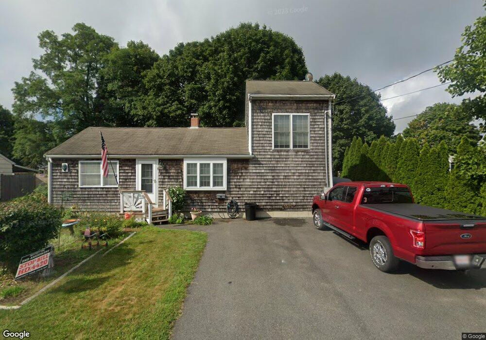
90-92 Sandwich Rd Unit 20 Bourne, MA 2532
Estimated Value: $240,766 - $377,000
1
Bed
1
Bath
626
Sq Ft
$448/Sq Ft
Est. Value
About This Home
This home is located at 90-92 Sandwich Rd Unit 20, Bourne, MA 2532 and is currently estimated at $280,192, approximately $447 per square foot. 90-92 Sandwich Rd Unit 20 is a home located in Barnstable County with nearby schools including Bourne High School, St Margaret Regional School, and Cadence Academy Preschool - Bourne.
Ownership History
Date
Name
Owned For
Owner Type
Purchase Details
Closed on
Sep 23, 2002
Sold by
Varsane Andrew A
Bought by
Francis Vickie B
Current Estimated Value
Home Financials for this Owner
Home Financials are based on the most recent Mortgage that was taken out on this home.
Original Mortgage
$76,000
Outstanding Balance
$32,026
Interest Rate
6.36%
Mortgage Type
Purchase Money Mortgage
Estimated Equity
$248,166
Purchase Details
Closed on
Jun 24, 1998
Sold by
Est Obrien John R and Bryer Donald
Bought by
Varsane Andrew A
Create a Home Valuation Report for This Property
The Home Valuation Report is an in-depth analysis detailing your home's value as well as a comparison with similar homes in the area
Purchase History
| Date | Buyer | Sale Price | Title Company |
|---|---|---|---|
| Francis Vickie B | $95,000 | -- | |
| Francis Vickie B | $95,000 | -- | |
| Varsane Andrew A | $30,000 | -- |
Source: Public Records
Mortgage History
| Date | Status | Borrower | Loan Amount |
|---|---|---|---|
| Open | Varsane Andrew A | $76,000 | |
| Closed | Varsane Andrew A | $76,000 |
Source: Public Records
Tax History
| Year | Tax Paid | Tax Assessment Tax Assessment Total Assessment is a certain percentage of the fair market value that is determined by local assessors to be the total taxable value of land and additions on the property. | Land | Improvement |
|---|---|---|---|---|
| 2025 | $1,400 | $179,200 | $0 | $179,200 |
| 2024 | $1,297 | $161,700 | $0 | $161,700 |
| 2023 | $1,261 | $143,100 | $0 | $143,100 |
| 2022 | $1,234 | $122,300 | $0 | $122,300 |
| 2021 | $1,125 | $104,500 | $0 | $104,500 |
| 2020 | $1,049 | $97,700 | $0 | $97,700 |
| 2019 | $920 | $87,500 | $0 | $87,500 |
| 2018 | $617 | $58,500 | $0 | $58,500 |
| 2017 | $510 | $49,500 | $0 | $49,500 |
| 2016 | $503 | $49,500 | $0 | $49,500 |
| 2015 | $498 | $49,500 | $0 | $49,500 |
Source: Public Records
Map
Nearby Homes
- 90-92 Sandwich Rd Unit 2
- 60 Sandwich Rd
- 90-92 Sandwich Rd Unit 9C
- 44 Cotuit Rd
- 6 Honora Ct
- 38 Old Bridge Rd
- 304 Main St
- 5 Sea Knoll Ct
- 46 Holt Rd Unit A
- 24 Ships View Terrace
- 13 Laurel Hill Ct
- 26 Carnoustie Rd
- 48 Maple St
- 1 Hollyhock Knoll Ct Unit 1
- 4 Hollyhock Knoll Ct Unit 4
- 4 Hollyhock Knoll Ct Unit 4
- 151 - 153 Main St
- 4 Mainstay Ln
- 12 Turnberry Rd Unit 12
- 7 Mizzen Ln
- 90-92 Sandwich Rd Unit 15
- 90-92 Sandwich Rd Unit 9
- 90-92 Sandwich Rd Unit 5
- 90-92 Sandwich Rd Unit 22
- 90-92 Sandwich Rd Unit 12
- 90-92 Sandwich Rd Unit 18
- 90-92 Sandwich Rd Unit 7
- 90-92 Sandwich Rd Unit 10
- 90-92 Sandwich Rd
- 90-92 Sandwich Rd Unit 16
- 90-92 Sandwich Rd Unit 17
- 90-92 Sandwich Rd Unit 21
- 90-92 Sandwich Rd Unit 11
- 90-92 Sandwich Rd Unit 3
- 90-92 Sandwich Rd Unit 23
- 90-92 Sandwich Rd Unit 13
- 90-92 Sandwich Rd Unit 6
- 90-92 Sandwich Rd Unit 19
- 90-92 Sandwich Rd Unit 24
- 90-92 Sandwich Rd Unit 8