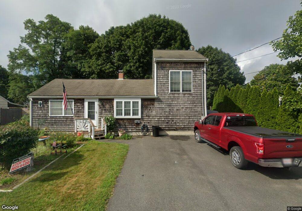
90-92 Sandwich Rd Bourne, MA 2532
Estimated Value: $219,399
--
Bed
--
Bath
--
Sq Ft
0.76
Acres
About This Home
This home is located at 90-92 Sandwich Rd, Bourne, MA 2532 and is currently estimated at $219,399. 90-92 Sandwich Rd is a home located in Barnstable County with nearby schools including Bourne High School, St Margaret Regional School, and Cadence Academy Preschool - Bourne.
Ownership History
Date
Name
Owned For
Owner Type
Purchase Details
Closed on
Sep 23, 2024
Sold by
Prete Frank
Bought by
Prete Frank C and Prete Michael
Current Estimated Value
Home Financials for this Owner
Home Financials are based on the most recent Mortgage that was taken out on this home.
Original Mortgage
$107,000
Outstanding Balance
$105,667
Interest Rate
6.77%
Mortgage Type
Purchase Money Mortgage
Estimated Equity
$113,732
Purchase Details
Closed on
Aug 29, 2024
Sold by
Gleick Michael A
Bought by
Prete Frank
Home Financials for this Owner
Home Financials are based on the most recent Mortgage that was taken out on this home.
Original Mortgage
$107,000
Outstanding Balance
$105,667
Interest Rate
6.77%
Mortgage Type
Purchase Money Mortgage
Estimated Equity
$113,732
Purchase Details
Closed on
Jun 20, 2023
Sold by
Banville Ft and Banville
Bought by
Ashley Christopher
Purchase Details
Closed on
Aug 5, 2020
Sold by
Henry F Barry T F and Henry Leverone
Bought by
Roberts Andrew J
Home Financials for this Owner
Home Financials are based on the most recent Mortgage that was taken out on this home.
Original Mortgage
$124,800
Interest Rate
3%
Mortgage Type
New Conventional
Purchase Details
Closed on
Jan 25, 2018
Sold by
Waterview Rt and Raponi
Bought by
Almeida Gail F
Purchase Details
Closed on
Oct 30, 2015
Sold by
Barry Henry F
Bought by
Henry F Barry T F and Henry Barry
Purchase Details
Closed on
Jun 13, 2012
Sold by
Pumphret Tara
Bought by
West Eric E
Purchase Details
Closed on
Feb 28, 1990
Sold by
Whelan John F
Bought by
Emerson Norma J
Purchase Details
Closed on
Mar 31, 1989
Sold by
Hession Paul W
Bought by
Smith Ivor S
Home Financials for this Owner
Home Financials are based on the most recent Mortgage that was taken out on this home.
Original Mortgage
$50,000
Interest Rate
10.63%
Mortgage Type
Purchase Money Mortgage
Purchase Details
Closed on
Aug 19, 1988
Sold by
Hession Eileen
Bought by
Hession Paul W
Create a Home Valuation Report for This Property
The Home Valuation Report is an in-depth analysis detailing your home's value as well as a comparison with similar homes in the area
Home Values in the Area
Average Home Value in this Area
Purchase History
| Date | Buyer | Sale Price | Title Company |
|---|---|---|---|
| Prete Frank C | -- | None Available | |
| Prete Frank C | -- | None Available | |
| Prete Frank C | -- | None Available | |
| Prete Frank | $215,000 | None Available | |
| Prete Frank | $215,000 | None Available | |
| Prete Frank | $215,000 | None Available | |
| Ashley Christopher | $280,000 | None Available | |
| Ashley Christopher | $280,000 | None Available | |
| Ashley Christopher | $280,000 | None Available | |
| Roberts Andrew J | $156,000 | None Available | |
| Roberts Andrew J | $156,000 | None Available | |
| Roberts Andrew J | $156,000 | None Available | |
| Almeida Gail F | $148,000 | -- | |
| Almeida Gail F | $148,000 | -- | |
| Almeida Gail F | $148,000 | -- | |
| Henry F Barry T F | -- | -- | |
| Henry F Barry T F | -- | -- | |
| Henry F Barry T F | -- | -- | |
| West Eric E | $50,000 | -- | |
| West Eric E | $50,000 | -- | |
| Emerson Norma J | $46,000 | -- | |
| Smith Ivor S | $65,000 | -- | |
| Hession Paul W | $32,500 | -- |
Source: Public Records
Mortgage History
| Date | Status | Borrower | Loan Amount |
|---|---|---|---|
| Open | Prete Frank | $107,000 | |
| Closed | Prete Frank | $107,000 | |
| Previous Owner | Roberts Andrew J | $124,800 | |
| Previous Owner | Hession Paul W | $50,000 |
Source: Public Records
Tax History Compared to Growth
Tax History
| Year | Tax Paid | Tax Assessment Tax Assessment Total Assessment is a certain percentage of the fair market value that is determined by local assessors to be the total taxable value of land and additions on the property. | Land | Improvement |
|---|---|---|---|---|
| 2025 | -- | $0 | $0 | $0 |
| 2024 | -- | $0 | $0 | $0 |
| 2023 | $0 | $0 | $0 | $0 |
| 2022 | $0 | $0 | $0 | $0 |
| 2021 | $0 | $0 | $0 | $0 |
| 2020 | $0 | $0 | $0 | $0 |
| 2019 | $0 | $0 | $0 | $0 |
| 2018 | $0 | $0 | $0 | $0 |
| 2017 | -- | $0 | $0 | $0 |
| 2016 | -- | $0 | $0 | $0 |
| 2015 | -- | $0 | $0 | $0 |
Source: Public Records
Map
Nearby Homes
- 90-92 Sandwich Rd Unit 2
- 60 Sandwich Rd
- 90-92 Sandwich Rd Unit 9C
- 44 Cotuit Rd
- 38 Old Bridge Rd
- 14 Great Rock Rd
- 304 Main St
- 85 Waterhouse Rd
- 85 Waterhouse Rd
- 405 Village Dr
- 405 Village Dr Unit 405
- 4 Finch Ln
- 5 Sea Knoll Ct
- 46 Holt Rd
- 46 Holt Rd Unit A
- 24 Ships View Terrace
- 27 Ships View Terrace
- 13 Laurel Hill Ct
- 26 Carnoustie Rd
- 1 Hollyhock Knoll Ct Unit 1
- 90-92 Sandwich Rd Unit 15
- 90-92 Sandwich Rd Unit 9
- 90-92 Sandwich Rd Unit 5
- 90-92 Sandwich Rd Unit 22
- 90-92 Sandwich Rd Unit 12
- 90-92 Sandwich Rd Unit 18
- 90-92 Sandwich Rd Unit 7
- 90-92 Sandwich Rd Unit 10
- 90-92 Sandwich Rd Unit 16
- 90-92 Sandwich Rd Unit 17
- 90-92 Sandwich Rd Unit 21
- 90-92 Sandwich Rd Unit 11
- 90-92 Sandwich Rd Unit 3
- 90-92 Sandwich Rd Unit 20
- 90-92 Sandwich Rd Unit 23
- 90-92 Sandwich Rd Unit 13
- 90-92 Sandwich Rd Unit 6
- 90-92 Sandwich Rd Unit 19
- 90-92 Sandwich Rd Unit 24
- 90-92 Sandwich Rd Unit 8