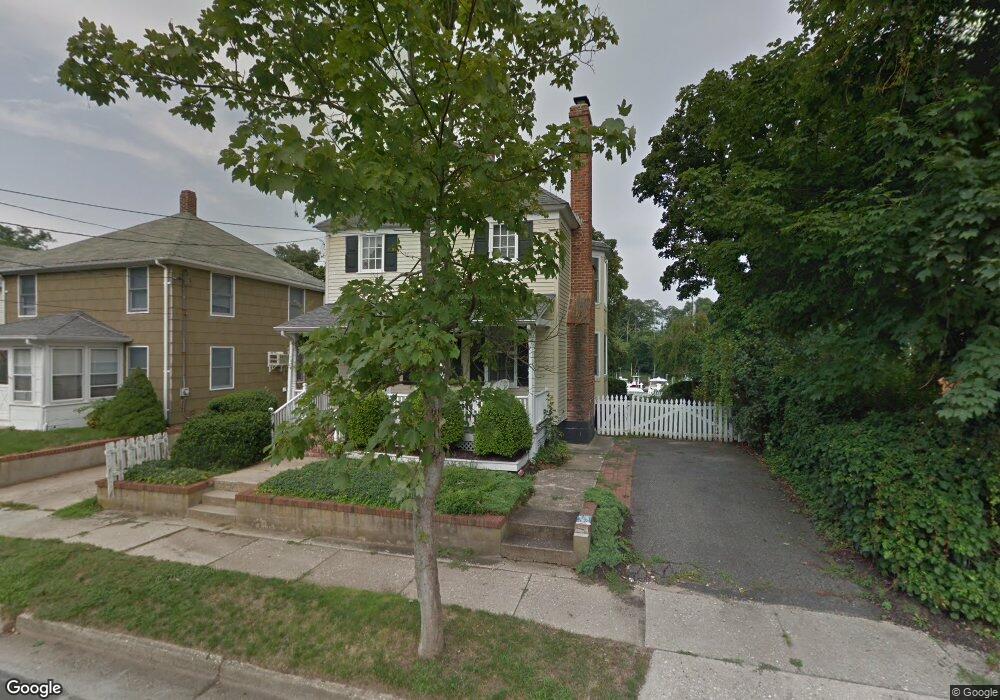
90 Atlantic Ave Sag Harbor, NY 11963
Estimated Value: $576,000 - $915,161
3
Beds
2
Baths
--
Sq Ft
4,356
Sq Ft Lot
About This Home
This home is located at 90 Atlantic Ave, Sag Harbor, NY 11963 and is currently estimated at $739,387. 90 Atlantic Ave is a home located in Suffolk County with nearby schools including Greenport Elementary School and Greenport High School.
Ownership History
Date
Name
Owned For
Owner Type
Purchase Details
Closed on
Oct 26, 2010
Sold by
Brouillard Anne and Starr Dennis J
Bought by
Colt Michael P and Colt Nancy Greene
Current Estimated Value
Home Financials for this Owner
Home Financials are based on the most recent Mortgage that was taken out on this home.
Original Mortgage
$165,000
Outstanding Balance
$109,308
Interest Rate
4.35%
Mortgage Type
Purchase Money Mortgage
Estimated Equity
$630,079
Purchase Details
Closed on
Mar 4, 1999
Sold by
Hundhammer Fred and Hundhammer Joan
Bought by
French Kathleen A
Home Financials for this Owner
Home Financials are based on the most recent Mortgage that was taken out on this home.
Original Mortgage
$157,500
Interest Rate
6.92%
Create a Home Valuation Report for This Property
The Home Valuation Report is an in-depth analysis detailing your home's value as well as a comparison with similar homes in the area
Home Values in the Area
Average Home Value in this Area
Purchase History
| Date | Buyer | Sale Price | Title Company |
|---|---|---|---|
| Colt Michael P | $532,500 | -- | |
| French Kathleen A | $225,000 | Fidelity National Title |
Source: Public Records
Mortgage History
| Date | Status | Borrower | Loan Amount |
|---|---|---|---|
| Open | Colt Michael P | $165,000 | |
| Previous Owner | French Kathleen A | $157,500 |
Source: Public Records
Tax History
| Year | Tax Paid | Tax Assessment Tax Assessment Total Assessment is a certain percentage of the fair market value that is determined by local assessors to be the total taxable value of land and additions on the property. | Land | Improvement |
|---|---|---|---|---|
| 2024 | $7,219 | $4,400 | $400 | $4,000 |
| 2023 | $7,219 | $4,400 | $400 | $4,000 |
| 2022 | $6,340 | $4,400 | $400 | $4,000 |
| 2021 | $6,041 | $4,200 | $400 | $3,800 |
| 2020 | $3,079 | $4,200 | $400 | $3,800 |
| 2019 | $3,079 | $0 | $0 | $0 |
| 2018 | $5,525 | $4,200 | $400 | $3,800 |
| 2017 | $5,769 | $4,200 | $400 | $3,800 |
| 2016 | $5,662 | $4,200 | $400 | $3,800 |
| 2015 | -- | $4,200 | $400 | $3,800 |
| 2014 | -- | $4,200 | $400 | $3,800 |
Source: Public Records
Map
Nearby Homes
- 415 Sterling Place
- 321 Bridge St
- 155 Bridge St
- 980 Manhanset Ave
- 35 Washington Ave
- 168 Sterling St
- 325 Fiddler Ln
- 604 Main St
- 1710 Gull Pond Ln
- 285 Sandy Beach Rd
- 216 North St
- 123 Sterling Ave Unit 4
- 660 Sutton Place
- 210 Bennet Rd
- 130 Sunset Ln
- 336 2nd St
- 56765 Route 48
- 1050 Tasker Ln
- 1760 Mccann Ln
- 151 Bay Ave
- 406 Atlantic Ave
- 120 Atlantic Ave
- 404 Atlantic Ave
- 1050 Champlin Place
- 412 Atlantic Ave
- 401 Atlantic Ave
- 314 Atlantic Ave
- 800 Champlin Place
- 312 Atlantic Ave
- 805 Bridge St
- 965 Champlin Place
- 211 Bridge St
- 780 Champlin Place
- 780 (215) Champlin Place
- 765 Bridge St
- 212 Bridge St
- 300 Atlantic Ave
- 213 Bridge St
- 900 Bailey Ave
- 506 (825) Bailey Ave
Your Personal Tour Guide
Ask me questions while you tour the home.