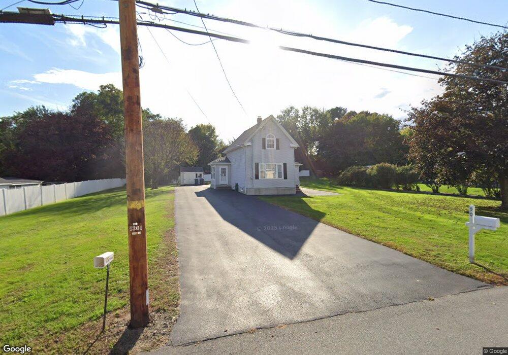
90 Ayer St Methuen, MA 01844
The East End NeighborhoodEstimated Value: $464,000 - $519,158
2
Beds
1
Bath
1,368
Sq Ft
$361/Sq Ft
Est. Value
About This Home
This home is located at 90 Ayer St, Methuen, MA 01844 and is currently estimated at $493,290, approximately $360 per square foot. 90 Ayer St is a home located in Essex County with nearby schools including Timony Grammar School, South Point Elementary School, and Methuen High School.
Ownership History
Date
Name
Owned For
Owner Type
Purchase Details
Closed on
Jul 16, 2019
Sold by
Marcello Michael D
Bought by
Michael D Marcello Ret and Marcello
Current Estimated Value
Purchase Details
Closed on
May 26, 2010
Sold by
Reilly Rose M and Lerner Mary E
Bought by
Marcello Michael
Purchase Details
Closed on
May 8, 1997
Sold by
Marcello Loretta C
Bought by
Marcello Michael D
Home Financials for this Owner
Home Financials are based on the most recent Mortgage that was taken out on this home.
Original Mortgage
$25,000
Interest Rate
8.09%
Create a Home Valuation Report for This Property
The Home Valuation Report is an in-depth analysis detailing your home's value as well as a comparison with similar homes in the area
Home Values in the Area
Average Home Value in this Area
Purchase History
| Date | Buyer | Sale Price | Title Company |
|---|---|---|---|
| Michael D Marcello Ret | -- | -- | |
| Michael D Marcello Ret | -- | -- | |
| Michael D Marcello Ret | -- | -- | |
| Michael D Marcello Ret | -- | -- | |
| Michael D Marcello Ret | -- | -- | |
| Marcello Michael | $16,000 | -- | |
| Marcello Michael | $16,000 | -- | |
| Marcello Michael D | $55,000 | -- | |
| Marcello Michael D | $55,000 | -- |
Source: Public Records
Mortgage History
| Date | Status | Borrower | Loan Amount |
|---|---|---|---|
| Previous Owner | Marcello Michael D | $25,000 | |
| Previous Owner | Marcello Michael D | $25,000 |
Source: Public Records
Tax History Compared to Growth
Tax History
| Year | Tax Paid | Tax Assessment Tax Assessment Total Assessment is a certain percentage of the fair market value that is determined by local assessors to be the total taxable value of land and additions on the property. | Land | Improvement |
|---|---|---|---|---|
| 2025 | $4,904 | $463,500 | $242,900 | $220,600 |
| 2024 | $4,803 | $442,300 | $221,500 | $220,800 |
| 2023 | $4,557 | $389,500 | $196,900 | $192,600 |
| 2022 | $4,353 | $333,600 | $164,100 | $169,500 |
| 2021 | $4,110 | $311,600 | $155,900 | $155,700 |
| 2020 | $4,094 | $304,600 | $155,900 | $148,700 |
| 2019 | $3,767 | $265,500 | $139,500 | $126,000 |
| 2018 | $3,692 | $258,700 | $139,500 | $119,200 |
| 2017 | $3,586 | $244,800 | $139,500 | $105,300 |
| 2016 | $3,504 | $236,600 | $131,300 | $105,300 |
| 2015 | $3,336 | $228,500 | $131,300 | $97,200 |
Source: Public Records
Map
Nearby Homes
- 49 Golf Ave
- 6 Aberdeen Rd
- 115 Merrimack Rd
- 3 Thissell St
- 2 Goodrich Ave
- 86 Comet Rd
- 1 Riverview Blvd Unit 3-8
- 1 Riverview Blvd Unit 2-203
- 29 Wallace St
- 29 Meadowbrook Rd
- 29 Pitman St
- 5 Harmony Ln
- 4 Alderbrook Ln
- 23 Constitution Way Unit 23
- 23 Constitution Way
- 106 Leroy Ave
- 262 E Haverhill St Unit 4
- 63 Lippold St
- 95 Pilgrim Cir Unit 95
- 35 Swan Ave