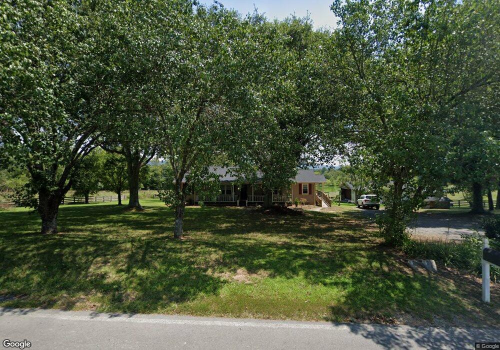
90 Ben Adams Rd Chatsworth, GA 30705
Estimated Value: $229,000 - $274,643
--
Bed
--
Bath
1,624
Sq Ft
$155/Sq Ft
Est. Value
About This Home
This home is located at 90 Ben Adams Rd, Chatsworth, GA 30705 and is currently estimated at $251,911, approximately $155 per square foot. 90 Ben Adams Rd is a home with nearby schools including Coker Elementary School, Gladden Middle School, and Murray County High School.
Ownership History
Date
Name
Owned For
Owner Type
Purchase Details
Closed on
Dec 21, 2017
Sold by
Owens Charles Larry
Bought by
Callaway Brooke Ashley
Current Estimated Value
Home Financials for this Owner
Home Financials are based on the most recent Mortgage that was taken out on this home.
Original Mortgage
$132,554
Outstanding Balance
$112,114
Interest Rate
4.12%
Mortgage Type
FHA
Estimated Equity
$139,797
Purchase Details
Closed on
Sep 1, 1998
Sold by
Davis Darryl
Bought by
Owens C Larry
Purchase Details
Closed on
Aug 31, 1998
Sold by
Davis Herman
Bought by
Davis Darryl
Create a Home Valuation Report for This Property
The Home Valuation Report is an in-depth analysis detailing your home's value as well as a comparison with similar homes in the area
Home Values in the Area
Average Home Value in this Area
Purchase History
| Date | Buyer | Sale Price | Title Company |
|---|---|---|---|
| Callaway Brooke Ashley | $135,000 | -- | |
| Owens Charles Larry | -- | -- | |
| Owens C Larry | $112,000 | -- | |
| Davis Darryl | $2,000 | -- |
Source: Public Records
Mortgage History
| Date | Status | Borrower | Loan Amount |
|---|---|---|---|
| Open | Callaway Brooke Ashley | $132,554 |
Source: Public Records
Tax History Compared to Growth
Tax History
| Year | Tax Paid | Tax Assessment Tax Assessment Total Assessment is a certain percentage of the fair market value that is determined by local assessors to be the total taxable value of land and additions on the property. | Land | Improvement |
|---|---|---|---|---|
| 2024 | $1,911 | $83,240 | $3,280 | $79,960 |
| 2023 | $1,929 | $82,428 | $3,280 | $79,148 |
| 2022 | $1,669 | $71,588 | $3,120 | $68,468 |
| 2021 | $1,504 | $63,148 | $3,120 | $60,028 |
| 2020 | $1,225 | $51,788 | $2,160 | $49,628 |
| 2019 | $1,180 | $49,788 | $2,160 | $47,628 |
| 2018 | $1,130 | $47,748 | $2,160 | $45,588 |
| 2017 | $0 | $41,268 | $2,160 | $39,108 |
| 2016 | $852 | $39,564 | $4,680 | $34,884 |
| 2015 | -- | $39,564 | $4,680 | $34,884 |
| 2014 | -- | $39,564 | $4,680 | $34,884 |
| 2013 | -- | $39,564 | $4,680 | $34,884 |
Source: Public Records
Map
Nearby Homes
- 1240 Old Highway 411
- 503 Smyrna Ramhurst Rd
- 00 Hwy 411s
- 350 Wilbanks Rd
- 290 Middleton Ct
- 0 Highway 411 S Unit 1511189
- 0 Highway 411 S Unit 129872
- 0 Highway 411 S Unit 10425195
- 00 Old Highway 411
- 1186 Berry Bennett Rd
- AUBURN Plan at Urban's Place
- CABOT Plan at Urban's Place
- BEAUMONT Plan at Urban's Place
- DUPONT Plan at Urban's Place
- 9 Barron Ct
- 1489 Smyrna Church Rd
- 3380 Old Federal Rd S
- 0 Grassy Mountain Rd Unit 419178
- 0 Grassy Mountain Rd Unit 1521379
- 0 Grassy Mountain Rd Unit 131049
- 53 Ben Adams Rd
- 168 Ben Adams Rd
- 1707 Smyrna Ramhurst Rd
- 170 Ben Adams Rd
- 1801 Smyrna Ramhurst Rd
- 1824 Smyrna Ramhurst Rd
- 143 Smyrna Ramhurst Rd
- 1703 Smyrna Ramhurst Rd
- 1699 Smyrna Ramhurst Rd
- 1695 Smyrna Ramhurst Rd
- 198 Ben Adams Rd
- 331 Ben Adams Rd
- 1697 Smyrna Ramhurst Rd
- 2353 Smyrna Ramhurst Rd
- 1759 Smyrna Ramhurst Rd
- 2348 Smyrna Ramhurst Rd
- 2368 Smyrna Ramhurst Rd
- 1713 Smyrna Ramhurst Rd
- 2391 Smyrna Ramhurst Rd
- 2350 Smyrna Ramhurst Rd