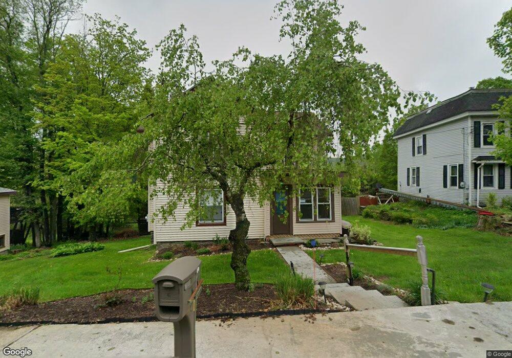
90 Darrow St Union Dale, PA 18470
Estimated Value: $166,247 - $534,000
--
Bed
--
Bath
--
Sq Ft
1
Acres
About This Home
This home is located at 90 Darrow St, Union Dale, PA 18470 and is currently estimated at $281,062. 90 Darrow St is a home located in Susquehanna County with nearby schools including Forest City Regional Elementary School and Forest City Regional High School.
Create a Home Valuation Report for This Property
The Home Valuation Report is an in-depth analysis detailing your home's value as well as a comparison with similar homes in the area
Home Values in the Area
Average Home Value in this Area
Tax History Compared to Growth
Tax History
| Year | Tax Paid | Tax Assessment Tax Assessment Total Assessment is a certain percentage of the fair market value that is determined by local assessors to be the total taxable value of land and additions on the property. | Land | Improvement |
|---|---|---|---|---|
| 2025 | $1,999 | $30,600 | $5,400 | $25,200 |
| 2024 | $1,941 | $30,600 | $5,400 | $25,200 |
| 2023 | $1,839 | $30,600 | $5,400 | $25,200 |
| 2022 | $1,829 | $30,600 | $5,400 | $25,200 |
| 2021 | $1,805 | $30,600 | $5,400 | $25,200 |
| 2020 | $1,739 | $30,600 | $5,400 | $25,200 |
| 2019 | $1,739 | $30,600 | $5,400 | $25,200 |
| 2018 | $1,668 | $30,600 | $5,400 | $25,200 |
| 2017 | $30,600 | $30,600 | $5,400 | $25,200 |
| 2016 | $1,557 | $30,600 | $5,400 | $25,200 |
| 2015 | $321 | $30,600 | $0 | $0 |
| 2014 | $321 | $30,600 | $0 | $0 |
Source: Public Records
Map
Nearby Homes
- 600 Paye Hill Rd
- 57 Creek Rd
- 535 Herrick Ridge
- 2051 Belmont Turnpike
- 520 State Route 2010
- 2416 State Route 2012
- 660 Wildenberg Rd
- 540 Pleasant Mount Dr
- 24 10th St
- 498 Lowe Lake Rd
- 162 Fall Ln
- 3533 State Route 2012
- 65 Fall Ln
- Lot 4 Skinny Dip Ln
- 0 Old Newburg Turnpike
- 00 Crossroad Rd
- 1795 Belmont Turnpike
- 815 Svecz Rd
- 1177 N Main St
- 801 Elkview Dr