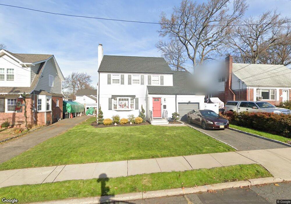
90 Davies Ave Dumont, NJ 07628
Estimated Value: $620,000 - $707,163
3
Beds
2
Baths
1,796
Sq Ft
$377/Sq Ft
Est. Value
About This Home
This home is located at 90 Davies Ave, Dumont, NJ 07628 and is currently estimated at $676,291, approximately $376 per square foot. 90 Davies Ave is a home located in Bergen County with nearby schools including Dumont High School.
Ownership History
Date
Name
Owned For
Owner Type
Purchase Details
Closed on
Aug 24, 2018
Sold by
Wilmington Svgs Fund Soc
Bought by
Willimas Clarence and Willimas Ann M
Current Estimated Value
Home Financials for this Owner
Home Financials are based on the most recent Mortgage that was taken out on this home.
Original Mortgage
$316,976
Interest Rate
4.6%
Mortgage Type
FHA
Purchase Details
Closed on
Apr 24, 2018
Sold by
Saudino Michael
Bought by
Wilimington T Na Tr
Create a Home Valuation Report for This Property
The Home Valuation Report is an in-depth analysis detailing your home's value as well as a comparison with similar homes in the area
Home Values in the Area
Average Home Value in this Area
Purchase History
| Date | Buyer | Sale Price | Title Company |
|---|---|---|---|
| Willimas Clarence | $322,875 | -- | |
| Wilimington T Na Tr | -- | -- |
Source: Public Records
Mortgage History
| Date | Status | Borrower | Loan Amount |
|---|---|---|---|
| Previous Owner | Willimas Clarence | $316,976 |
Source: Public Records
Tax History
| Year | Tax Paid | Tax Assessment Tax Assessment Total Assessment is a certain percentage of the fair market value that is determined by local assessors to be the total taxable value of land and additions on the property. | Land | Improvement |
|---|---|---|---|---|
| 2025 | $12,841 | $606,600 | $284,800 | $321,800 |
| 2024 | $12,525 | $315,900 | $154,000 | $161,900 |
| 2023 | $12,266 | $315,900 | $154,000 | $161,900 |
| 2022 | $12,266 | $315,900 | $154,000 | $161,900 |
| 2021 | $12,206 | $311,100 | $154,000 | $157,100 |
| 2020 | $11,694 | $311,100 | $154,000 | $157,100 |
| 2019 | $10,794 | $294,200 | $154,000 | $140,200 |
| 2018 | $10,574 | $294,200 | $154,000 | $140,200 |
| 2017 | $10,371 | $294,200 | $154,000 | $140,200 |
| 2016 | $10,129 | $294,200 | $154,000 | $140,200 |
| 2015 | $9,897 | $294,200 | $154,000 | $140,200 |
| 2014 | $9,703 | $294,200 | $154,000 | $140,200 |
Source: Public Records
Map
Nearby Homes
- 82 Blauvelt Ave
- 7 Overlook Dr
- 40 Depew St
- 112 Oxford Place
- 42 Lenox Ave
- 67 Central Ave
- 116 Lexington Ave
- 95 W Shore Ave
- 19 Bedford Rd
- 15 Dunn Place
- 28 Park Ave
- 74 Shadyside Ave
- 16 Roosevelt Ave
- 110 New York Ave
- 292 Magnolia Ave
- 71 W Madison Ave
- 15 Pleasant St
- 284 Madison Ave
- 225 12th St
- 181 Phelps Ave
- 102 Davies Ave
- 80 Davies Ave
- 106 Davies Ave
- 76 Davies Ave
- 117 Virginia Ave
- 131 Virginia Ave
- 135 Virginia Ave
- 115 Virginia Ave
- 74 Davies Ave
- 97 Davies Ave
- 101 Davies Ave
- 93 Davies Ave
- 192 Howard St
- 107 Davies Ave
- 190 Howard St
- 111 Virginia Ave
- 111 Davies Ave
- 89 Davies Ave
- 115 Davies Ave
- 145 Virginia Ave
Your Personal Tour Guide
Ask me questions while you tour the home.