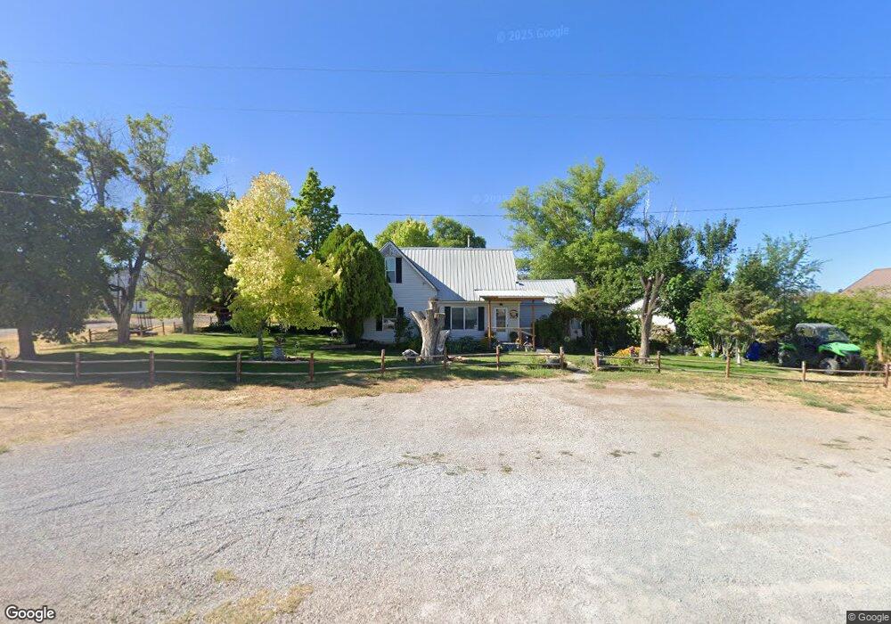
90 E 100 N Kanosh, UT 84637
Estimated Value: $329,187 - $798,000
--
Bed
--
Bath
--
Sq Ft
0.78
Acres
About This Home
This home is located at 90 E 100 N, Kanosh, UT 84637 and is currently estimated at $460,797. 90 E 100 N is a home.
Ownership History
Date
Name
Owned For
Owner Type
Purchase Details
Closed on
Oct 8, 2007
Sold by
Chevalier Robert M and Chevalier Emmaline D
Bought by
Whitaker Benjamin W and Whitaker Rachel D
Current Estimated Value
Home Financials for this Owner
Home Financials are based on the most recent Mortgage that was taken out on this home.
Original Mortgage
$123,322
Outstanding Balance
$77,477
Interest Rate
6.42%
Mortgage Type
FHA
Estimated Equity
$383,320
Create a Home Valuation Report for This Property
The Home Valuation Report is an in-depth analysis detailing your home's value as well as a comparison with similar homes in the area
Home Values in the Area
Average Home Value in this Area
Purchase History
| Date | Buyer | Sale Price | Title Company |
|---|---|---|---|
| Whitaker Benjamin W | -- | -- |
Source: Public Records
Mortgage History
| Date | Status | Borrower | Loan Amount |
|---|---|---|---|
| Open | Whitaker Benjamin W | $123,322 |
Source: Public Records
Tax History Compared to Growth
Tax History
| Year | Tax Paid | Tax Assessment Tax Assessment Total Assessment is a certain percentage of the fair market value that is determined by local assessors to be the total taxable value of land and additions on the property. | Land | Improvement |
|---|---|---|---|---|
| 2025 | $1,086 | $142,277 | $35,219 | $107,058 |
| 2024 | $1,086 | $147,070 | $24,401 | $122,669 |
| 2023 | $1,359 | $147,070 | $24,401 | $122,669 |
| 2022 | $954 | $89,623 | $19,520 | $70,103 |
| 2021 | $922 | $83,565 | $16,975 | $66,590 |
| 2020 | $802 | $73,370 | $15,431 | $57,939 |
| 2019 | $724 | $66,590 | $14,157 | $52,433 |
| 2018 | $693 | $65,303 | $12,870 | $52,433 |
| 2017 | $724 | $65,303 | $12,870 | $52,433 |
| 2016 | $688 | $64,717 | $9,653 | $55,064 |
| 2015 | $688 | $64,717 | $9,653 | $55,064 |
| 2014 | -- | $64,717 | $9,653 | $55,064 |
| 2013 | -- | $64,717 | $9,653 | $55,064 |
Source: Public Records
Map
Nearby Homes
- 58 E 300 South St
- 115 W 200 S
- 135 E 200 N
- 8610 S Highway 91
- 5098 W Hatton Rd
- Parcel # 8816
- 145 N 200 E
- 60 W Center St
- 50 N 100 Rd E
- 1565 W Sunflower Ln Unit 3
- 1615 W Sunflower Ln
- 1615 W Sunflower Ln Unit 4
- 1565 W Sunflower Ln
- 0 Tbd Black Rock Rd Unit LotWP001
- 2000 N West Frontage I-15
- 1100 S 725 Rd W
- 310 S 500 West Rd
- 190 W 400 St S
- 760 E 700 St S
- 155 E 500 St S