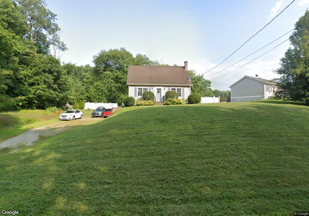
90 Grove St Wauregan, CT 06387
Estimated Value: $389,000
3
Beds
2
Baths
1,306
Sq Ft
$298/Sq Ft
Est. Value
About This Home
This home is located at 90 Grove St, Wauregan, CT 06387 and is currently estimated at $389,000, approximately $297 per square foot. 90 Grove St is a home with nearby schools including Plainfield Memorial School, Plainfield Central Middle School, and Plainfield High School.
Ownership History
Date
Name
Owned For
Owner Type
Purchase Details
Closed on
Jan 4, 2006
Sold by
Brais Adam M and Brais Amy L
Bought by
Oconnell Arthur J and Oconnell Ericka S
Current Estimated Value
Home Financials for this Owner
Home Financials are based on the most recent Mortgage that was taken out on this home.
Original Mortgage
$233,450
Outstanding Balance
$131,294
Interest Rate
6.28%
Mortgage Type
Purchase Money Mortgage
Estimated Equity
$257,706
Purchase Details
Closed on
Sep 11, 2003
Sold by
Pasay Keith D
Bought by
Brais Adam M and Trudelle Amy L
Home Financials for this Owner
Home Financials are based on the most recent Mortgage that was taken out on this home.
Original Mortgage
$165,850
Interest Rate
6.22%
Mortgage Type
Purchase Money Mortgage
Create a Home Valuation Report for This Property
The Home Valuation Report is an in-depth analysis detailing your home's value as well as a comparison with similar homes in the area
Home Values in the Area
Average Home Value in this Area
Purchase History
| Date | Buyer | Sale Price | Title Company |
|---|---|---|---|
| Oconnell Arthur J | $230,000 | -- | |
| Oconnell Arthur J | $230,000 | -- | |
| Brais Adam M | $168,500 | -- | |
| Brais Adam M | $168,500 | -- |
Source: Public Records
Mortgage History
| Date | Status | Borrower | Loan Amount |
|---|---|---|---|
| Open | Brais Adam M | $233,450 | |
| Closed | Brais Adam M | $233,450 | |
| Previous Owner | Brais Adam M | $25,000 | |
| Previous Owner | Brais Adam M | $165,850 |
Source: Public Records
Tax History Compared to Growth
Tax History
| Year | Tax Paid | Tax Assessment Tax Assessment Total Assessment is a certain percentage of the fair market value that is determined by local assessors to be the total taxable value of land and additions on the property. | Land | Improvement |
|---|---|---|---|---|
| 2024 | $4,107 | $175,530 | $27,970 | $147,560 |
| 2023 | $4,000 | $175,530 | $27,970 | $147,560 |
| 2022 | $5,579 | $111,990 | $28,450 | $83,540 |
| 2021 | $3,430 | $111,990 | $28,450 | $83,540 |
| 2020 | $3,430 | $111,990 | $28,450 | $83,540 |
| 2019 | $3,430 | $111,990 | $28,450 | $83,540 |
| 2018 | $3,389 | $111,990 | $28,450 | $83,540 |
| 2017 | $3,525 | $109,400 | $26,950 | $82,450 |
| 2016 | $3,430 | $109,400 | $26,950 | $82,450 |
Source: Public Records
Map
Nearby Homes
- 44-46 S Chestnut St
- 0 Wauregan Rd NE Unit 24117158
- 50 Marie St
- 8 Jolley Rd
- 277 Moosup Pond Rd
- 462 Wauregan Rd
- 279 Moosup Pond Rd
- 22 Shepard Hill Rd
- 0 Putnam Rd Unit 24117166
- 8 Juniper Ln
- 10 Black Hill Rd
- 36 Water St
- 46 Water St
- 45 Main St Unit 202
- 54 Main St
- 14 Walnut St
- 53 Carol Ave
- 22 Philmar Dr
- 103 Gloria Ave
- 478 Wauregan Rd
- 57 S Chestnut St Unit 2nd floor
- 63 S Chestnut St
- 70 S Chestnut St
- 70 S Chestnut St
- 69 S Chestnut St
- 63 S Chestnut St
- 44 Grove St
- 57 S Chestnut St
- 84 S Chestnut St
- 70 S Chestnut St
- 27 S Chestnut St
- 51-53 S Chestnut St
- 44 S Chestnut St
- 72-74 S Walnut St
- 34 S Walnut St Unit 34
- 43-45 Wauregan Rd
- 72 S Walnut St
- 57 S Chestnut Street 2nd Floor
- 59 S Chestnut Street 1st Floor
- 57-59 S Chestnut St