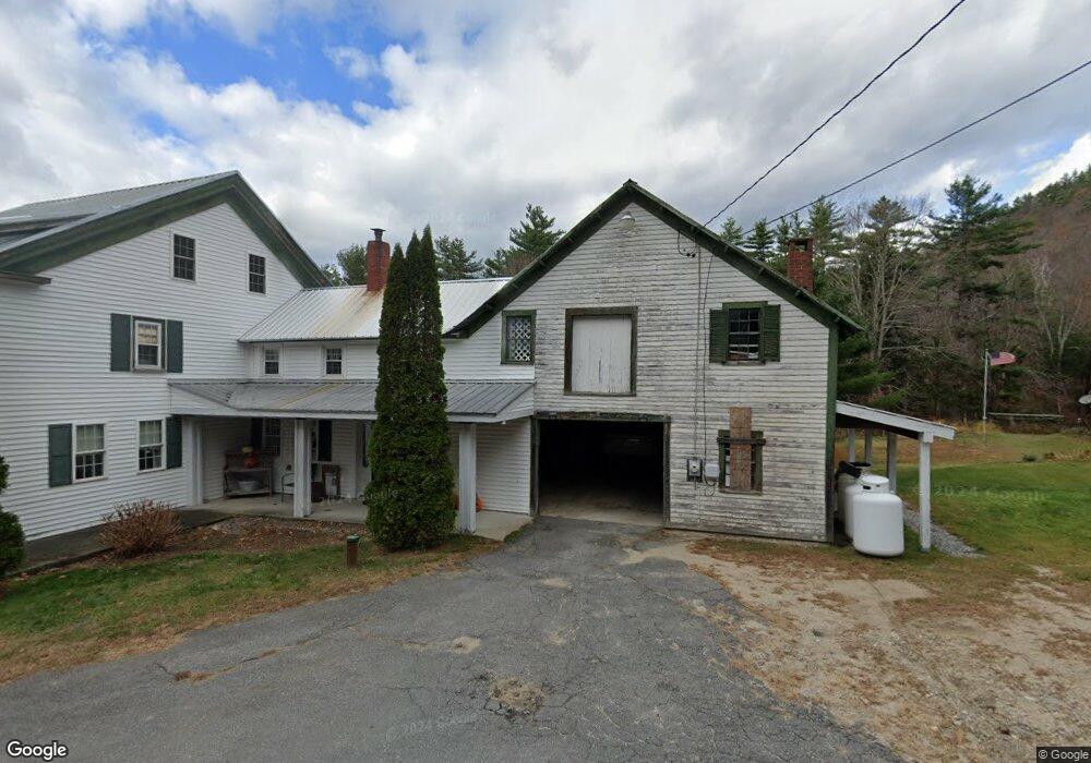
90 Lowd Rd Cornish, ME 04020
Estimated Value: $93,000 - $468,000
4
Beds
2
Baths
1,812
Sq Ft
$187/Sq Ft
Est. Value
About This Home
This home is located at 90 Lowd Rd, Cornish, ME 04020 and is currently estimated at $338,498, approximately $186 per square foot. 90 Lowd Rd is a home located in York County with nearby schools including Ossipee Valley Christian School.
Ownership History
Date
Name
Owned For
Owner Type
Purchase Details
Closed on
Feb 27, 2008
Sold by
Lowd Roger
Bought by
Lowd Roger D and Lowd Emily G
Current Estimated Value
Home Financials for this Owner
Home Financials are based on the most recent Mortgage that was taken out on this home.
Original Mortgage
$129,500
Interest Rate
5.8%
Mortgage Type
Purchase Money Mortgage
Purchase Details
Closed on
Apr 25, 2006
Sold by
Lowd Paul F
Bought by
Lowd Stephany A and Lowd Paul F
Create a Home Valuation Report for This Property
The Home Valuation Report is an in-depth analysis detailing your home's value as well as a comparison with similar homes in the area
Home Values in the Area
Average Home Value in this Area
Purchase History
| Date | Buyer | Sale Price | Title Company |
|---|---|---|---|
| Lowd Roger D | $1,001 | -- | |
| Lowd Roger D | $1,001 | -- | |
| Lowd Stephany A | -- | -- | |
| Lowd Stephany A | -- | -- |
Source: Public Records
Mortgage History
| Date | Status | Borrower | Loan Amount |
|---|---|---|---|
| Open | Lowd Stephany A | $140,000 | |
| Closed | Lowd Stephany A | $129,500 |
Source: Public Records
Tax History
| Year | Tax Paid | Tax Assessment Tax Assessment Total Assessment is a certain percentage of the fair market value that is determined by local assessors to be the total taxable value of land and additions on the property. | Land | Improvement |
|---|---|---|---|---|
| 2025 | $3,423 | $362,200 | $106,000 | $256,200 |
| 2024 | $3,239 | $352,100 | $100,000 | $252,100 |
| 2023 | $2,953 | $206,500 | $82,000 | $124,500 |
| 2022 | $2,850 | $206,500 | $82,000 | $124,500 |
| 2021 | $2,788 | $206,500 | $82,000 | $124,500 |
| 2020 | $2,767 | $206,500 | $82,000 | $124,500 |
| 2019 | $2,767 | $206,500 | $82,000 | $124,500 |
| 2018 | $2,788 | $206,500 | $82,000 | $124,500 |
| 2016 | $2,662 | $206,500 | $82,000 | $124,500 |
| 2015 | $2,664 | $206,500 | $82,000 | $124,500 |
| 2014 | $2,642 | $204,800 | $82,000 | $122,800 |
Source: Public Records
Map
Nearby Homes
- TBD Sokokis Trail N
- R13/038 Weeks Rd
- 1882 North Rd
- 1783 North Rd
- 5 Tracey Ln
- Lot #3 Jordan Heights Rd
- 50AC Sawyer Mountain Rd
- 1384 Cape Rd
- 85 Quarry Rd
- 6-13 Main St
- 71 Quarry Rd
- 22 High Rd
- 27 Nocturne Rd
- 20 Main St
- 4 Bridge St
- 96 Maple St
- 120 Cumberland St
- 761 Pendexter Rd
- 16 Whiteley Rd
- Lot 12 Prokey Dr
- 92 Lowd Rd
- 87 Lowd Rd
- 79 Lowd Rd
- 297 Sawyer Rd
- 281 Sawyer Rd
- 25 Pasture Dr
- 0 Lowd Unit 906854
- 0 Lowd Unit 906866
- 40 Appalossa Dr
- 35 Scott Ln
- 765 Sokokis Trail
- 194 Lowd Rd
- Lot #5 Jordan Heights Rd
- 0 Maine 5
- 53 Sokokis Trail N
- 0 Greep Lot Rd
- 0 Federal Rd Unit 743900
- 0 River Rd Unit 571265
- 0 Federal Rd Unit 446605
- 0 Federal Rd Unit 348441
Your Personal Tour Guide
Ask me questions while you tour the home.