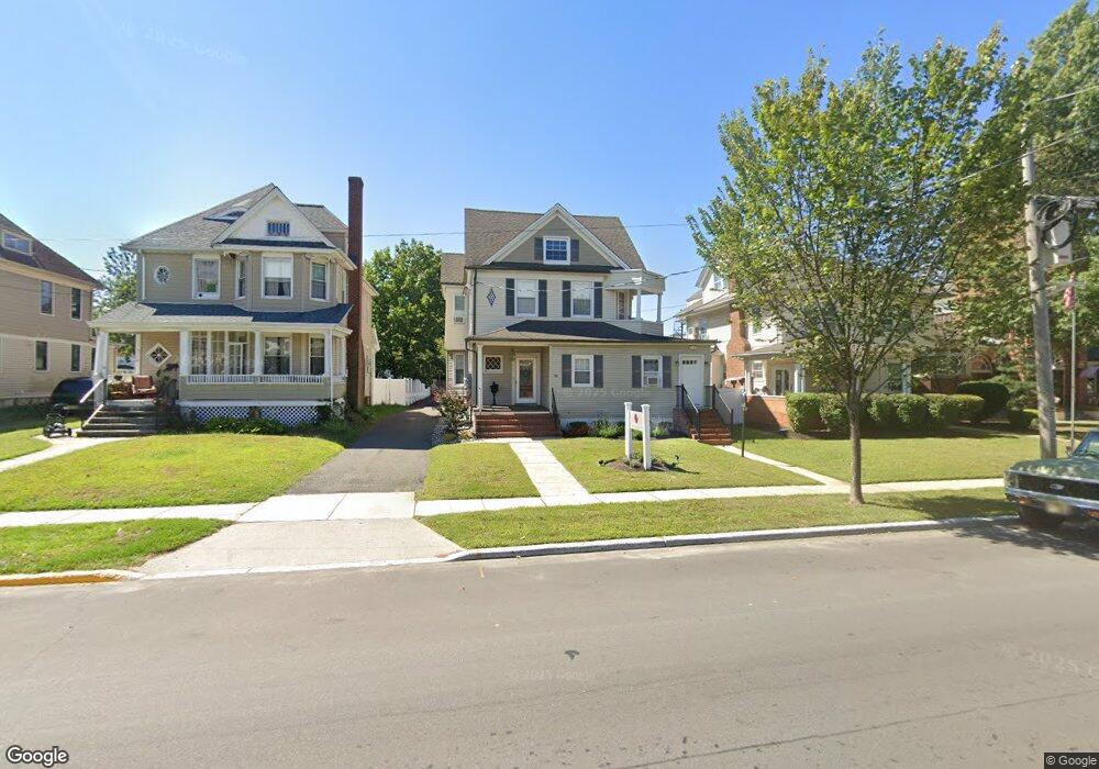
90 Maple Ave Red Bank, NJ 07701
Estimated Value: $910,000
--
Bed
--
Bath
2,170
Sq Ft
$419/Sq Ft
Est. Value
About This Home
This home is located at 90 Maple Ave, Red Bank, NJ 07701 and is currently estimated at $910,000, approximately $419 per square foot. 90 Maple Ave is a home located in Monmouth County with nearby schools including Red Bank Primary School, Red Bank Middle School, and Red Bank Regional High School.
Ownership History
Date
Name
Owned For
Owner Type
Purchase Details
Closed on
Jul 31, 2023
Sold by
Rrm Realty Llc
Bought by
First Baptist Church Of Red Bank
Current Estimated Value
Home Financials for this Owner
Home Financials are based on the most recent Mortgage that was taken out on this home.
Original Mortgage
$536,250
Outstanding Balance
$523,505
Interest Rate
6.81%
Estimated Equity
$386,495
Purchase Details
Closed on
Jun 18, 2018
Sold by
Reilly Bernard M
Bought by
Rrm Realty Llc
Home Financials for this Owner
Home Financials are based on the most recent Mortgage that was taken out on this home.
Original Mortgage
$125,000
Interest Rate
4.6%
Mortgage Type
New Conventional
Create a Home Valuation Report for This Property
The Home Valuation Report is an in-depth analysis detailing your home's value as well as a comparison with similar homes in the area
Home Values in the Area
Average Home Value in this Area
Purchase History
| Date | Buyer | Sale Price | Title Company |
|---|---|---|---|
| First Baptist Church Of Red Bank | $800,000 | Pure Title | |
| Rrm Realty Llc | $505,000 | None Available |
Source: Public Records
Mortgage History
| Date | Status | Borrower | Loan Amount |
|---|---|---|---|
| Open | First Baptist Church Of Red Bank | $536,250 | |
| Previous Owner | Rrm Realty Llc | $125,000 |
Source: Public Records
Tax History Compared to Growth
Tax History
| Year | Tax Paid | Tax Assessment Tax Assessment Total Assessment is a certain percentage of the fair market value that is determined by local assessors to be the total taxable value of land and additions on the property. | Land | Improvement |
|---|---|---|---|---|
| 2025 | -- | $721,900 | $353,600 | $368,300 |
| 2024 | $12,592 | $668,800 | $315,200 | $353,600 |
| 2023 | $12,592 | $658,900 | $315,200 | $343,700 |
| 2022 | $12,161 | $622,200 | $293,200 | $329,000 |
| 2021 | $12,161 | $543,900 | $244,400 | $299,500 |
| 2020 | $11,764 | $517,800 | $244,400 | $273,400 |
| 2019 | $10,754 | $486,400 | $244,400 | $242,000 |
| 2018 | $10,443 | $477,500 | $244,400 | $233,100 |
| 2017 | $10,033 | $475,500 | $244,400 | $231,100 |
| 2016 | $9,892 | $469,500 | $244,400 | $225,100 |
| 2015 | $9,921 | $488,000 | $309,400 | $178,600 |
| 2014 | $9,335 | $488,000 | $309,400 | $178,600 |
Source: Public Records
Map
Nearby Homes
- 59 Peters Place
- 59 Leroy Place
- 17 Leroy Place Unit 1A
- 17 Leroy Place Unit 2B
- 28 Riverside Ave Unit 2G
- 28 Riverside Ave Unit 4g
- 28 Riverside Ave Unit 10h
- 28 Riverside Ave Unit 1G
- 48 Hudson Ave
- 44 Hudson Ave
- 159 Bridge Ave
- 70 Hudson Ave
- 58 Hudson Ave
- 171-173 Bridge Ave
- 23 Wallace St Unit 306
- 4 Boat Club Ct Unit 3E
- 24 Cedar Crossing
- 3 Cedar Crossing
- 82 Linden Place
- 69 Washington St
- 92 Maple Ave
- 26 Chestnut St
- 23 Oakland St
- 87 Maple Ave Unit 2
- 87 Maple Ave
- 87 Maple Ave Unit Side Unit
- 17 Chestnut St
- 25 Oakland St
- 32 Chestnut St
- 30 Chestnut St Unit 30
- 72 Peters Place Unit 74
- 74 Peters Place
- 30 32 Chestnut St
- 68 Maple Ave
- 27 Oakland St
- 27 Oakland St Unit 2nd floor
- 104 Maple Ave Unit 110
- 79 Maple Ave
- 83 Pearl St
- 14 Oakland St