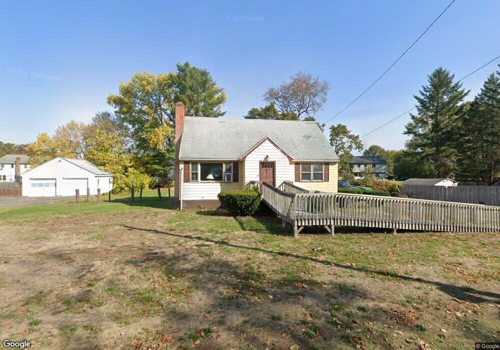
90 Michael Ave East Hartford, CT 06108
Estimated Value: $272,000 - $346,000
3
Beds
2
Baths
1,629
Sq Ft
$189/Sq Ft
Est. Value
About This Home
This home is located at 90 Michael Ave, East Hartford, CT 06108 and is currently estimated at $308,068, approximately $189 per square foot. 90 Michael Ave is a home located in Hartford County with nearby schools including Anna E. Norris School, East Hartford Middle School, and East Hartford High School.
Ownership History
Date
Name
Owned For
Owner Type
Purchase Details
Closed on
Feb 8, 2013
Sold by
Halstead Berneeda A
Bought by
Hutchinson Berneeda A
Current Estimated Value
Home Financials for this Owner
Home Financials are based on the most recent Mortgage that was taken out on this home.
Original Mortgage
$117,000
Outstanding Balance
$23,069
Interest Rate
3.38%
Estimated Equity
$284,999
Create a Home Valuation Report for This Property
The Home Valuation Report is an in-depth analysis detailing your home's value as well as a comparison with similar homes in the area
Home Values in the Area
Average Home Value in this Area
Purchase History
| Date | Buyer | Sale Price | Title Company |
|---|---|---|---|
| Hutchinson Berneeda A | -- | -- |
Source: Public Records
Mortgage History
| Date | Status | Borrower | Loan Amount |
|---|---|---|---|
| Open | Hutchinson Berneeda A | $117,000 | |
| Previous Owner | Hutchinson Berneeda A | $71,000 |
Source: Public Records
Tax History Compared to Growth
Tax History
| Year | Tax Paid | Tax Assessment Tax Assessment Total Assessment is a certain percentage of the fair market value that is determined by local assessors to be the total taxable value of land and additions on the property. | Land | Improvement |
|---|---|---|---|---|
| 2025 | $6,722 | $146,440 | $29,980 | $116,460 |
| 2024 | $6,443 | $146,440 | $29,980 | $116,460 |
| 2023 | $6,230 | $146,440 | $29,980 | $116,460 |
| 2022 | $6,004 | $146,440 | $29,980 | $116,460 |
| 2021 | $5,455 | $110,540 | $27,960 | $82,580 |
| 2020 | $5,518 | $110,540 | $27,960 | $82,580 |
| 2019 | $5,429 | $110,540 | $27,960 | $82,580 |
| 2018 | $5,268 | $110,540 | $27,960 | $82,580 |
| 2017 | $5,201 | $110,540 | $27,960 | $82,580 |
| 2016 | $5,277 | $115,060 | $27,490 | $87,570 |
| 2015 | $5,277 | $115,060 | $27,490 | $87,570 |
| 2014 | $5,224 | $115,060 | $27,490 | $87,570 |
Source: Public Records
Map
Nearby Homes
- 89 Henderson Dr
- 15 Michael Ave
- 22 Matthew Rd
- 67 Laurel St
- 29 Joanne Dr Unit 29
- 51 Daniel St
- 421 Tolland St
- 421 Tolland St Unit 209
- 506 Burnside Ave
- 453 Burnside Ave
- 509 Burnside Ave Unit A18
- 39 Tiffany Rd
- 110 Goodwin St
- 345 Goodwin St
- 11 Westbrook St
- 50 Northbrook Ct
- 577 Goodwin St
- 51 Wood Dr
- 265 Burnside Ave
- 59 Laraia Ave
- 82 Michael Ave
- 100 Michael Ave Unit 102
- 89 Michael Ave
- 72 Timothy Rd Unit 74
- 60 Amy Dr Unit 62
- 99 Michael Ave
- 64 Amy Dr Unit 66
- 93 Michael Ave
- 62 Amy Dr
- 68 Timothy Rd Unit 70
- 60-62 Amy Dr
- 110 Michael Ave Unit 112
- 54 Amy Dr Unit 56
- 76 Michael Ave
- 103 Michael Ave
- 79 Michael Ave
- 79 Michael Ave
- 62 Timothy Rd Unit 64
- 76 Timothy Rd Unit 78
- 120 Michael Ave Unit 122