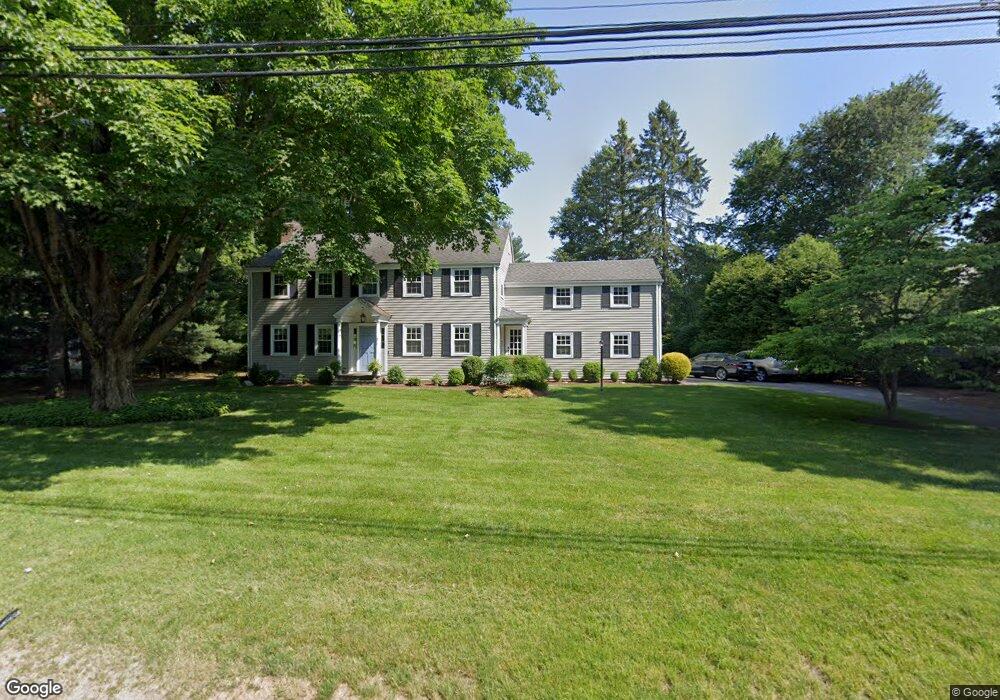
90 N Cedar Rd Fairfield, CT 06824
University NeighborhoodEstimated Value: $1,180,000 - $1,816,000
4
Beds
3
Baths
2,624
Sq Ft
$547/Sq Ft
Est. Value
About This Home
This home is located at 90 N Cedar Rd, Fairfield, CT 06824 and is currently estimated at $1,434,145, approximately $546 per square foot. 90 N Cedar Rd is a home located in Fairfield County with nearby schools including Dwight Elementary School, Roger Ludlowe Middle School, and Fairfield Ludlowe High School.
Ownership History
Date
Name
Owned For
Owner Type
Purchase Details
Closed on
Apr 5, 2023
Sold by
Walsh Catherine T
Bought by
Walsh Catherine T and Walsh Thomas J
Current Estimated Value
Purchase Details
Closed on
Apr 24, 1997
Sold by
Naramore Dorothy W Est
Bought by
Walsh Catherine T
Create a Home Valuation Report for This Property
The Home Valuation Report is an in-depth analysis detailing your home's value as well as a comparison with similar homes in the area
Home Values in the Area
Average Home Value in this Area
Purchase History
| Date | Buyer | Sale Price | Title Company |
|---|---|---|---|
| Walsh Catherine T | -- | None Available | |
| Walsh Catherine T | -- | None Available | |
| Walsh Catherine T | $350,000 | -- | |
| Walsh Catherine T | $350,000 | -- |
Source: Public Records
Mortgage History
| Date | Status | Borrower | Loan Amount |
|---|---|---|---|
| Previous Owner | Walsh Catherine T | $329,000 | |
| Previous Owner | Walsh Catherine T | $270,000 |
Source: Public Records
Tax History
| Year | Tax Paid | Tax Assessment Tax Assessment Total Assessment is a certain percentage of the fair market value that is determined by local assessors to be the total taxable value of land and additions on the property. | Land | Improvement |
|---|---|---|---|---|
| 2025 | $17,297 | $609,280 | $401,380 | $207,900 |
| 2024 | $16,999 | $609,280 | $401,380 | $207,900 |
| 2023 | $16,761 | $609,280 | $401,380 | $207,900 |
| 2022 | $16,597 | $609,280 | $401,380 | $207,900 |
| 2021 | $16,438 | $609,280 | $401,380 | $207,900 |
| 2020 | $17,170 | $640,920 | $396,900 | $244,020 |
| 2019 | $17,170 | $640,920 | $396,900 | $244,020 |
| 2018 | $16,895 | $640,920 | $396,900 | $244,020 |
| 2017 | $16,549 | $640,920 | $396,900 | $244,020 |
| 2016 | $16,267 | $639,170 | $396,900 | $242,270 |
| 2015 | $14,965 | $603,680 | $426,510 | $177,170 |
| 2014 | $14,730 | $603,680 | $426,510 | $177,170 |
Source: Public Records
Map
Nearby Homes
- 360 Duck Farm Rd
- 2683 Bronson Rd
- 1353 Mill Plain Rd
- 148 Millspaugh Dr
- 688 Hulls Farm Rd
- 647 Bronson Rd
- 218 Lower Farm Rd
- 1091 Round Hill Rd
- 53 Hilltop Dr
- 329 Bronson Rd
- 1380 Old Academy Rd
- 110 Queens Grant Dr
- 153 Pease Ave
- 28 Mill Hill Rd Unit 28
- 1 Sturges Hwy Unit 2
- 54 Ridgedale Rd
- 49 Southport Woods Dr
- 20 Ermine St
- 42 Robin Cir
- 1478 Jennings Rd
- 58 N Cedar Rd
- 130 N Cedar Rd
- 172 N Cedar Rd
- 172 N Cedar Rd
- 1780 Bronson Rd
- 1728 Bronson Rd
- 159 N Cedar Rd
- 14 Hillside Rd
- 40 Hillside Rd Unit SF
- 40 Hillside Rd
- 66 Hillside Rd
- 1731 Bronson Rd
- 189 N Cedar Rd
- 88 Hillside Rd
- 601 Hill Farm Rd
- 208 N Cedar Rd
- 217 N Cedar Rd
- 1700 Bronson Rd
- 1785 Bronson Rd
- 240 N Cedar Rd
Your Personal Tour Guide
Ask me questions while you tour the home.