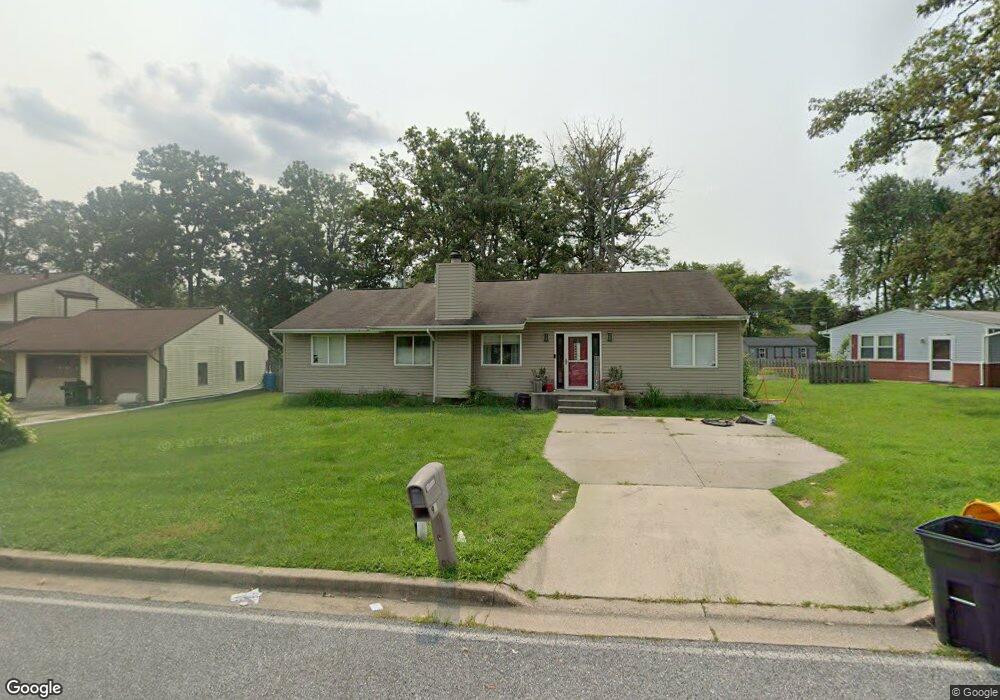
90 Otis Dr Severn, MD 21144
Estimated Value: $392,027 - $520,000
Studio
1
Bath
1,754
Sq Ft
$265/Sq Ft
Est. Value
About This Home
This home is located at 90 Otis Dr, Severn, MD 21144 and is currently estimated at $465,257, approximately $265 per square foot. 90 Otis Dr is a home located in Anne Arundel County with nearby schools including Severn Elementary School, Old Mill Middle School North, and Old Mill High School.
Ownership History
Date
Name
Owned For
Owner Type
Purchase Details
Closed on
Sep 28, 2000
Sold by
Redman James G
Bought by
Redman Sheila D
Current Estimated Value
Purchase Details
Closed on
Feb 28, 1990
Sold by
Bigott Thomas R
Bought by
Redman James G
Home Financials for this Owner
Home Financials are based on the most recent Mortgage that was taken out on this home.
Original Mortgage
$75,750
Interest Rate
10.31%
Create a Home Valuation Report for This Property
The Home Valuation Report is an in-depth analysis detailing your home's value as well as a comparison with similar homes in the area
Home Values in the Area
Average Home Value in this Area
Purchase History
| Date | Buyer | Sale Price | Title Company |
|---|---|---|---|
| Redman Sheila D | -- | -- | |
| Redman James G | $90,000 | -- |
Source: Public Records
Mortgage History
| Date | Status | Borrower | Loan Amount |
|---|---|---|---|
| Previous Owner | Redman James G | $75,750 |
Source: Public Records
Tax History
| Year | Tax Paid | Tax Assessment Tax Assessment Total Assessment is a certain percentage of the fair market value that is determined by local assessors to be the total taxable value of land and additions on the property. | Land | Improvement |
|---|---|---|---|---|
| 2025 | $2,589 | $380,700 | $186,100 | $194,600 |
| 2024 | $2,589 | $363,733 | $0 | $0 |
| 2023 | $2,030 | $346,767 | $0 | $0 |
| 2022 | $3,446 | $329,800 | $160,300 | $169,500 |
| 2020 | $2,227 | $326,800 | $0 | $0 |
| 2019 | $4,313 | $325,300 | $176,100 | $149,200 |
| 2018 | $3,214 | $316,933 | $0 | $0 |
| 2017 | $2,078 | $308,567 | $0 | $0 |
| 2016 | -- | $300,200 | $0 | $0 |
| 2015 | -- | $274,667 | $0 | $0 |
| 2014 | -- | $249,133 | $0 | $0 |
Source: Public Records
Map
Nearby Homes
- 1012 Morgan Station Dr
- 7716 Dignity Way
- 900 S Wieker Rd
- 1025 Ironwood Ln
- 1029 Ironwood Ln
- 7425 Hawkins Dr
- 7428 Hawkins Dr
- 902 Hillcrest Rd
- 7633 Amos Ave
- 7860 Telegraph Rd
- 7831 Wolf Run Ln
- 7830 Wolf Run Ln
- 7826 Wolf Run Ln
- 917 Reece Rd
- 1422 Fairbanks Dr
- 7827 Clark Station Rd
- 1125 Dorsey Rd
- 7711 Phelps Farm Ln
- 7810 Grandison Way
- 7966 Foster Ave
Your Personal Tour Guide
Ask me questions while you tour the home.