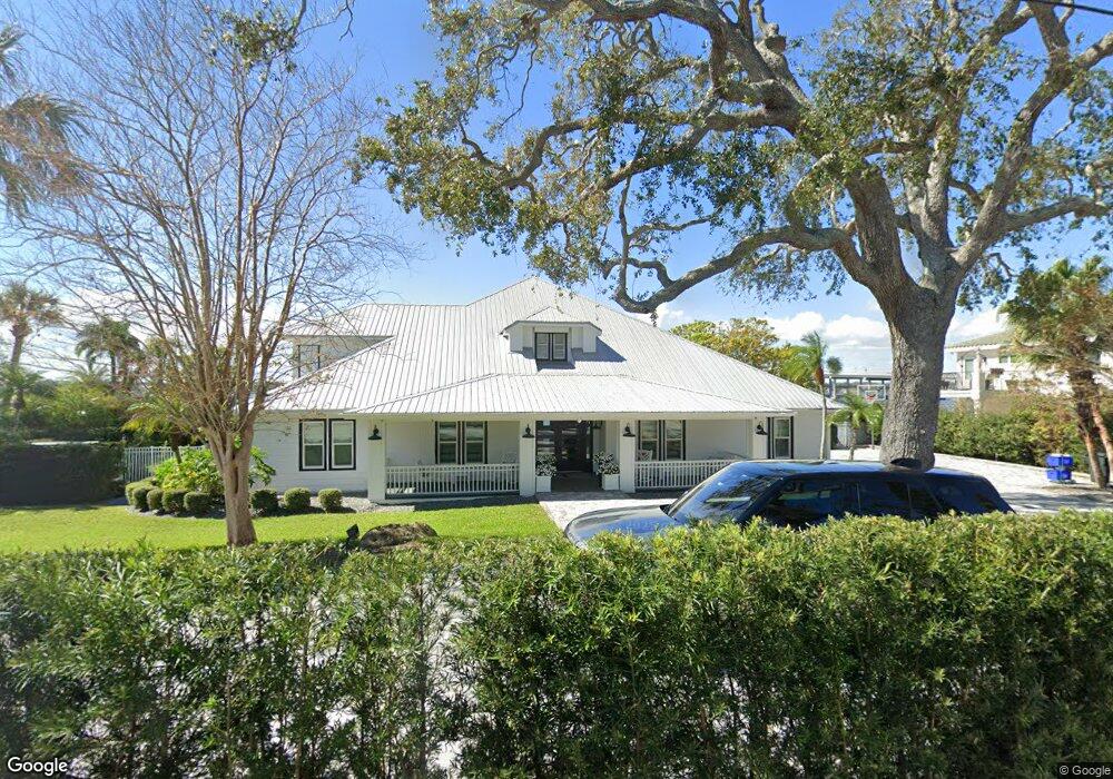
90 Riverside Dr Ormond Beach, FL 32176
Estimated Value: $790,000 - $3,354,000
4
Beds
5
Baths
4,888
Sq Ft
$455/Sq Ft
Est. Value
About This Home
This home is located at 90 Riverside Dr, Ormond Beach, FL 32176 and is currently estimated at $2,222,928, approximately $454 per square foot. 90 Riverside Dr is a home located in Volusia County with nearby schools including Ormond Beach Middle School, Seabreeze High School, and St Brendan Catholic School.
Ownership History
Date
Name
Owned For
Owner Type
Purchase Details
Closed on
May 22, 2006
Sold by
Ebbs George H and Ebbs Agnes R
Bought by
Heaster Lewis M and Lewis M Heaster Revocable Trust
Current Estimated Value
Purchase Details
Closed on
Aug 12, 2003
Sold by
Ebbs George H and Ebbs George H
Bought by
Ebbs George H and Ebbs Agnes R
Purchase Details
Closed on
Apr 7, 1999
Sold by
Bower Robert E and Bower Paula
Bought by
Ebbs George H and Ebbs Agnes R
Home Financials for this Owner
Home Financials are based on the most recent Mortgage that was taken out on this home.
Original Mortgage
$700,000
Interest Rate
6.85%
Purchase Details
Closed on
Apr 15, 1987
Bought by
Heaster Lewis M Tr
Purchase Details
Closed on
Mar 15, 1987
Bought by
Heaster Lewis M Tr
Purchase Details
Closed on
Aug 15, 1980
Bought by
Heaster Lewis M Tr
Purchase Details
Closed on
Jul 15, 1976
Bought by
Heaster Lewis M Tr
Create a Home Valuation Report for This Property
The Home Valuation Report is an in-depth analysis detailing your home's value as well as a comparison with similar homes in the area
Home Values in the Area
Average Home Value in this Area
Purchase History
| Date | Buyer | Sale Price | Title Company |
|---|---|---|---|
| Heaster Lewis M | $2,735,000 | None Available | |
| Ebbs George H | -- | -- | |
| Ebbs George H | $700,000 | -- | |
| Heaster Lewis M Tr | $100 | -- | |
| Heaster Lewis M Tr | $160,000 | -- | |
| Heaster Lewis M Tr | $95,000 | -- | |
| Heaster Lewis M Tr | $52,500 | -- |
Source: Public Records
Mortgage History
| Date | Status | Borrower | Loan Amount |
|---|---|---|---|
| Previous Owner | Ebbs George H | $700,000 |
Source: Public Records
Tax History
| Year | Tax Paid | Tax Assessment Tax Assessment Total Assessment is a certain percentage of the fair market value that is determined by local assessors to be the total taxable value of land and additions on the property. | Land | Improvement |
|---|---|---|---|---|
| 2026 | $22,699 | $1,468,176 | -- | -- |
| 2025 | $22,699 | $1,429,578 | -- | -- |
| 2024 | $21,344 | $1,389,289 | -- | -- |
| 2023 | $21,344 | $1,348,825 | $0 | $0 |
| 2022 | $20,775 | $1,309,539 | $0 | $0 |
| 2021 | $21,639 | $1,271,397 | $0 | $0 |
| 2020 | $21,339 | $1,253,843 | $0 | $0 |
| 2019 | $21,022 | $1,225,653 | $614,040 | $611,613 |
| 2018 | $22,299 | $1,263,864 | $0 | $0 |
| 2017 | $22,818 | $1,237,869 | $0 | $0 |
| 2016 | $23,180 | $1,212,408 | $0 | $0 |
| 2015 | $23,946 | $1,203,980 | $0 | $0 |
| 2014 | $23,810 | $1,194,425 | $0 | $0 |
Source: Public Records
Map
Nearby Homes
- 65 Seton Trail Unit 8
- 1 John Anderson Dr Unit 205
- 1 John Anderson Dr Unit 604
- 1 John Anderson Dr Unit 303
- 1 John Anderson Dr Unit 3010
- 1 John Anderson Dr Unit 4120
- 1 John Anderson Dr Unit 301
- 1 John Anderson Dr Unit 412
- 55 Vining Ct Unit 104
- 55 Vining Ct Unit 1040
- 156 Bosarvey Dr
- 65 Coquina Dr
- 105 John Anderson Dr
- 84 N Halifax Dr
- 114 N Halifax Dr
- 111 S Atlantic Ave Unit 505
- 111 S Atlantic Ave Unit 702
- 111 S Atlantic Ave Unit 1104
- 123 Arlington Way
- 89 S Atlantic Ave Unit 401
- 108 Riverside Dr
- 70 Riverside Dr
- 87 Riverside Dr
- 110 Riverside Dr
- 40 Riverside Dr
- 105 Riverside Dr
- 116 Riverside Dr
- 71 Riverside Dr
- 115 Riverside Dr
- 25 Bosarvey Cir
- 65 Riverside Dr
- 130 Riverside Dr
- 30 Bosarvey Cir
- 127 Riverside Dr
- 136 Riverside Dr
- 82 S Halifax Dr
- 40 Bosarvey Cir
- 135 Riverside Dr
- 49 Bosarvey Cir
- 23 Willis Dr
Your Personal Tour Guide
Ask me questions while you tour the home.