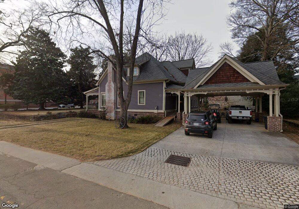
90 S Hill St Buford, GA 30518
Estimated Value: $452,000 - $668,528
3
Beds
4
Baths
2,576
Sq Ft
$226/Sq Ft
Est. Value
About This Home
This home is located at 90 S Hill St, Buford, GA 30518 and is currently estimated at $582,382, approximately $226 per square foot. 90 S Hill St is a home located in Gwinnett County with nearby schools including Buford Elementary School, Buford Senior Academy, and Buford Academy.
Ownership History
Date
Name
Owned For
Owner Type
Purchase Details
Closed on
Nov 23, 2016
Sold by
Janet C
Bought by
1006 Pinbrook Dr Llc
Current Estimated Value
Purchase Details
Closed on
Jul 29, 2004
Sold by
Frix Dianne M
Bought by
Poynter William M and Poynter Janet
Home Financials for this Owner
Home Financials are based on the most recent Mortgage that was taken out on this home.
Original Mortgage
$50,000
Interest Rate
6.22%
Purchase Details
Closed on
Jul 19, 1999
Sold by
Rosa Ferdinand
Bought by
Conaty Patricia
Home Financials for this Owner
Home Financials are based on the most recent Mortgage that was taken out on this home.
Original Mortgage
$73,501
Interest Rate
7.51%
Create a Home Valuation Report for This Property
The Home Valuation Report is an in-depth analysis detailing your home's value as well as a comparison with similar homes in the area
Home Values in the Area
Average Home Value in this Area
Purchase History
| Date | Buyer | Sale Price | Title Company |
|---|---|---|---|
| 1006 Pinbrook Dr Llc | $40,000 | -- | |
| Poynter William M | $150,000 | -- | |
| Conaty Patricia | $80,000 | -- |
Source: Public Records
Mortgage History
| Date | Status | Borrower | Loan Amount |
|---|---|---|---|
| Previous Owner | Poynter William M | $50,000 | |
| Previous Owner | Conaty Patricia | $73,501 |
Source: Public Records
Tax History Compared to Growth
Tax History
| Year | Tax Paid | Tax Assessment Tax Assessment Total Assessment is a certain percentage of the fair market value that is determined by local assessors to be the total taxable value of land and additions on the property. | Land | Improvement |
|---|---|---|---|---|
| 2025 | -- | $307,600 | $40,000 | $267,600 |
| 2024 | -- | $311,160 | $33,600 | $277,560 |
| 2023 | $3,114 | $217,000 | $26,000 | $191,000 |
| 2022 | $0 | $217,000 | $26,000 | $191,000 |
| 2021 | $360 | $155,360 | $16,800 | $138,560 |
| 2020 | $360 | $155,360 | $16,800 | $138,560 |
| 2019 | $360 | $146,640 | $16,800 | $129,840 |
| 2018 | $207 | $16,000 | $8,800 | $7,200 |
| 2016 | $360 | $28,080 | $5,600 | $22,480 |
| 2015 | $246 | $18,520 | $5,600 | $12,920 |
| 2014 | -- | $18,520 | $5,600 | $12,920 |
Source: Public Records
Map
Nearby Homes
- 4942 Greenard Watson Ln
- 304 E Jackson St
- 4933 Greenard Watson Ln
- 120 Gwinnett St
- 449 S Hill St
- 489 Williams St
- 401 Pirkle Ave
- 550 Gwinnett St
- 4817 Cooper Farm Dr
- 25 Stonehedge Dr
- 5065 Cooper Farm Dr
- 480 S Hill St
- 185 Scott St
- 10 Shadburn Ferry Rd
- 2051 Harvester Ln
- 408 Bona Rd
- 48 Stonehedge Ct
- 130 W Main St Unit 1
- 146 S Hill St
- 10 S Hill St
- 156 S Hill St
- 359 W Moreno St
- 279 W Moreno St
- 389 W Moreno St
- 375 E Main St
- 135 S Hill St
- 169 Wilson Ave
- 145 S Hill St
- 8 E Park St
- 6 E Park St
- 289 E Shadburn Ave
- 369 E Park St
- E E Moreno St
- 208 S Hill St
- 4974 Grace Harris St
- 395 Sawnee Ave
- 4964 Grace Harris St
- 274 W Shadburn Ave