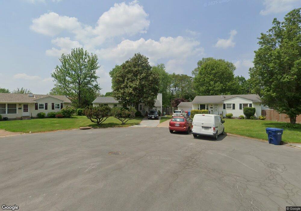
90 Saint Albert Ln Florissant, MO 63031
Estimated Value: $147,645 - $165,000
2
Beds
1
Bath
1,226
Sq Ft
$128/Sq Ft
Est. Value
About This Home
This home is located at 90 Saint Albert Ln, Florissant, MO 63031 and is currently estimated at $156,411, approximately $127 per square foot. 90 Saint Albert Ln is a home located in St. Louis County with nearby schools including Combs Elementary School, Cross Keys Middle School, and McCluer North High School.
Ownership History
Date
Name
Owned For
Owner Type
Purchase Details
Closed on
Mar 3, 2023
Sold by
Burke Dorothy Jean
Bought by
Burke Edward T
Current Estimated Value
Purchase Details
Closed on
Jun 29, 2005
Sold by
Odell Abigail E and Odell Bryan
Bought by
Burke Dorothy
Home Financials for this Owner
Home Financials are based on the most recent Mortgage that was taken out on this home.
Original Mortgage
$82,400
Interest Rate
5.87%
Mortgage Type
Fannie Mae Freddie Mac
Purchase Details
Closed on
Feb 1, 2001
Sold by
Barr Thomas J and Barr Jane E
Bought by
Thomas J Barr Living Trust
Create a Home Valuation Report for This Property
The Home Valuation Report is an in-depth analysis detailing your home's value as well as a comparison with similar homes in the area
Home Values in the Area
Average Home Value in this Area
Purchase History
| Date | Buyer | Sale Price | Title Company |
|---|---|---|---|
| Burke Edward T | -- | None Listed On Document | |
| Burke Dorothy | $103,000 | -- | |
| Thomas J Barr Living Trust | -- | -- |
Source: Public Records
Mortgage History
| Date | Status | Borrower | Loan Amount |
|---|---|---|---|
| Previous Owner | Burke Dorothy | $82,400 |
Source: Public Records
Tax History Compared to Growth
Tax History
| Year | Tax Paid | Tax Assessment Tax Assessment Total Assessment is a certain percentage of the fair market value that is determined by local assessors to be the total taxable value of land and additions on the property. | Land | Improvement |
|---|---|---|---|---|
| 2025 | $1,961 | $27,060 | $5,380 | $21,680 |
| 2024 | $1,961 | $25,230 | $3,720 | $21,510 |
| 2023 | $1,954 | $25,230 | $3,720 | $21,510 |
| 2022 | $1,777 | $20,140 | $5,380 | $14,760 |
| 2021 | $1,747 | $20,140 | $5,380 | $14,760 |
| 2020 | $1,507 | $16,340 | $4,920 | $11,420 |
| 2019 | $1,478 | $16,340 | $4,920 | $11,420 |
| 2018 | $1,520 | $15,020 | $2,950 | $12,070 |
| 2017 | $1,512 | $15,020 | $2,950 | $12,070 |
| 2016 | $1,707 | $16,570 | $4,750 | $11,820 |
| 2015 | $1,717 | $16,570 | $4,750 | $11,820 |
| 2014 | $1,635 | $16,280 | $5,810 | $10,470 |
Source: Public Records
Map
Nearby Homes
- 279 Elmdale Ct
- 216 Graham Rd
- 630 Graham Rd
- 540 S Jefferson St
- 305 S Lafayette St
- 580 Saint Marie St
- 201 Brower Ln
- 260 N Jefferson St
- 175 Clark St
- 937 Cades Cove
- 940 Harrison St
- 15 Henson Ln
- 7731 Hazelcrest Dr Unit H
- 200 Calbreath Ct
- 7641 Hazelcrest Dr Unit 47
- 7594 Hazelcrest Dr Unit B
- 215 Maple Dr
- 270 W Saint Anthony Ln
- 7520 Hazelcrest Dr Unit 227
- 7446 Sieloff Dr Unit H
- 95 Saint Albert Ln
- 80 Saint Albert Ln
- 70 Saint Albert Ln
- 85 Saint Albert Ln
- 280 Elmdale Ct
- 272 Elmdale Ct
- 60 Saint Albert Ln
- 75 Saint Albert Ln
- 60 St Albert Ln
- 264 Elmdale Ct
- 65 Saint Albert Ln
- 50 Saint Albert Ln
- 256 Elmdale Ct
- 40 Saint Albert Ln
- 296 Elmdale Ct
- 248 Elmdale Ct
- 30 Saint Albert Ln
- 55 St Alice Ln
- 240 Elmdale Ct
- 287 Elmdale Ct