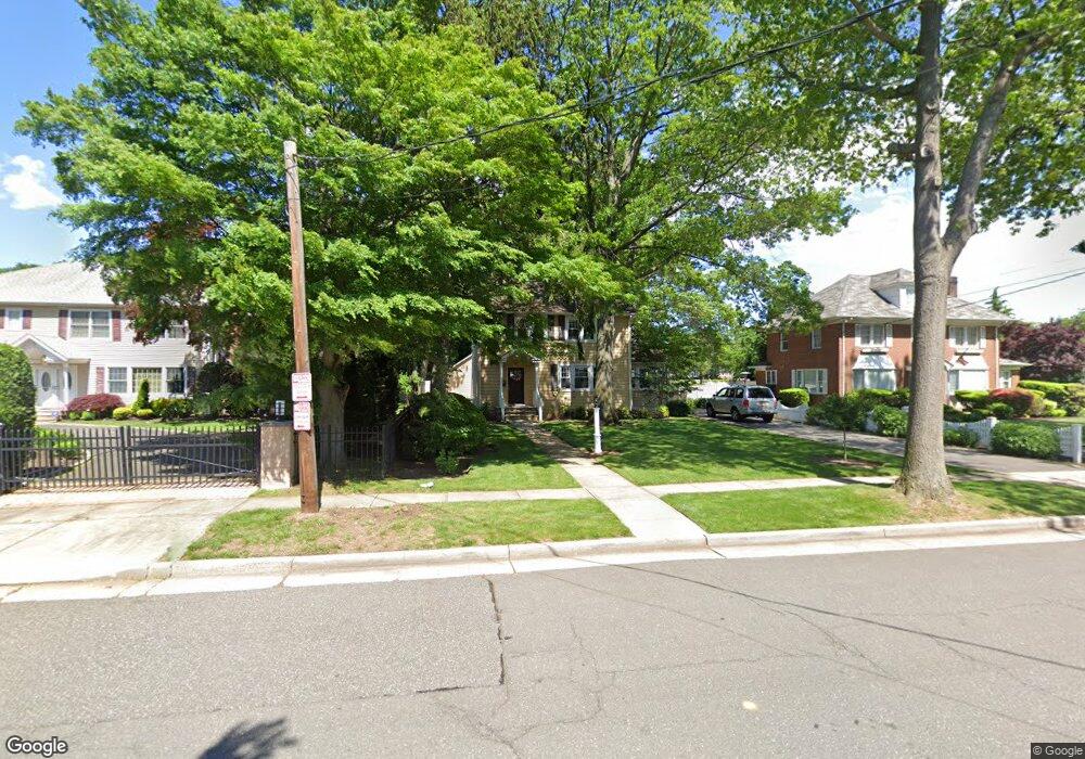
90 Saint Pauls Rd N Hempstead, NY 11550
Estimated Value: $669,000 - $772,254
4
Beds
2
Baths
1,935
Sq Ft
$372/Sq Ft
Est. Value
About This Home
This home is located at 90 Saint Pauls Rd N, Hempstead, NY 11550 and is currently estimated at $720,627, approximately $372 per square foot. 90 Saint Pauls Rd N is a home located in Nassau County with nearby schools including The Academy Charter School, Evergreen Charter School, and Crescent School.
Ownership History
Date
Name
Owned For
Owner Type
Purchase Details
Closed on
Feb 23, 2015
Sold by
Wells Frango Bank
Bought by
Greene Troy and Greene Heather
Current Estimated Value
Home Financials for this Owner
Home Financials are based on the most recent Mortgage that was taken out on this home.
Original Mortgage
$360,905
Outstanding Balance
$274,382
Interest Rate
3.64%
Mortgage Type
New Conventional
Estimated Equity
$446,245
Create a Home Valuation Report for This Property
The Home Valuation Report is an in-depth analysis detailing your home's value as well as a comparison with similar homes in the area
Home Values in the Area
Average Home Value in this Area
Purchase History
| Date | Buyer | Sale Price | Title Company |
|---|---|---|---|
| Greene Troy | $379,900 | Fidelity National | |
| Greene Troy | $379,900 | Fidelity National | |
| Greene Troy | $379,900 | Fidelity National |
Source: Public Records
Mortgage History
| Date | Status | Borrower | Loan Amount |
|---|---|---|---|
| Open | Greene Troy | $360,905 | |
| Closed | Greene Troy | $360,905 |
Source: Public Records
Tax History Compared to Growth
Tax History
| Year | Tax Paid | Tax Assessment Tax Assessment Total Assessment is a certain percentage of the fair market value that is determined by local assessors to be the total taxable value of land and additions on the property. | Land | Improvement |
|---|---|---|---|---|
| 2025 | $488 | $446 | $228 | $218 |
| 2024 | $426 | $473 | $242 | $231 |
| 2023 | $439 | $489 | $250 | $239 |
| 2022 | $439 | $489 | $250 | $239 |
| 2021 | $425 | $474 | $242 | $232 |
| 2020 | $520 | $638 | $610 | $28 |
| 2019 | $362 | $665 | $636 | $29 |
| 2018 | $423 | $608 | $0 | $0 |
| 2017 | $0 | $646 | $521 | $125 |
| 2016 | $340 | $788 | $636 | $152 |
| 2015 | $1,320 | $788 | $636 | $152 |
| 2014 | $1,320 | $788 | $636 | $152 |
| 2013 | $1,222 | $788 | $636 | $152 |
Source: Public Records
Map
Nearby Homes
- 39 Hilbert St
- 30 Cathedral Ave Unit 4A
- 22 Mulford Place Unit 2D
- 22 Mulford Place Unit 6C
- 35 Mulford Place
- 32 Cathedral Ave Unit 6c
- 82 Hilton Ave
- 144 Hilton Ave
- 47 Stratford Rd
- 44 Saint Pauls Rd S
- 20 Wendell St Unit A16
- 20 Wendell St Unit E2
- 20 Wendell St Unit 39C
- 14 Parsons Dr
- 60 Long Dr
- 200 Hilton Ave Unit 55
- 24 Parsons Dr
- 144 N Franklin St
- 60 Parsons Dr
- 170 Ivy St
- 84 Saint Pauls Rd N
- 102 Saint Pauls Rd N
- 80 Saint Pauls Rd N
- 83 Saint Pauls Rd N
- 99 Saint Pauls Rd N
- 87 Saint Pauls Rd N
- 95 Cathedral Ave
- 70 Saint Pauls Rd N
- 79 Saint Pauls Rd N
- 105 Cathedral Ave
- 83 Cathedral Ave
- 79 Cathedral Ave
- 111 Cathedral Ave
- 34 Clark Place
- 77 Saint Pauls Rd N
- 4 Azalia Ct
- 120 Saint Pauls Rd N
- 75 Saint Pauls Rd N
- 73 Cathedral Ave
- 16 Azalia Ct