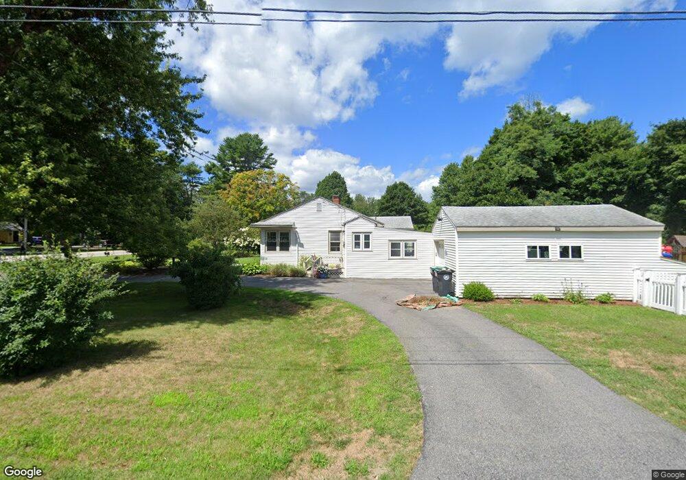
90 Sea Rd Kennebunk, ME 04043
Estimated Value: $505,163 - $624,000
3
Beds
1
Bath
1,432
Sq Ft
$406/Sq Ft
Est. Value
About This Home
This home is located at 90 Sea Rd, Kennebunk, ME 04043 and is currently estimated at $581,041, approximately $405 per square foot. 90 Sea Rd is a home located in York County with nearby schools including Kennebunk High School and The New School.
Ownership History
Date
Name
Owned For
Owner Type
Purchase Details
Closed on
Oct 22, 2015
Sold by
Simonds James E and Simonds Judith F
Bought by
Grover Whitney A and Sabelawski Zachary T
Current Estimated Value
Home Financials for this Owner
Home Financials are based on the most recent Mortgage that was taken out on this home.
Original Mortgage
$185,000
Outstanding Balance
$146,146
Interest Rate
4%
Mortgage Type
New Conventional
Estimated Equity
$434,895
Create a Home Valuation Report for This Property
The Home Valuation Report is an in-depth analysis detailing your home's value as well as a comparison with similar homes in the area
Home Values in the Area
Average Home Value in this Area
Purchase History
| Date | Buyer | Sale Price | Title Company |
|---|---|---|---|
| Grover Whitney A | -- | -- |
Source: Public Records
Mortgage History
| Date | Status | Borrower | Loan Amount |
|---|---|---|---|
| Open | Grover Whitney A | $185,000 |
Source: Public Records
Tax History
| Year | Tax Paid | Tax Assessment Tax Assessment Total Assessment is a certain percentage of the fair market value that is determined by local assessors to be the total taxable value of land and additions on the property. | Land | Improvement |
|---|---|---|---|---|
| 2024 | $4,339 | $256,000 | $113,700 | $142,300 |
| 2023 | $4,109 | $256,000 | $113,700 | $142,300 |
| 2022 | $3,738 | $256,000 | $113,700 | $142,300 |
| 2021 | $3,292 | $256,000 | $113,700 | $142,300 |
| 2020 | $3,269 | $256,000 | $113,700 | $142,300 |
| 2019 | $3,520 | $256,000 | $113,700 | $142,300 |
| 2018 | $4,145 | $192,000 | $85,300 | $106,700 |
| 2017 | $4,032 | $192,000 | $85,300 | $106,700 |
| 2016 | $3,053 | $192,000 | $85,300 | $106,700 |
| 2015 | $2,938 | $192,000 | $85,300 | $106,700 |
| 2014 | $2,861 | $192,000 | $85,300 | $106,700 |
Source: Public Records
Map
Nearby Homes
- 3 Clarkdale Rd
- 4 Conservation Dr
- 5 Heath Rd
- 5 Surrey Ln
- 5 Lake Brook Dr
- 14 Rachel Dr
- 17 Webhannet Place Unit 11
- Lot 14A River Rd
- 15 Dane St
- 1 Hall St
- 30 York St Unit 1
- 93 Main St Unit A
- 12 Ephraim Tyler Way
- 5 Cider Mill Ln
- 1 Cider Mill Ln
- 2 Cross St
- 3 Cider Mill Ln
- 4 Cider Mill Ln
- 11 Greenwich Way Unit 43
- 24 Cat Mousam Rd
Your Personal Tour Guide
Ask me questions while you tour the home.