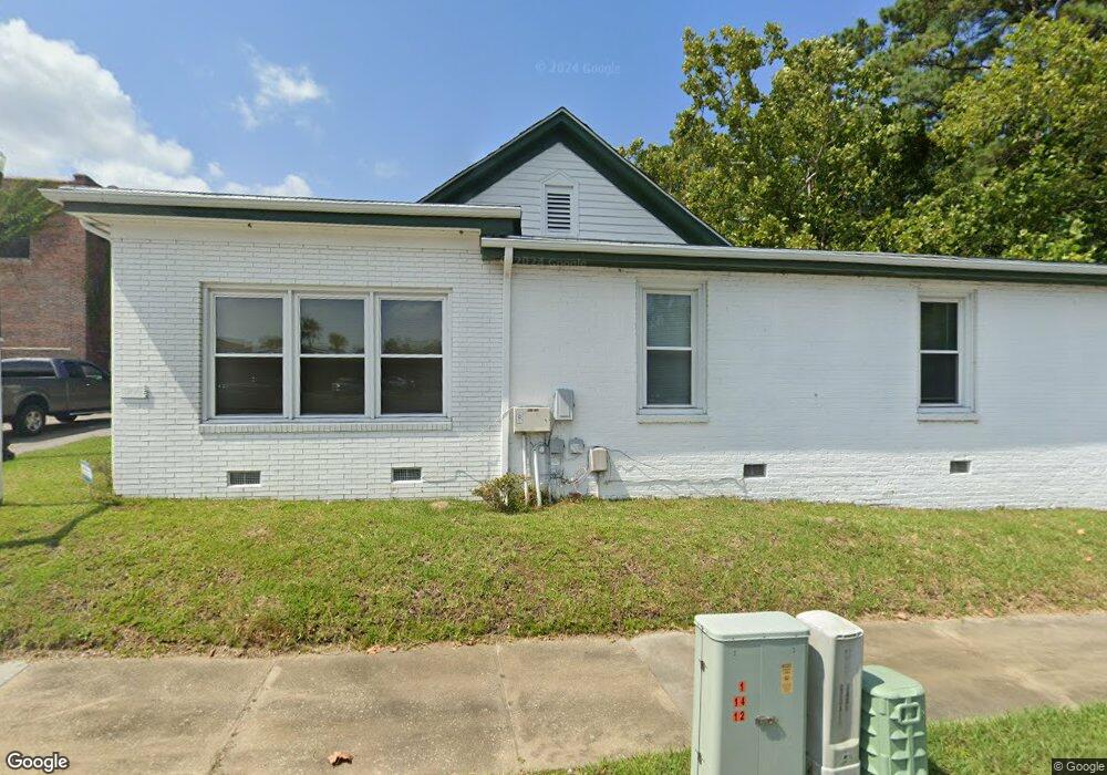
900 4th Ave Conway, SC 29526
Estimated Value: $397,425
--
Bed
--
Bath
3,500
Sq Ft
$114/Sq Ft
Est. Value
About This Home
This home is located at 900 4th Ave, Conway, SC 29526 and is currently estimated at $397,425, approximately $113 per square foot. 900 4th Ave is a home located in Horry County with nearby schools including Conway Elementary School, Conway Middle School, and Conway High School.
Ownership History
Date
Name
Owned For
Owner Type
Purchase Details
Closed on
Sep 23, 2024
Sold by
West Orrie E
Bought by
Me Industries Llc
Current Estimated Value
Home Financials for this Owner
Home Financials are based on the most recent Mortgage that was taken out on this home.
Original Mortgage
$319,200
Outstanding Balance
$243,866
Interest Rate
6.46%
Mortgage Type
New Conventional
Estimated Equity
$153,429
Purchase Details
Closed on
Jul 19, 2006
Sold by
Asburg Floree J
Bought by
Asburg Wayne
Create a Home Valuation Report for This Property
The Home Valuation Report is an in-depth analysis detailing your home's value as well as a comparison with similar homes in the area
Home Values in the Area
Average Home Value in this Area
Purchase History
| Date | Buyer | Sale Price | Title Company |
|---|---|---|---|
| Me Industries Llc | $399,000 | -- | |
| Asburg Wayne | -- | None Available |
Source: Public Records
Mortgage History
| Date | Status | Borrower | Loan Amount |
|---|---|---|---|
| Open | Me Industries Llc | $319,200 |
Source: Public Records
Tax History
| Year | Tax Paid | Tax Assessment Tax Assessment Total Assessment is a certain percentage of the fair market value that is determined by local assessors to be the total taxable value of land and additions on the property. | Land | Improvement |
|---|---|---|---|---|
| 2025 | $6,197 | $0 | $0 | $0 |
| 2024 | $6,197 | $13,775 | $8,786 | $4,989 |
| 2023 | $2,465 | $8,044 | $4,283 | $3,761 |
| 2021 | $2,123 | $14,420 | $7,322 | $7,098 |
| 2020 | $2,049 | $14,420 | $7,322 | $7,098 |
| 2019 | $2,049 | $14,420 | $7,322 | $7,098 |
| 2018 | $0 | $11,870 | $7,322 | $4,548 |
| 2017 | $1,875 | $11,870 | $7,322 | $4,548 |
| 2016 | -- | $11,870 | $7,322 | $4,548 |
| 2015 | $1,875 | $11,870 | $7,322 | $4,548 |
| 2014 | $1,825 | $11,870 | $7,322 | $4,548 |
Source: Public Records
Map
Nearby Homes
- TBD U S 501 Business
- Hunting Swamp Rd
- Lot 1 & 2 College Park Rd Unit COLLEGE PARK
- TBD Kates Bay Hwy
- 509 Beaty St
- 1517 3rd Ave
- 1507 Hiland Ave
- 1006 10th Ave
- 109 Powell St
- 1520 4th Ave
- 2204 6th Ave
- 7921 U S 701 Hwy
- 1170 Oak Meadows Dr
- 1170 Oak Meadows Dr Unit Lot 141
- 1003 Winding Rd
- TBD 4.48 acres E Highway 501
- TBD HWY 501 E Highway 501
- 1305 Forest View Rd
- TBD1150 U S 501 Business
- 411 Apple Ln
- 902 4th Ave
- 902 Highway 905
- 902 4th Ave
- 100 4th Ave S
- 408 N Main St Unit Lot 60
- 428 Kingston St
- 412 N Main St
- 332 Main St
- 330 N Main St
- 324 Main St
- 320 Main St
- 00000 Highway 501 Unit business only
- 322 Main St Unit 316 & 318 Main Stree
- 328 Main St
- 328 Main St
- 1340 U S 501 Business
- TBD U S 501 Business Unit HWY 501 BUS; TR A1,
- 302 Kingston St
- 322 and 32 Main St
- 322 and 324 Main St