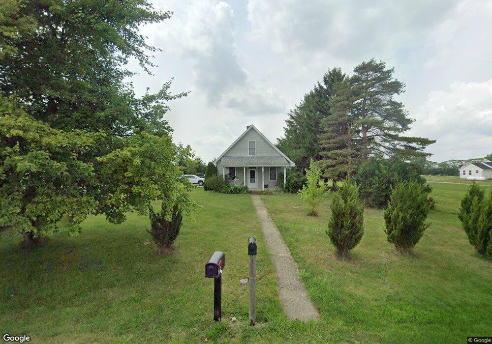
900 Brindle Rd Ostrander, OH 43061
Scioto NeighborhoodEstimated Value: $315,871 - $366,000
3
Beds
1
Bath
1,528
Sq Ft
$228/Sq Ft
Est. Value
About This Home
This home is located at 900 Brindle Rd, Ostrander, OH 43061 and is currently estimated at $347,718, approximately $227 per square foot. 900 Brindle Rd is a home located in Delaware County with nearby schools including Buckeye Valley High School.
Ownership History
Date
Name
Owned For
Owner Type
Purchase Details
Closed on
Nov 17, 2005
Sold by
Schultz Troy R
Bought by
Schultz Troy R and Schultz Laura M
Current Estimated Value
Home Financials for this Owner
Home Financials are based on the most recent Mortgage that was taken out on this home.
Original Mortgage
$100,448
Interest Rate
6.04%
Mortgage Type
Purchase Money Mortgage
Purchase Details
Closed on
Oct 15, 1997
Sold by
Evans William F
Bought by
Schultz Carolyn S
Create a Home Valuation Report for This Property
The Home Valuation Report is an in-depth analysis detailing your home's value as well as a comparison with similar homes in the area
Home Values in the Area
Average Home Value in this Area
Purchase History
| Date | Buyer | Sale Price | Title Company |
|---|---|---|---|
| Schultz Troy R | $89,400 | -- | |
| Schultz Carolyn S | $29,500 | -- |
Source: Public Records
Mortgage History
| Date | Status | Borrower | Loan Amount |
|---|---|---|---|
| Closed | Schultz Troy R | $100,448 |
Source: Public Records
Tax History
| Year | Tax Paid | Tax Assessment Tax Assessment Total Assessment is a certain percentage of the fair market value that is determined by local assessors to be the total taxable value of land and additions on the property. | Land | Improvement |
|---|---|---|---|---|
| 2024 | $2,464 | $74,200 | $12,600 | $61,600 |
| 2023 | $2,464 | $74,200 | $12,600 | $61,600 |
| 2022 | $1,834 | $49,210 | $9,240 | $39,970 |
| 2021 | $1,785 | $49,210 | $9,240 | $39,970 |
| 2020 | $1,795 | $49,210 | $9,240 | $39,970 |
| 2019 | $1,699 | $42,460 | $7,700 | $34,760 |
| 2018 | $1,730 | $42,460 | $7,700 | $34,760 |
| 2017 | $1,595 | $38,190 | $7,000 | $31,190 |
| 2016 | $1,463 | $38,190 | $7,000 | $31,190 |
| 2015 | $1,544 | $38,190 | $7,000 | $31,190 |
| 2014 | $1,451 | $38,190 | $7,000 | $31,190 |
| 2013 | $1,180 | $30,030 | $7,000 | $23,030 |
Source: Public Records
Map
Nearby Homes
- 0 Carr Rd Unit 225016840
- 6685 State Route 37 W
- 0 Burnt Pond Rd Unit Tract 2
- 0 Burnt Pond Rd Unit Tract 4
- 0 Burnt Pond Rd Unit Tract 3
- 0 Burnt Pond Rd Unit Tract 5
- 715 Tyler Rd
- 535 Brayshaw Dr
- 1817 Lawrence Rd
- 3480 Ostrander Rd
- 20478 Delaware County Line Rd
- 0 Delaware County Line Rd
- 231 Bluegrass Way
- 311 Ben Curtis Dr
- 9485 State Route 37
- 0 E High St Unit Tract 1 225034753
- 0 E High St Unit Tract 4 225034758
- 0 E High St Unit Tract 3 225034757
- 101 S Main St
- 0 Dean Rd Unit 225032132
- 0 Brindle Rd Tract 13a
- 876 Brindle Rd
- 935 Brindle Rd
- 880 Brindle Rd
- 895 Brindle Rd
- 849 Brindle Rd
- 835 Brindle Rd
- 944 Brindle Rd
- 862 Brindle Rd
- 883 Brindle Rd
- 0 Brindle Rd Unit Tract 2 219032537
- 0 Brindle Rd Unit 11686
- 0 Brindle Rd Unit 11689
- 0 Brindle Rd Unit Trac5 2443328
- 0 Brindle Rd Unit Trac7 2443331
- 0 Brindle Rd Unit Tr7 2612212
- 0 Brindle Rd Unit Lot4 2421096
- 0 Brindle Rd Unit Lot1 2421080
- 0 Brindle Rd Unit Tr7 2542076
- 0 Brindle Rd Unit Tr5 2541914
Your Personal Tour Guide
Ask me questions while you tour the home.